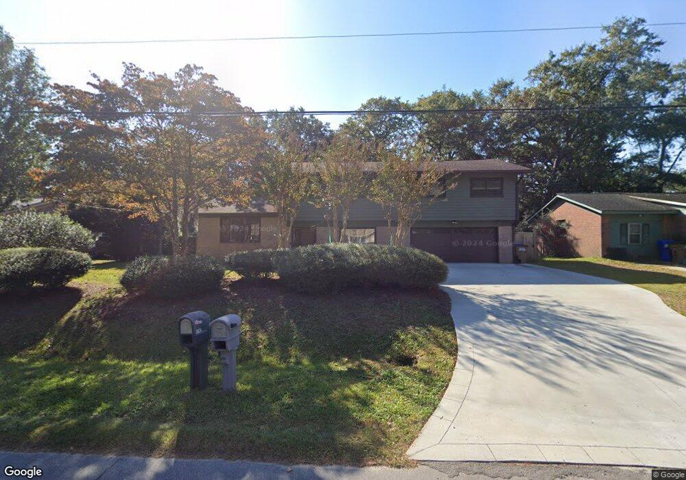
1741 Ashworth Ln Charleston, SC 29412
James Island NeighborhoodEstimated Value: $634,000 - $718,131
4
Beds
4
Baths
2,180
Sq Ft
$317/Sq Ft
Est. Value
About This Home
This home is located at 1741 Ashworth Ln, Charleston, SC 29412 and is currently estimated at $690,783, approximately $316 per square foot. 1741 Ashworth Ln is a home located in Charleston County with nearby schools including James Island Elementary School, Camp Road Middle, and Septima P Clark Corporate Academy.
Ownership History
Date
Name
Owned For
Owner Type
Purchase Details
Closed on
Sep 30, 2013
Sold by
Pride Damon O and Burdick William M
Bought by
Bouronich Robert B and Footer Kimberly D
Current Estimated Value
Home Financials for this Owner
Home Financials are based on the most recent Mortgage that was taken out on this home.
Original Mortgage
$230,743
Outstanding Balance
$173,386
Interest Rate
4.5%
Mortgage Type
FHA
Estimated Equity
$517,397
Purchase Details
Closed on
Nov 4, 2005
Sold by
Pride Damon O
Bought by
Pride Damon O and Burdick William M
Purchase Details
Closed on
Oct 24, 2005
Sold by
Cendant Mobility Financial Corp
Bought by
Pride Damon O
Purchase Details
Closed on
Aug 23, 2005
Sold by
Zytynski Joseph E and Zytynski Kelly C
Bought by
Cendant Mobility Financial Corp
Purchase Details
Closed on
Aug 13, 1999
Sold by
Smith Mary I and Inez Mary
Bought by
Zytynski Joseph E and Zytynski Kelly C
Create a Home Valuation Report for This Property
The Home Valuation Report is an in-depth analysis detailing your home's value as well as a comparison with similar homes in the area
Home Values in the Area
Average Home Value in this Area
Purchase History
| Date | Buyer | Sale Price | Title Company |
|---|---|---|---|
| Bouronich Robert B | $235,000 | -- | |
| Pride Damon O | -- | -- | |
| Pride Damon O | $239,000 | -- | |
| Cendant Mobility Financial Corp | $239,000 | -- | |
| Zytynski Joseph E | $145,000 | -- |
Source: Public Records
Mortgage History
| Date | Status | Borrower | Loan Amount |
|---|---|---|---|
| Open | Bouronich Robert B | $230,743 |
Source: Public Records
Tax History Compared to Growth
Tax History
| Year | Tax Paid | Tax Assessment Tax Assessment Total Assessment is a certain percentage of the fair market value that is determined by local assessors to be the total taxable value of land and additions on the property. | Land | Improvement |
|---|---|---|---|---|
| 2024 | $1,345 | $10,810 | $0 | $0 |
| 2023 | $1,345 | $10,810 | $0 | $0 |
| 2022 | $1,216 | $10,810 | $0 | $0 |
| 2021 | $1,299 | $10,810 | $0 | $0 |
| 2020 | $1,313 | $10,810 | $0 | $0 |
| 2019 | $1,202 | $9,400 | $0 | $0 |
| 2017 | $1,275 | $9,400 | $0 | $0 |
| 2016 | $1,223 | $9,400 | $0 | $0 |
| 2015 | $1,267 | $9,400 | $0 | $0 |
| 2014 | $1,204 | $0 | $0 | $0 |
| 2011 | -- | $0 | $0 | $0 |
Source: Public Records
Map
Nearby Homes
- 1056 Yorktown Dr
- 0 Turkey Pen Rd Unit 16023532
- 1039 Yorktown Dr
- 1182 Folly Rd Unit A,B,C,D
- 1815 Walsingham Way
- 1152 Bradford Ave
- 1206 Folly Rd
- 1047 Bradford Ave
- 1153 Pauline Ave
- 1662 Dexter Ln
- 1291 Apex Ln
- 1570 Blaze Ln
- 1827 S Mayflower Dr
- 1814 S Mayflower Dr
- 1137 Rivercrest Dr
- 1262 Apex Ln
- 1030 Pauline Ave
- 1527 Blaze Ln
- 1135 Bellwood Rd
- 1530 Fort Johnson Rd Unit 1E
- 1745 Ashworth Ln
- 1737 Ashworth Ln
- 1740 Pittsford Cir
- 1749 Ashworth Ln
- 1744 Pittsford Cir
- 1736 Pittsford Cir
- 1742 Ashworth Ln
- 1731 Ashworth Ln
- 1750 Pittsford Cir
- 1732 Pittsford Cir
- 1736 Ashworth Ln
- 1753 Ashworth Ln
- 1088 Yorktown Dr
- 1750 Ashworth Ln
- 1754 Pittsford Cir
- 1730 Ashworth Ln
- 1161 Pittsford Cir
- 1155 Pittsford Cir
- 1757 Ashworth Ln
- 1087 Yorktown Dr