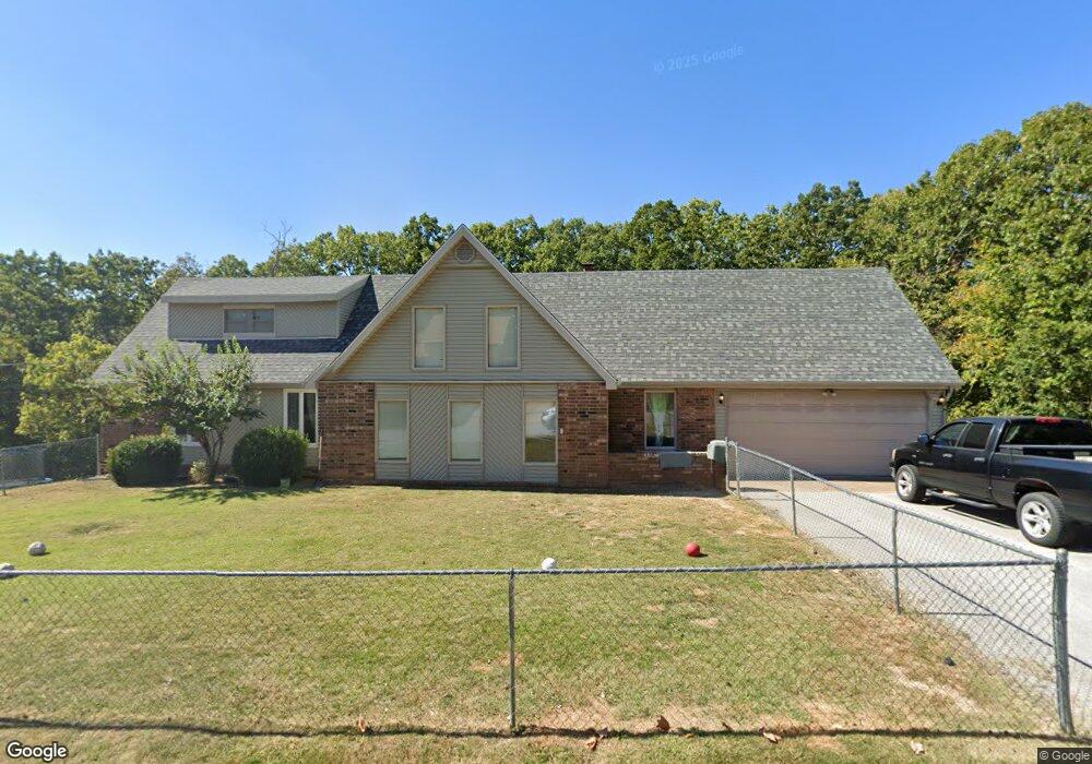
1741 J C Ave Waynesville, MO 65583
Estimated Value: $239,000 - $332,590
3
Beds
4
Baths
3,126
Sq Ft
$92/Sq Ft
Est. Value
About This Home
This home is located at 1741 J C Ave, Waynesville, MO 65583 and is currently estimated at $288,648, approximately $92 per square foot. 1741 J C Ave is a home located in Pulaski County with nearby schools including Waynesville East Elementary School, Freedom Elementary School, and Waynesville Middle School.
Ownership History
Date
Name
Owned For
Owner Type
Purchase Details
Closed on
Sep 29, 2020
Bought by
Porter Zachariah
Current Estimated Value
Purchase Details
Closed on
Jul 29, 2009
Sold by
Monique D Monique D and Spears Phillip E
Bought by
Hurt Deborah L and Hurt Kevin
Home Financials for this Owner
Home Financials are based on the most recent Mortgage that was taken out on this home.
Original Mortgage
$192,552
Interest Rate
5.31%
Mortgage Type
VA
Purchase Details
Closed on
Jul 28, 2009
Sold by
Spears Phillip E and Spears Monique D
Bought by
Hurt Kevin and Hurt Deborah L
Home Financials for this Owner
Home Financials are based on the most recent Mortgage that was taken out on this home.
Original Mortgage
$192,552
Interest Rate
5.31%
Mortgage Type
VA
Purchase Details
Closed on
Aug 27, 2007
Sold by
Rumfelt Robert L and Rumfelt Donna S
Bought by
Spears Phillip E
Home Financials for this Owner
Home Financials are based on the most recent Mortgage that was taken out on this home.
Original Mortgage
$173,655
Interest Rate
6.72%
Mortgage Type
VA
Create a Home Valuation Report for This Property
The Home Valuation Report is an in-depth analysis detailing your home's value as well as a comparison with similar homes in the area
Home Values in the Area
Average Home Value in this Area
Purchase History
| Date | Buyer | Sale Price | Title Company |
|---|---|---|---|
| Porter Zachariah | -- | -- | |
| Hurt Deborah L | -- | -- | |
| Hurt Kevin | -- | None Available | |
| Spears Phillip E | -- | None Available |
Source: Public Records
Mortgage History
| Date | Status | Borrower | Loan Amount |
|---|---|---|---|
| Previous Owner | Hurt Kevin | $192,552 | |
| Previous Owner | Spears Phillip E | $173,655 |
Source: Public Records
Tax History Compared to Growth
Tax History
| Year | Tax Paid | Tax Assessment Tax Assessment Total Assessment is a certain percentage of the fair market value that is determined by local assessors to be the total taxable value of land and additions on the property. | Land | Improvement |
|---|---|---|---|---|
| 2024 | $1,545 | $36,531 | $3,173 | $33,358 |
| 2023 | $1,508 | $36,531 | $3,173 | $33,358 |
| 2022 | $1,497 | $36,531 | $3,173 | $33,358 |
| 2021 | $1,481 | $36,531 | $3,173 | $33,358 |
| 2020 | $1,447 | $34,943 | $0 | $0 |
| 2019 | $1,447 | $34,943 | $0 | $0 |
| 2018 | $1,445 | $34,943 | $0 | $0 |
| 2017 | $1,090 | $34,943 | $0 | $0 |
| 2016 | $1,037 | $26,680 | $0 | $0 |
| 2015 | -- | $26,680 | $0 | $0 |
| 2014 | $1,017 | $26,680 | $0 | $0 |
Source: Public Records
Map
Nearby Homes
- 1718 Sanders Rd
- 114 Pioneer Ct
- 101 Ridge Ct
- 1903 Long Dr
- 0 Lot 16 Westwinds S D Unit MAR25013085
- 1802 Pearson St
- 128 Jared St
- 602 Sunset Dr
- 600 Sunset Dr
- 127 Jared St
- 212 Tremont Dr
- 412 Fleetwood Dr
- 312 Summit Ave
- 307 Ellis Ave
- 21675 Sable Rd
- 0 Lot 1 Westwinds S D
- 100 S Newport Ln
- 104 Story St
- 123 Hull Dr
- 103 S Newport Ln
- 1744 J C Ave
- 1742 J C Ave
- 1748 J C Ave
- 1737 J C Ave
- 1740 J C Ave
- 1710 Sanders Rd
- 1712 Sanders Rd
- 1708 Sanders Rd
- 1738 J C Ave
- 1735 J C Ave
- 1714 Sanders Rd
- 1706 Sanders Rd
- 267 Settlers Pass
- 1716 Sanders Rd
- 271 Settlers Pass
- 1733 J C Ave
- 0XXX Sanders Rd
- 273 Settlers Pass
- 269 Settlers Pass
- 1709 Sanders Rd