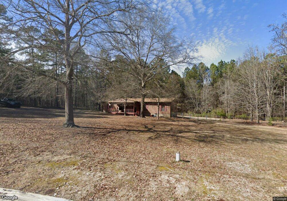
1741 Knotty Branch Trail Rock Hill, SC 29730
Estimated Value: $197,401 - $331,000
--
Bed
--
Bath
1,680
Sq Ft
$163/Sq Ft
Est. Value
About This Home
This home is located at 1741 Knotty Branch Trail, Rock Hill, SC 29730 and is currently estimated at $273,100, approximately $162 per square foot. 1741 Knotty Branch Trail is a home with nearby schools including Lesslie Elementary School, Castle Heights Middle School, and Rock Hill High School.
Ownership History
Date
Name
Owned For
Owner Type
Purchase Details
Closed on
Nov 15, 2016
Sold by
Rash Jarrod A and Wells Charles A
Bought by
Ocwen Loan Servicing Llc
Current Estimated Value
Purchase Details
Closed on
Aug 22, 2008
Sold by
Wells Charles A and Wells Wanda K
Bought by
Rash Jarrod A
Home Financials for this Owner
Home Financials are based on the most recent Mortgage that was taken out on this home.
Original Mortgage
$107,808
Interest Rate
6.61%
Mortgage Type
FHA
Create a Home Valuation Report for This Property
The Home Valuation Report is an in-depth analysis detailing your home's value as well as a comparison with similar homes in the area
Home Values in the Area
Average Home Value in this Area
Purchase History
| Date | Buyer | Sale Price | Title Company |
|---|---|---|---|
| Ocwen Loan Servicing Llc | $10,000 | None Available | |
| Rash Jarrod A | $109,500 | -- |
Source: Public Records
Mortgage History
| Date | Status | Borrower | Loan Amount |
|---|---|---|---|
| Previous Owner | Rash Jarrod A | $107,808 |
Source: Public Records
Tax History Compared to Growth
Tax History
| Year | Tax Paid | Tax Assessment Tax Assessment Total Assessment is a certain percentage of the fair market value that is determined by local assessors to be the total taxable value of land and additions on the property. | Land | Improvement |
|---|---|---|---|---|
| 2024 | $506 | $3,604 | $1,120 | $2,484 |
| 2023 | $519 | $3,604 | $1,120 | $2,484 |
| 2022 | $521 | $3,604 | $1,120 | $2,484 |
| 2021 | -- | $3,604 | $1,120 | $2,484 |
| 2020 | $519 | $3,604 | $0 | $0 |
| 2019 | $595 | $3,940 | $0 | $0 |
| 2018 | $536 | $3,940 | $0 | $0 |
| 2017 | $1,918 | $3,940 | $0 | $0 |
| 2016 | $539 | $3,940 | $0 | $0 |
| 2014 | $532 | $3,940 | $1,200 | $2,740 |
| 2013 | $532 | $4,240 | $1,200 | $3,040 |
Source: Public Records
Map
Nearby Homes
- 574 Karen Dr
- Lot 2 Ratteree Farm Rd Unit 2
- 686 Cannon Dr
- 3943 Walker Road (Land Only)
- 3943 Walker Rd Unit LOT ONLY
- 3943 Walker Rd
- 1206 Old Friendship Rd
- 1009 Rainbow Cir
- 57 Acres Woodstock Dr
- 3886 Lesslie Hwy
- 0000 Tract #1A Roddey Rd
- 3835 Lesslie Hwy
- 4000 Lesslie Hwy
- 4001 Lesslie Hwy
- 709 Pierce Ct
- 1463 Glasscock Rd
- 356 Emma Wood Ln
- 2999 Starnes Dr
- 1903 Manning Place
- 00 Southwinds Ct Unit 24
- 1755 Knotty Branch Trail
- 1729 Knotty Branch Trail
- 1769 Knotty Branch Trail
- 315 Ashley Woods Dr
- 1783 Knotty Branch Trail
- 4391 Fields Farm Rd
- 4326 Walker Rd
- 4340 Fields Farm Rd
- 325 Ashley Woods Dr
- 4335 Fields Farm Rd
- 4344 Walker Rd
- 611 Karen Dr
- 1797 Knotty Branch Trail
- 4394 Fields Farm Rd
- 4266 Walker Rd
- 4434 Walker Rd
- 4310 Fields Farm Rd
- 591 Karen Dr
- 621 Old Friendship Rd
- 611 Old Friendship Rd