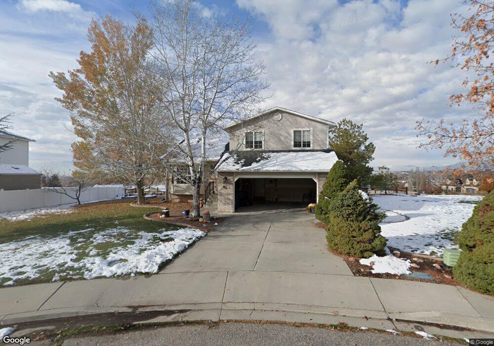
1741 N 390 E Pleasant Grove, UT 84062
Estimated Value: $521,000 - $601,000
3
Beds
3
Baths
1,650
Sq Ft
$345/Sq Ft
Est. Value
About This Home
This home is located at 1741 N 390 E, Pleasant Grove, UT 84062 and is currently estimated at $569,068, approximately $344 per square foot. 1741 N 390 E is a home located in Utah County with nearby schools including Manila Elementary School, Pleasant Grove Junior High School, and Pleasant Grove High School.
Ownership History
Date
Name
Owned For
Owner Type
Purchase Details
Closed on
Feb 9, 2001
Sold by
Hayes Beatrice M
Bought by
Hayes Stephen D and Hayes Lisa R
Current Estimated Value
Home Financials for this Owner
Home Financials are based on the most recent Mortgage that was taken out on this home.
Original Mortgage
$66,000
Outstanding Balance
$23,840
Interest Rate
7.08%
Estimated Equity
$545,228
Purchase Details
Closed on
Aug 28, 1996
Sold by
Hayes Stephen D and Hayes Lisa R
Bought by
Hayes Stephen D and Hayes Lisa R
Home Financials for this Owner
Home Financials are based on the most recent Mortgage that was taken out on this home.
Original Mortgage
$30,000
Interest Rate
8.23%
Purchase Details
Closed on
Jul 15, 1996
Sold by
Woodside Homes Corp
Bought by
Hayes Stephen D and Hayes Lisa R
Home Financials for this Owner
Home Financials are based on the most recent Mortgage that was taken out on this home.
Original Mortgage
$30,000
Interest Rate
8.23%
Create a Home Valuation Report for This Property
The Home Valuation Report is an in-depth analysis detailing your home's value as well as a comparison with similar homes in the area
Home Values in the Area
Average Home Value in this Area
Purchase History
| Date | Buyer | Sale Price | Title Company |
|---|---|---|---|
| Hayes Stephen D | -- | Sundance Title Insurance Ag | |
| Hayes Stephen D | -- | -- | |
| Hayes Stephen D | -- | -- |
Source: Public Records
Mortgage History
| Date | Status | Borrower | Loan Amount |
|---|---|---|---|
| Open | Hayes Stephen D | $66,000 | |
| Previous Owner | Hayes Stephen D | $30,000 |
Source: Public Records
Tax History Compared to Growth
Tax History
| Year | Tax Paid | Tax Assessment Tax Assessment Total Assessment is a certain percentage of the fair market value that is determined by local assessors to be the total taxable value of land and additions on the property. | Land | Improvement |
|---|---|---|---|---|
| 2025 | $2,336 | $294,965 | $245,500 | $290,800 |
| 2024 | $2,336 | $278,850 | $0 | $0 |
| 2023 | $2,298 | $280,775 | $0 | $0 |
| 2022 | $2,368 | $287,925 | $0 | $0 |
| 2021 | $2,020 | $373,900 | $154,100 | $219,800 |
| 2020 | $1,880 | $341,100 | $137,600 | $203,500 |
| 2019 | $1,779 | $333,900 | $130,400 | $203,500 |
| 2018 | $1,695 | $300,800 | $123,200 | $177,600 |
| 2017 | $1,571 | $148,445 | $0 | $0 |
| 2016 | $1,495 | $136,345 | $0 | $0 |
| 2015 | $1,430 | $123,475 | $0 | $0 |
| 2014 | -- | $122,705 | $0 | $0 |
Source: Public Records
Map
Nearby Homes
- 429 E 1600 N
- 1726 N Siena Cir Unit 10
- 1656 N Siena Cir Unit 7
- 1727 N Siena Cir Unit 4
- 1192 N 730 E
- 540 E 990 N
- 344 E 900 N
- 1152 N 200 W
- 825 N 350 E
- 532 W 2000 N
- 1051 N 600 W
- 1031 N 600 W
- 1041 N 600 W
- 641 E 700 N
- 8905 N Pine Hollow Dr
- 731 W 1590 N Unit 15
- 8944 Silver Lake Dr
- 1534 N 750 W Unit 16
- 674 W 1590 N Unit 11
- 3373 Bear Canyon Ln