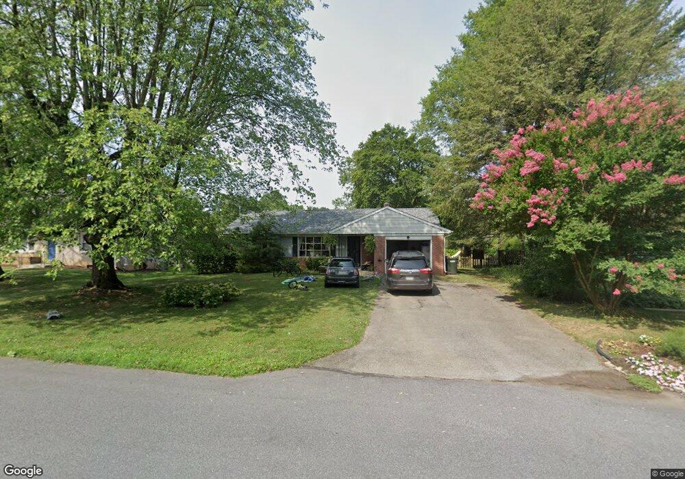
1741 Zarker Rd Lancaster, PA 17601
Eden NeighborhoodEstimated Value: $325,000 - $342,741
3
Beds
2
Baths
1,142
Sq Ft
$289/Sq Ft
Est. Value
About This Home
This home is located at 1741 Zarker Rd, Lancaster, PA 17601 and is currently estimated at $330,185, approximately $289 per square foot. 1741 Zarker Rd is a home located in Lancaster County with nearby schools including Nitrauer School, Landis Run Intermediate School, and Manheim Township Middle School.
Ownership History
Date
Name
Owned For
Owner Type
Purchase Details
Closed on
Nov 22, 2016
Sold by
Meisl Anne and Meisl Robert
Bought by
Marriott Chad S and Marriott Sarah L
Current Estimated Value
Home Financials for this Owner
Home Financials are based on the most recent Mortgage that was taken out on this home.
Original Mortgage
$124,000
Outstanding Balance
$99,707
Interest Rate
3.47%
Mortgage Type
New Conventional
Estimated Equity
$230,478
Purchase Details
Closed on
Jul 19, 2005
Sold by
Ostermann Rosalia and Ostermann Rose
Bought by
Meisl Anne
Create a Home Valuation Report for This Property
The Home Valuation Report is an in-depth analysis detailing your home's value as well as a comparison with similar homes in the area
Home Values in the Area
Average Home Value in this Area
Purchase History
| Date | Buyer | Sale Price | Title Company |
|---|---|---|---|
| Marriott Chad S | $155,000 | Attorney | |
| Meisl Anne | -- | -- |
Source: Public Records
Mortgage History
| Date | Status | Borrower | Loan Amount |
|---|---|---|---|
| Open | Marriott Chad S | $124,000 |
Source: Public Records
Tax History Compared to Growth
Tax History
| Year | Tax Paid | Tax Assessment Tax Assessment Total Assessment is a certain percentage of the fair market value that is determined by local assessors to be the total taxable value of land and additions on the property. | Land | Improvement |
|---|---|---|---|---|
| 2025 | $3,488 | $161,200 | $55,200 | $106,000 |
| 2024 | $3,488 | $161,200 | $55,200 | $106,000 |
| 2023 | $3,397 | $161,200 | $55,200 | $106,000 |
| 2022 | $3,340 | $161,200 | $55,200 | $106,000 |
| 2021 | $3,265 | $161,200 | $55,200 | $106,000 |
| 2020 | $3,265 | $161,200 | $55,200 | $106,000 |
| 2019 | $3,234 | $161,200 | $55,200 | $106,000 |
| 2018 | $2,436 | $161,200 | $55,200 | $106,000 |
| 2017 | $2,916 | $114,600 | $42,800 | $71,800 |
| 2016 | $2,916 | $114,600 | $42,800 | $71,800 |
| 2015 | $733 | $114,600 | $42,800 | $71,800 |
| 2014 | $2,136 | $114,600 | $42,800 | $71,800 |
Source: Public Records
Map
Nearby Homes
- 1550 Euclid Dr
- 1922 Pickering Trail
- 1914 Pickering Trail
- 1915 Pickering Trail
- 1923 Pickering Trail
- 1919 Pickering Trail
- 1935 New Holland Pike
- 1150 Groff Ln
- 1981 Landis Valley Rd
- 2111 Landis Valley Rd
- 2010 Landis Valley Rd
- 200 Hershey Ln Unit CRESTWOOD
- 200 Hershey Ln Unit CEDARBROOK
- 1100 Bluegrass Rd Unit NOTTINGHAM
- 1100 Bluegrass Rd Unit HAWTHORNE
- 1100 Bluegrass Rd Unit DEVONSHIRE
- 1100 Bluegrass Rd Unit AUGUSTA
- 1100 Bluegrass Rd Unit SAVANNAH
- 1100 Bluegrass Rd Unit COVINGTON
- 1100 Bluegrass Rd Unit ARCADIA