Estimated Value: $431,000 - $575,681
2
Beds
2
Baths
1,756
Sq Ft
$298/Sq Ft
Est. Value
About This Home
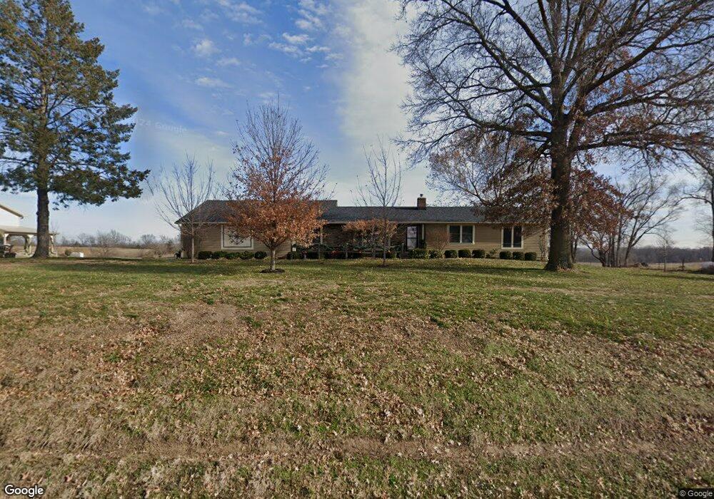
This home is located at 17415 State Route 33, Holt, MO 64048 and is currently estimated at $522,894, approximately $297 per square foot. 17415 State Route 33 is a home located in Clay County with nearby schools including Kearney Junior High School, Kearney High School, and Northern Hills Christian Academy.
Ownership History
Date
Name
Owned For
Owner Type
Purchase Details
Closed on
Aug 30, 2022
Sold by
Reed James E and Reed Cheryl J
Bought by
Reed Living Trust
Current Estimated Value
Purchase Details
Closed on
Dec 18, 2012
Sold by
Reed Robert G and Reed Marilyn A
Bought by
Reed James E and Reed Cheryl J
Home Financials for this Owner
Home Financials are based on the most recent Mortgage that was taken out on this home.
Original Mortgage
$210,750
Interest Rate
3.42%
Mortgage Type
Purchase Money Mortgage
Purchase Details
Closed on
Nov 29, 2006
Sold by
Everett Linda J
Bought by
Reed Robert G and Reed Marilyn A
Create a Home Valuation Report for This Property
The Home Valuation Report is an in-depth analysis detailing your home's value as well as a comparison with similar homes in the area
Home Values in the Area
Average Home Value in this Area
Purchase History
| Date | Buyer | Sale Price | Title Company |
|---|---|---|---|
| Reed Living Trust | -- | -- | |
| Reed Living Trust | -- | None Listed On Document | |
| Reed James E | -- | None Available | |
| Reed Robert G | -- | Source One Title Llc |
Source: Public Records
Mortgage History
| Date | Status | Borrower | Loan Amount |
|---|---|---|---|
| Previous Owner | Reed James E | $210,750 |
Source: Public Records
Tax History Compared to Growth
Tax History
| Year | Tax Paid | Tax Assessment Tax Assessment Total Assessment is a certain percentage of the fair market value that is determined by local assessors to be the total taxable value of land and additions on the property. | Land | Improvement |
|---|---|---|---|---|
| 2025 | $3,907 | $68,450 | -- | -- |
| 2024 | $3,907 | $61,760 | -- | -- |
| 2023 | $3,893 | $61,760 | $0 | $0 |
| 2022 | $3,566 | $54,790 | $0 | $0 |
| 2021 | $3,490 | $55,461 | $10,089 | $45,372 |
| 2020 | $2,580 | $36,800 | $0 | $0 |
| 2019 | $2,565 | $37,867 | $8,189 | $29,678 |
Source: Public Records
Map
Nearby Homes
- 17504 State Route 33
- 16816 Landmark Loop
- 17102 Barr Ave
- 15806 NE 176th St
- Tract 2 Nation Rd
- 18123 Crestview Cir
- 0 Lot 5 Arnold Park Lot N A Unit HMS2572371
- 0 Lot 3 Arnold Park Lot N A Unit HMS2572330
- 18208 Crestview Dr
- Tbd Northeast 188th St
- 702 N Grove St
- 15016 NE 186th St
- 16211 Dr
- 1200 W 10th Ave
- 19122 33 Hwy
- 16115 Kountry Ridge Dr
- TBD 188th Street N A
- 102 W Lawrence St
- 911 Crestridge Dr
- 907 Englewood Dr
- 17418 State Route 33
- 17503 State Route 33
- 17402 State Route 33
- 17510 State Route 33
- 17313 State Route 33
- 17315 State Route 33
- 17522 State Route 33
- 17323 Landmark Dr
- 17215 NE 176th St
- 17608 State Route 33
- 17218 State Route 33
- 17212 State Route 33
- 17216 NE 176th St
- 17602 NE 176th St
- 17202 State Route 33
- 17225 Landmark Dr
- 17406 NE 176th St
- 16610 NE 173rd St
- 17706 State Route 33
- 17310 Landmark Dr