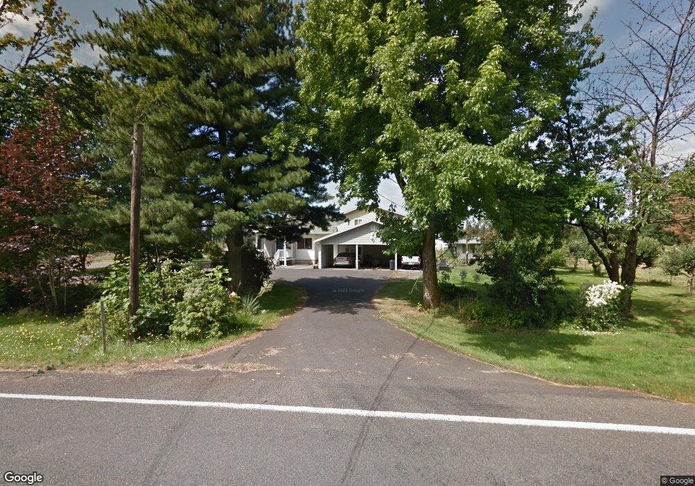
17416 NE 122nd Ave Battle Ground, WA 98604
Estimated Value: $928,000 - $1,032,069
6
Beds
3
Baths
3,152
Sq Ft
$311/Sq Ft
Est. Value
About This Home
This home is located at 17416 NE 122nd Ave, Battle Ground, WA 98604 and is currently estimated at $980,035, approximately $310 per square foot. 17416 NE 122nd Ave is a home located in Clark County with nearby schools including Glenwood Heights Primary School, Laurin Middle School, and Prairie High School.
Ownership History
Date
Name
Owned For
Owner Type
Purchase Details
Closed on
Jul 7, 2010
Sold by
Bergeron Wayne M
Bought by
Bergeron Farm Property Llc
Current Estimated Value
Purchase Details
Closed on
Jul 1, 2010
Sold by
Hennessy Linda Kay
Bought by
Bergeron Farm Property Llc
Purchase Details
Closed on
May 2, 2008
Sold by
Bergeron Wayne M
Bought by
Bergeron Wayne M and Murry J Bergeron Credit Shelter Trust
Create a Home Valuation Report for This Property
The Home Valuation Report is an in-depth analysis detailing your home's value as well as a comparison with similar homes in the area
Home Values in the Area
Average Home Value in this Area
Purchase History
| Date | Buyer | Sale Price | Title Company |
|---|---|---|---|
| Bergeron Farm Property Llc | -- | None Available | |
| Bergeron Wayne M | -- | None Available | |
| Bergeron Wayne M | -- | None Available | |
| Bergeron Farm Property Llc | -- | None Available | |
| Bergeron Wayne M | -- | None Available |
Source: Public Records
Tax History Compared to Growth
Tax History
| Year | Tax Paid | Tax Assessment Tax Assessment Total Assessment is a certain percentage of the fair market value that is determined by local assessors to be the total taxable value of land and additions on the property. | Land | Improvement |
|---|---|---|---|---|
| 2025 | $5,833 | $969,348 | $381,222 | $588,126 |
| 2024 | $5,146 | $946,793 | $381,222 | $565,571 |
| 2023 | $5,435 | $917,331 | $364,497 | $552,834 |
| 2022 | $4,990 | $929,035 | $404,514 | $524,521 |
| 2021 | $5,000 | $784,024 | $340,917 | $443,107 |
| 2020 | $4,882 | $715,987 | $312,652 | $403,335 |
| 2019 | $4,308 | $674,427 | $287,213 | $387,214 |
| 2018 | $5,118 | $472,148 | $0 | $0 |
| 2017 | $3,138 | $429,755 | $0 | $0 |
| 2016 | $2,987 | $281,724 | $0 | $0 |
| 2015 | $3,056 | $246,652 | $0 | $0 |
| 2014 | -- | $240,749 | $0 | $0 |
| 2013 | -- | $221,877 | $0 | $0 |
Source: Public Records
Map
Nearby Homes
- 18004 NE 113th Ave
- 12605 NE 184th St
- 15628 NE Caples Rd
- 11700 NE 185th St
- Laurel Plan at Woodin Creek Station
- Oakridge Plan at Woodin Creek Station
- Bramble Plan at Woodin Creek Station - Townhomes
- Nettle Plan at Woodin Creek Station - Townhomes
- Dahlia Plan at Woodin Creek Station - Townhomes
- Riverbend Plan at Woodin Creek Station
- 3201 SW 4th Ave
- 3115 SW 4th Ave
- 11900 NE 189th St
- 1927 SE 27th St
- 3416 SE 6th Ave
- 3404 SE 6th Ave
- 714 SE 37th St
- 622 SE 35th St
- 626 SE 35th St
- 632 SE 35th St
- 17600 NE 122nd Ave
- 17514 NE 122nd Ave
- 10 NE 120th
- 12101 NE 174th St
- 12117 NE 174th St
- 12215 NE 176th St
- 12007 NE 174th St
- 0 NE 120th Ave
- 17415 NE 122nd Ave
- 0 NE 177th (Lot 9) Cir Unit 8085584
- 0 NE 177th (Lot 9) Cir Unit 9012339
- 11811 NE 177th Cir
- 12218 NE 176th St
- 17640 NE 120th Ave
- 17313 NE Caples Rd
- 12401 NE 176th St
- 11814 NE 177th Cir
- 0 NE 0 Rd Unit 6007906
- 17630 NE 120th Ave
- 0 NE 179th Sr503 St Unit 8085401