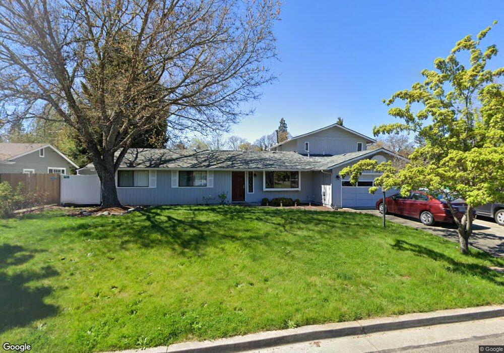
1742 Darrell Cir Grants Pass, OR 97527
Fruitdale NeighborhoodEstimated Value: $440,379 - $469,000
4
Beds
2
Baths
2,256
Sq Ft
$202/Sq Ft
Est. Value
About This Home
This home is located at 1742 Darrell Cir, Grants Pass, OR 97527 and is currently estimated at $454,690, approximately $201 per square foot. 1742 Darrell Cir is a home located in Josephine County with nearby schools including Fruitdale Elementary School, Lincoln Savage Middle School, and Hidden Valley High School.
Ownership History
Date
Name
Owned For
Owner Type
Purchase Details
Closed on
Apr 23, 2020
Sold by
Brown Steven M and Brown Debra K
Bought by
Brown Steven M and Brown Debra K
Current Estimated Value
Purchase Details
Closed on
May 15, 2007
Sold by
Marcello Darla D
Bought by
Brown Steven M and Brown Debra K
Home Financials for this Owner
Home Financials are based on the most recent Mortgage that was taken out on this home.
Original Mortgage
$50,000
Outstanding Balance
$30,265
Interest Rate
6.17%
Mortgage Type
Purchase Money Mortgage
Estimated Equity
$424,425
Create a Home Valuation Report for This Property
The Home Valuation Report is an in-depth analysis detailing your home's value as well as a comparison with similar homes in the area
Home Values in the Area
Average Home Value in this Area
Purchase History
| Date | Buyer | Sale Price | Title Company |
|---|---|---|---|
| Brown Steven M | -- | None Available | |
| Brown Steven M | $290,000 | Ticor Title |
Source: Public Records
Mortgage History
| Date | Status | Borrower | Loan Amount |
|---|---|---|---|
| Open | Brown Steven M | $50,000 |
Source: Public Records
Tax History Compared to Growth
Tax History
| Year | Tax Paid | Tax Assessment Tax Assessment Total Assessment is a certain percentage of the fair market value that is determined by local assessors to be the total taxable value of land and additions on the property. | Land | Improvement |
|---|---|---|---|---|
| 2025 | $3,046 | $249,450 | -- | -- |
| 2024 | $3,046 | $242,190 | -- | -- |
| 2023 | $2,958 | $235,140 | $0 | $0 |
| 2022 | $2,883 | $228,300 | -- | -- |
| 2021 | $2,708 | $221,660 | $0 | $0 |
| 2020 | $2,728 | $215,210 | $0 | $0 |
| 2019 | $2,632 | $208,950 | $0 | $0 |
| 2018 | $2,697 | $202,870 | $0 | $0 |
| 2017 | $2,689 | $196,970 | $0 | $0 |
| 2016 | $2,361 | $191,240 | $0 | $0 |
| 2015 | $2,285 | $185,670 | $0 | $0 |
| 2014 | $1,083 | $180,270 | $0 | $0 |
Source: Public Records
Map
Nearby Homes
- 1665 Fruitdale Dr
- 1022 SE Jerrine St
- 1721 Brookhurst Way
- 1781 SE Brookhurst Way
- 1419 Fruitdale Dr
- 1974 Hamilton Ln
- 1407 Fruitdale Dr Unit 10
- 1407 Fruitdale Dr Unit 12
- 1407 Fruitdale Dr Unit 2
- 1407 Fruitdale Dr Unit 4
- 1407 Fruitdale Dr Unit 3
- 1407 Fruitdale Dr Unit 6
- 1407 Fruitdale Dr Unit 11
- 1407 Fruitdale Dr Unit 5
- 1407 Fruitdale Dr Unit 7
- 1461 Rogue River Hwy
- 1841 Cloverlawn Dr
- 1980 Keldan Ln
- 1455 SE Rogue Dr
- 1275 E Park St
- 1754 Darrell Cir
- 1621 Axtell Dr
- 1762 Darrell Cir
- 1658 Axtell Dr
- 1673 Axtell Dr
- 1664 Axtell Dr
- 1753 Darrell Cir
- 1600 Axtell Dr
- 1670 Axtell Dr
- 1770 Darrell Cir
- 1765 Darrell Cir
- 1744 Overland Dr
- 1684 Axtell Dr
- 1691 Axtell Dr
- 1641 Fruitdale Dr
- 1776 Darrell Cir
- 1752 Johnmark Cir
- 1773 Darrell Cir
- 1780 Darrell Cir
- 1764 Johnmark Cir