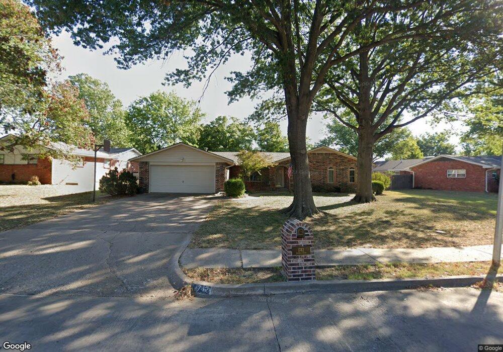
1742 Harned Dr Bartlesville, OK 74006
Estimated Value: $199,544 - $258,000
3
Beds
4
Baths
2,007
Sq Ft
$116/Sq Ft
Est. Value
About This Home
This home is located at 1742 Harned Dr, Bartlesville, OK 74006 and is currently estimated at $233,636, approximately $116 per square foot. 1742 Harned Dr is a home located in Washington County with nearby schools including Ranch Heights Elementary School, Madison Middle School, and Bartlesville High School.
Ownership History
Date
Name
Owned For
Owner Type
Purchase Details
Closed on
Nov 30, 2020
Sold by
Kintner Jerrold L and Kintner Shirley F
Bought by
Kintner Jerrold L and Kintner Shirley F
Current Estimated Value
Purchase Details
Closed on
Jul 9, 1997
Sold by
Driver Melvis P and Driver Cassandra R
Bought by
Kintner Jerrold L and Kintner Shirley F
Purchase Details
Closed on
Feb 23, 1994
Sold by
Renfro David R and Renfro Bonita R
Purchase Details
Closed on
Feb 5, 1975
Sold by
Holt James L and Holt Martha C
Create a Home Valuation Report for This Property
The Home Valuation Report is an in-depth analysis detailing your home's value as well as a comparison with similar homes in the area
Home Values in the Area
Average Home Value in this Area
Purchase History
| Date | Buyer | Sale Price | Title Company |
|---|---|---|---|
| Kintner Jerrold L | -- | None Available | |
| Kintner Jerrold L | $76,500 | -- | |
| -- | $69,000 | -- | |
| -- | -- | -- |
Source: Public Records
Tax History Compared to Growth
Tax History
| Year | Tax Paid | Tax Assessment Tax Assessment Total Assessment is a certain percentage of the fair market value that is determined by local assessors to be the total taxable value of land and additions on the property. | Land | Improvement |
|---|---|---|---|---|
| 2025 | $1,456 | $13,124 | $1,176 | $11,948 |
| 2024 | $1,456 | $13,125 | $1,271 | $11,854 |
| 2023 | $1,456 | $13,125 | $1,271 | $11,854 |
| 2022 | $1,452 | $13,124 | $1,357 | $11,767 |
| 2021 | $1,424 | $13,124 | $1,357 | $11,767 |
| 2020 | $1,456 | $13,124 | $1,357 | $11,767 |
| 2019 | $1,456 | $13,124 | $1,357 | $11,767 |
| 2018 | $1,449 | $13,124 | $1,379 | $11,745 |
| 2017 | $1,483 | $13,124 | $1,686 | $11,438 |
| 2016 | $1,348 | $12,742 | $1,686 | $11,056 |
| 2015 | $1,326 | $12,371 | $1,686 | $10,685 |
| 2014 | $1,279 | $12,011 | $1,686 | $10,325 |
Source: Public Records
Map
Nearby Homes
- 5269 Nowata Rd Unit O102
- 5239 Nowata Rd Unit H102
- 5217 Nowata Rd Unit 203C
- 5217 Nowata Rd Unit C204
- 5229 Nowata Rd Unit F101
- 1521 Lariat Dr
- 1912 Lester Ave
- 1500 Harris Dr
- 4821 SE Barlow Dr
- 1869 Putnam Dr
- 1801 Rolling Hills Place
- 4908 SE Barlow Dr
- 5301 Barnett Ave
- 1435 Lariat Dr
- 4607 Rolling Hills Dr
- 1425 S Madison Blvd
- 2104 SE Lester
- 5205 Charleston Dr
- 5300 Charleston Dr
- 1354 Harris Dr
- 4702 Harned Ct
- 4710 Harned Ct
- 4707 Harned Place
- 4701 Harned Place
- 1733 Harned Dr
- 1741 Harned Dr
- 1749 Harned Dr
- 1757 Harned Dr
- 1725 Harned Dr
- 4703 Harned Ct
- 4715 Harned Place
- 1717 Harned Dr
- 4709 Harned Ct
- 1765 Harned Dr
- 4725 Harned Ct
- 4717 Harned Ct
- 1776 Harned Dr
- 4628 SE Barlow Dr
- 4725 Harned Place
- 4634 SE Barlow Dr