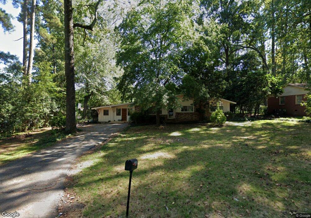
1742 Omarest Dr Columbia, SC 29210
Saint Andrews NeighborhoodEstimated Value: $169,378 - $218,000
3
Beds
2
Baths
1,348
Sq Ft
$141/Sq Ft
Est. Value
About This Home
This home is located at 1742 Omarest Dr, Columbia, SC 29210 and is currently estimated at $190,345, approximately $141 per square foot. 1742 Omarest Dr is a home located in Richland County with nearby schools including H. B. Rhame Elementary School, St. Andrews Middle School, and Columbia High School.
Ownership History
Date
Name
Owned For
Owner Type
Purchase Details
Closed on
Apr 16, 2024
Sold by
Peralta Ernesto A
Bought by
Epk Holdings Llc
Current Estimated Value
Purchase Details
Closed on
Feb 25, 2002
Sold by
Federal National Mortgage Association
Bought by
Peralta Ernesto A
Home Financials for this Owner
Home Financials are based on the most recent Mortgage that was taken out on this home.
Original Mortgage
$74,520
Interest Rate
6.81%
Purchase Details
Closed on
Nov 27, 2001
Sold by
Merritt Dixon B and Merritt Brenda H
Bought by
Federal National Mortgage Association
Purchase Details
Closed on
Nov 30, 1999
Sold by
Merritt Brenda H
Bought by
Merritt Dixon B
Purchase Details
Closed on
Sep 18, 1998
Sold by
Strevens John B and Strevens Jane P
Bought by
Merritt Brenda H
Home Financials for this Owner
Home Financials are based on the most recent Mortgage that was taken out on this home.
Original Mortgage
$86,450
Interest Rate
6.92%
Create a Home Valuation Report for This Property
The Home Valuation Report is an in-depth analysis detailing your home's value as well as a comparison with similar homes in the area
Home Values in the Area
Average Home Value in this Area
Purchase History
| Date | Buyer | Sale Price | Title Company |
|---|---|---|---|
| Epk Holdings Llc | -- | None Listed On Document | |
| Peralta Ernesto A | $81,000 | -- | |
| Federal National Mortgage Association | $2,500 | -- | |
| Merritt Dixon B | -- | -- | |
| Merritt Brenda H | $91,000 | -- |
Source: Public Records
Mortgage History
| Date | Status | Borrower | Loan Amount |
|---|---|---|---|
| Previous Owner | Peralta Ernesto A | $74,520 | |
| Previous Owner | Merritt Brenda H | $86,450 |
Source: Public Records
Tax History
| Year | Tax Paid | Tax Assessment Tax Assessment Total Assessment is a certain percentage of the fair market value that is determined by local assessors to be the total taxable value of land and additions on the property. | Land | Improvement |
|---|---|---|---|---|
| 2024 | $2,946 | $98,200 | $0 | $0 |
| 2023 | $2,872 | $3,416 | $0 | $0 |
| 2022 | $2,633 | $85,400 | $12,600 | $72,800 |
| 2021 | $2,622 | $5,120 | $0 | $0 |
| 2020 | $2,635 | $5,120 | $0 | $0 |
| 2019 | $2,610 | $5,120 | $0 | $0 |
| 2018 | $2,459 | $4,820 | $0 | $0 |
| 2017 | $2,392 | $4,820 | $0 | $0 |
| 2016 | $807 | $3,210 | $0 | $0 |
| 2015 | $788 | $3,210 | $0 | $0 |
| 2014 | $767 | $80,300 | $0 | $0 |
| 2013 | -- | $3,210 | $0 | $0 |
Source: Public Records
Map
Nearby Homes
- 1727 Omarest Dr
- 1650 Omarest Dr
- 1924 Koulter Dr
- 1707 Carl Rd
- 1613 Ashford Ln
- 1908 Grays Inn Rd
- 1913 Grays Inn Rd
- 1540 Romain Dr
- 529 Cambout St
- 201 Burbank St
- 204 River Bluff Blvd
- 210 River Bluff Way
- 112 Gateway Ln
- 105 River Bluff Ct
- 1850 Atlantic Dr Unit 416
- 1850 Atlantic Dr Unit 414
- 1850 Atlantic Dr Unit 423
- 2103 Marley Dr
- 1510 Canal Dr
- 0 Marley Dr Unit 623584
- 1734 Omarest Dr
- 1741 Koulter Dr
- 1749 Koulter Dr
- 1733 Koulter Dr
- 1758 Omarest Dr
- 1728 Omarest Dr
- 1741 Omarest Dr
- 1743 Omarest Dr
- 1733 Omarest Dr
- 1757 Koulter Dr
- 1727 Koulter Dr
- 1757 Omarest Dr
- 1804 Omarest Dr
- 1720 Omarest Dr
- 1719 Koulter Dr
- 1803 Koulter Dr
- 1740 Romain Dr
- 1719 Omarest Dr
- 1740 Koulter Dr
- 1732 Romain Dr
Your Personal Tour Guide
Ask me questions while you tour the home.