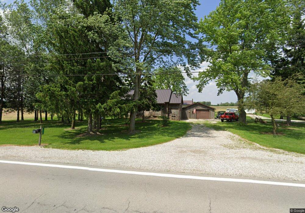
1742 State Route 412 Fremont, OH 43420
Estimated Value: $182,850 - $232,000
3
Beds
2
Baths
1,244
Sq Ft
$170/Sq Ft
Est. Value
About This Home
This home is located at 1742 State Route 412, Fremont, OH 43420 and is currently estimated at $211,463, approximately $169 per square foot. 1742 State Route 412 is a home located in Sandusky County with nearby schools including Fremont Ross High School, Temple Christian Academy, and Bishop Hoffman Catholic School - This is St Joe's School now.
Ownership History
Date
Name
Owned For
Owner Type
Purchase Details
Closed on
Jul 14, 2000
Sold by
Wellman John P
Bought by
Fisher Ii Joseph A
Current Estimated Value
Home Financials for this Owner
Home Financials are based on the most recent Mortgage that was taken out on this home.
Original Mortgage
$100,000
Outstanding Balance
$36,594
Interest Rate
8.55%
Mortgage Type
New Conventional
Estimated Equity
$174,869
Purchase Details
Closed on
Aug 8, 1995
Sold by
Fisher Joseph A
Bought by
Wellman John P and Wellman Tamara M
Home Financials for this Owner
Home Financials are based on the most recent Mortgage that was taken out on this home.
Original Mortgage
$70,000
Interest Rate
7.56%
Mortgage Type
New Conventional
Create a Home Valuation Report for This Property
The Home Valuation Report is an in-depth analysis detailing your home's value as well as a comparison with similar homes in the area
Home Values in the Area
Average Home Value in this Area
Purchase History
| Date | Buyer | Sale Price | Title Company |
|---|---|---|---|
| Fisher Ii Joseph A | $125,000 | -- | |
| Wellman John P | $90,000 | -- |
Source: Public Records
Mortgage History
| Date | Status | Borrower | Loan Amount |
|---|---|---|---|
| Open | Fisher Ii Joseph A | $100,000 | |
| Previous Owner | Wellman John P | $70,000 |
Source: Public Records
Tax History Compared to Growth
Tax History
| Year | Tax Paid | Tax Assessment Tax Assessment Total Assessment is a certain percentage of the fair market value that is determined by local assessors to be the total taxable value of land and additions on the property. | Land | Improvement |
|---|---|---|---|---|
| 2024 | $1,820 | $48,230 | $7,000 | $41,230 |
| 2023 | $1,820 | $48,230 | $7,000 | $41,230 |
| 2022 | $1,919 | $48,230 | $7,000 | $41,230 |
| 2021 | $1,980 | $48,230 | $7,000 | $41,230 |
| 2020 | $1,597 | $38,470 | $7,000 | $31,470 |
| 2019 | $1,595 | $38,470 | $7,000 | $31,470 |
| 2018 | $1,514 | $38,470 | $7,000 | $31,470 |
| 2017 | $1,430 | $34,370 | $7,000 | $27,370 |
| 2016 | $1,257 | $34,370 | $7,000 | $27,370 |
| 2015 | $1,237 | $34,370 | $7,000 | $27,370 |
| 2014 | $1,539 | $40,670 | $7,280 | $33,390 |
| 2013 | $1,506 | $40,670 | $7,280 | $33,390 |
Source: Public Records
Map
Nearby Homes
- 263 Saint Paul Dr
- 251 Saint Paul Dr
- 315 Ethan Dr
- 199 Saint Thomas Dr
- 318 Ethan Dr
- 2248 E State St
- 711 Bloom Rd
- 1014 S County Road 198
- 230 N Pennsylvania Ave
- 1526 Sunrise Blvd
- 612 2nd St
- 0 Cr 214 Unit 20253055
- 533 Sandusky Ave Unit 535
- 800 Lawndale Dr
- 714 E State St
- 546 Oaklawn Ave
- 322 4th St
- 433 Sandusky Ave
- 314 S Collinwood Blvd
- 340 340 Sandusky Ave
- 1756 State Route 412
- 1768 State Route 412
- 1731 State Route 412
- 1731 Ohio 412
- 1761 Ohio 412
- 1761 State Route 412
- 1784 State Route 412 Unit 17
- 1699 State Route 412
- 1788 State Route 412
- 1789 State Route 412
- 1806 State Route 412
- 1667 State Route 412
- 1816 State Route 412
- 1657 Ohio 412
- 1657 State Route 412
- 1625 State Route 412
- 721 N County Road 198
- 1615 State Route 412
- 1615 Ohio 412
- 633 N County Road 198