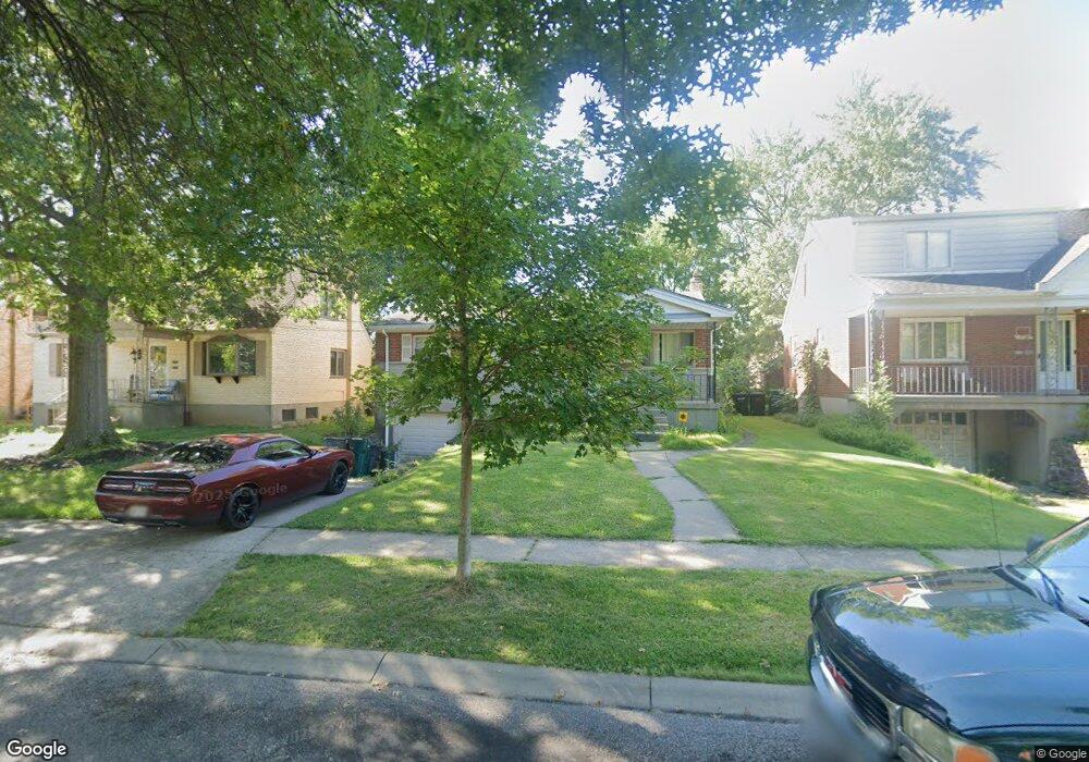
1742 Tuxworth Ave Cincinnati, OH 45238
West Price Hill NeighborhoodEstimated Value: $166,959 - $201,000
3
Beds
1
Bath
1,036
Sq Ft
$177/Sq Ft
Est. Value
About This Home
This home is located at 1742 Tuxworth Ave, Cincinnati, OH 45238 and is currently estimated at $183,490, approximately $177 per square foot. 1742 Tuxworth Ave is a home located in Hamilton County with nearby schools including Carson School, Gilbert A. Dater High School, and Western Hills High School.
Ownership History
Date
Name
Owned For
Owner Type
Purchase Details
Closed on
Sep 24, 2018
Sold by
Estate Of Chiquita C Hancock Armstrong
Bought by
Armstrong Trenell
Current Estimated Value
Purchase Details
Closed on
Nov 29, 2004
Sold by
Pufal Elizabeth A and Pufal Michael A
Bought by
Hancock Chiquita
Home Financials for this Owner
Home Financials are based on the most recent Mortgage that was taken out on this home.
Original Mortgage
$94,050
Interest Rate
8.65%
Mortgage Type
Fannie Mae Freddie Mac
Purchase Details
Closed on
Jun 17, 1999
Sold by
Hensley Janice Lynne
Bought by
Pufal Elizabeth A
Home Financials for this Owner
Home Financials are based on the most recent Mortgage that was taken out on this home.
Original Mortgage
$83,845
Interest Rate
7.15%
Mortgage Type
FHA
Create a Home Valuation Report for This Property
The Home Valuation Report is an in-depth analysis detailing your home's value as well as a comparison with similar homes in the area
Home Values in the Area
Average Home Value in this Area
Purchase History
| Date | Buyer | Sale Price | Title Company |
|---|---|---|---|
| Armstrong Trenell | -- | None Available | |
| Hancock Chiquita | -- | Precision Land Title Agency | |
| Pufal Elizabeth A | $85,000 | First Title Agency Inc |
Source: Public Records
Mortgage History
| Date | Status | Borrower | Loan Amount |
|---|---|---|---|
| Previous Owner | Hancock Chiquita | $94,050 | |
| Previous Owner | Pufal Elizabeth A | $83,845 |
Source: Public Records
Tax History Compared to Growth
Tax History
| Year | Tax Paid | Tax Assessment Tax Assessment Total Assessment is a certain percentage of the fair market value that is determined by local assessors to be the total taxable value of land and additions on the property. | Land | Improvement |
|---|---|---|---|---|
| 2024 | $2,409 | $37,870 | $5,208 | $32,662 |
| 2023 | $2,413 | $37,870 | $5,208 | $32,662 |
| 2022 | $1,652 | $23,265 | $5,173 | $18,092 |
| 2021 | $1,620 | $23,265 | $5,173 | $18,092 |
| 2020 | $1,625 | $23,265 | $5,173 | $18,092 |
| 2019 | $1,623 | $21,151 | $4,704 | $16,447 |
| 2018 | $1,624 | $21,151 | $4,704 | $16,447 |
| 2017 | $1,491 | $21,151 | $4,704 | $16,447 |
| 2016 | $1,726 | $24,168 | $5,026 | $19,142 |
| 2015 | $1,557 | $24,168 | $5,026 | $19,142 |
| 2014 | $1,568 | $24,168 | $5,026 | $19,142 |
| 2013 | $1,811 | $27,465 | $5,712 | $21,753 |
Source: Public Records
Map
Nearby Homes
- 1774 Ashbrook Dr
- 4764 Clevesdale Dr
- 1803 Ashbrook Dr
- 1861 Ashbrook Dr
- 1869 Ashbrook Dr
- 4769 Hardwick Dr
- 4798 Prosperity Place
- 4826 Prosperity Place
- 4885 N Overlook Ave
- 4965 Glenway Ave
- 4934 Relleum Ave
- 1131 Olivia Ln
- 4910 Ferguson Place
- 4638 Glenway Ave
- 5020 Sidney Rd
- 4925 Shirley Place
- 5027 Sidney Rd
- 5009 Relleum Ave
- 4975 Heuwerth Ave
- 1225 Amanda Place
- 1746 Tuxworth Ave
- 1738 Tuxworth Ave
- 1750 Tuxworth Ave
- 1734 Tuxworth Ave
- 1734 Tuxworth Ave Unit 1
- 1740 Admiral Ct
- 4734 Embrett Ct
- 1754 Tuxworth Ave
- 4730 Embrett Ct
- 1743 Tuxworth Ave
- 1736 Admiral Ct
- 1739 Tuxworth Ave
- 1747 Tuxworth Ave
- 1735 Tuxworth Ave
- 1726 Tuxworth Ave
- 1751 Tuxworth Ave
- 4735 Embrett Ct
- 4724 Embrett Ct
- 1731 Tuxworth Ave
- 1755 Tuxworth Ave