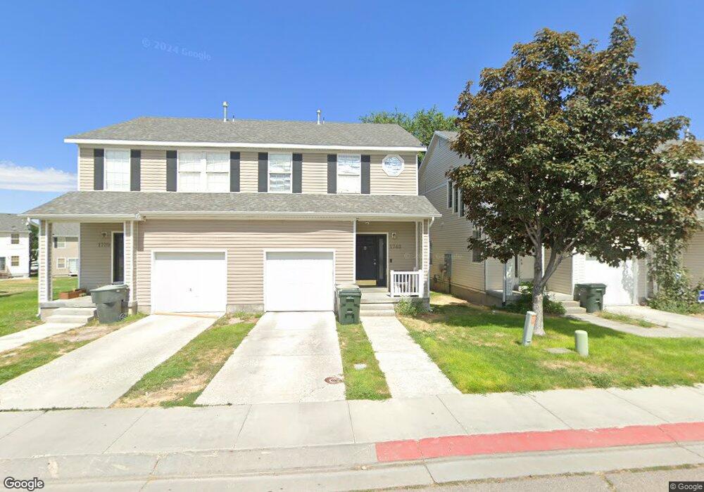
1743 Anson Dr Tooele, UT 84074
Estimated Value: $303,000 - $351,000
3
Beds
2
Baths
2,117
Sq Ft
$156/Sq Ft
Est. Value
About This Home
This home is located at 1743 Anson Dr, Tooele, UT 84074 and is currently estimated at $329,414, approximately $155 per square foot. 1743 Anson Dr is a home located in Tooele County with nearby schools including Overlake Elementary School, Clarke N. Johnsen Junior High School, and Stansbury High School.
Ownership History
Date
Name
Owned For
Owner Type
Purchase Details
Closed on
May 7, 2008
Sold by
Deutsche Bank National Trust Co
Bought by
Flowers Lee M
Current Estimated Value
Home Financials for this Owner
Home Financials are based on the most recent Mortgage that was taken out on this home.
Original Mortgage
$132,815
Outstanding Balance
$84,067
Interest Rate
5.87%
Mortgage Type
FHA
Estimated Equity
$245,347
Purchase Details
Closed on
Mar 6, 2008
Sold by
Schmitt Adam and Moore Cammie
Bought by
Deutsche Bank Natioanl Trust Co
Purchase Details
Closed on
Mar 16, 2006
Sold by
Holmes Homes Inc
Bought by
Schmitt Adam and Moore Cammie
Home Financials for this Owner
Home Financials are based on the most recent Mortgage that was taken out on this home.
Original Mortgage
$100,800
Interest Rate
7.25%
Mortgage Type
Adjustable Rate Mortgage/ARM
Create a Home Valuation Report for This Property
The Home Valuation Report is an in-depth analysis detailing your home's value as well as a comparison with similar homes in the area
Home Values in the Area
Average Home Value in this Area
Purchase History
| Date | Buyer | Sale Price | Title Company |
|---|---|---|---|
| Flowers Lee M | -- | None Available | |
| Deutsche Bank Natioanl Trust Co | $108,078 | None Available | |
| Schmitt Adam | -- | Meridian Title Co |
Source: Public Records
Mortgage History
| Date | Status | Borrower | Loan Amount |
|---|---|---|---|
| Open | Flowers Lee M | $132,815 | |
| Previous Owner | Schmitt Adam | $100,800 |
Source: Public Records
Tax History Compared to Growth
Tax History
| Year | Tax Paid | Tax Assessment Tax Assessment Total Assessment is a certain percentage of the fair market value that is determined by local assessors to be the total taxable value of land and additions on the property. | Land | Improvement |
|---|---|---|---|---|
| 2025 | $2,067 | $302,896 | $73,000 | $229,896 |
| 2024 | $2,343 | $173,232 | $55,000 | $118,232 |
| 2023 | $2,343 | $167,241 | $36,300 | $130,941 |
| 2022 | $1,772 | $146,419 | $41,250 | $105,169 |
| 2021 | $1,649 | $113,267 | $13,750 | $99,517 |
| 2020 | $1,554 | $188,009 | $25,000 | $163,009 |
| 2019 | $1,462 | $175,114 | $23,333 | $151,781 |
| 2018 | $1,285 | $146,425 | $25,000 | $121,425 |
| 2017 | $1,004 | $135,386 | $25,000 | $110,386 |
| 2016 | $724 | $66,543 | $13,750 | $52,793 |
| 2015 | $724 | $51,334 | $0 | $0 |
| 2014 | -- | $51,334 | $0 | $0 |
Source: Public Records
Map
Nearby Homes
- 1778 Brett St
- 94 E Broxburn Way
- 39 W 1930 N
- Drysdale Twinhomes Plan at Drysdale Twinhomes
- 1861 N 70 W Unit 616
- 1885 N 70 W Unit 619
- 1877 N 70 W Unit 618
- 69 1930 N
- 1893 N 70 W
- 1893 N 70 W Unit 620
- 179 Green Pines Ave
- 1909 N 70 W
- 81 W 1930 N
- 61 W 1570 N
- 1725 180 E Unit D137
- 1206 N Berra Blvd
- 2057 N Loxley Dr
- 2065 N Loxley Dr
- 1466 N Berra Blvd Unit 227
- 1428 Baen Way Unit 241
- 1739 Anson Dr
- 1749 Anson Dr
- 1751 Anson Dr
- 1753 Anson Dr
- 1759 Anson Dr
- 1753 Aaron Dr
- 1743 N Aaron Dr Unit 47
- 1763 Anson Dr
- 1743 Aaron Dr
- 1772 Banks St
- 1733 N Aaron Dr Unit 48
- 1733 N Aaron Dr
- 1733 Aaron Dr
- 1763 N Aaron Dr Unit 45
- 1763 Banks St
- 1767 Anson Dr
- 1763 Aaron Dr
- 1776 Banks St
- 1767 Banks St
- 1767 Banks St Unit 121