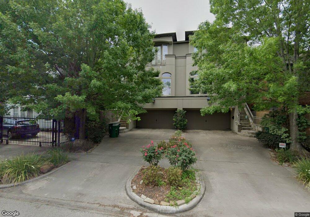
1743 Branard St Houston, TX 77098
Montrose NeighborhoodEstimated Value: $715,620 - $879,000
3
Beds
4
Baths
2,870
Sq Ft
$272/Sq Ft
Est. Value
About This Home
This home is located at 1743 Branard St, Houston, TX 77098 and is currently estimated at $781,155, approximately $272 per square foot. 1743 Branard St is a home located in Harris County with nearby schools including Poe Elementary School, Lanier Middle School, and Lamar High School.
Ownership History
Date
Name
Owned For
Owner Type
Purchase Details
Closed on
Apr 8, 2015
Sold by
Eversole Mark David
Bought by
Court Laurence
Current Estimated Value
Home Financials for this Owner
Home Financials are based on the most recent Mortgage that was taken out on this home.
Original Mortgage
$417,000
Outstanding Balance
$322,640
Interest Rate
3.88%
Mortgage Type
New Conventional
Estimated Equity
$458,515
Purchase Details
Closed on
Jun 26, 2007
Sold by
Hhn Homes Lp
Bought by
Eversole Mark David
Home Financials for this Owner
Home Financials are based on the most recent Mortgage that was taken out on this home.
Original Mortgage
$352,425
Interest Rate
6.37%
Mortgage Type
Purchase Money Mortgage
Purchase Details
Closed on
Feb 15, 2006
Sold by
Williams Lila A
Bought by
Hhn Homes Lp
Create a Home Valuation Report for This Property
The Home Valuation Report is an in-depth analysis detailing your home's value as well as a comparison with similar homes in the area
Home Values in the Area
Average Home Value in this Area
Purchase History
| Date | Buyer | Sale Price | Title Company |
|---|---|---|---|
| Court Laurence | -- | Chicago Title | |
| Eversole Mark David | -- | Fidelity National Title | |
| Hhn Homes Lp | -- | Stewart Title Company |
Source: Public Records
Mortgage History
| Date | Status | Borrower | Loan Amount |
|---|---|---|---|
| Open | Court Laurence | $417,000 | |
| Previous Owner | Eversole Mark David | $352,425 |
Source: Public Records
Tax History Compared to Growth
Tax History
| Year | Tax Paid | Tax Assessment Tax Assessment Total Assessment is a certain percentage of the fair market value that is determined by local assessors to be the total taxable value of land and additions on the property. | Land | Improvement |
|---|---|---|---|---|
| 2025 | $11,116 | $763,680 | $316,250 | $447,430 |
| 2024 | $11,116 | $714,732 | $316,250 | $398,482 |
| 2023 | $11,116 | $740,100 | $316,250 | $423,850 |
| 2022 | $14,314 | $650,064 | $258,750 | $391,314 |
| 2021 | $14,534 | $623,607 | $301,875 | $321,732 |
| 2020 | $15,246 | $629,580 | $301,875 | $327,705 |
| 2019 | $14,664 | $579,488 | $165,000 | $414,488 |
| 2018 | $12,130 | $611,065 | $165,000 | $446,065 |
| 2017 | $16,215 | $611,065 | $165,000 | $446,065 |
| 2016 | $16,215 | $611,065 | $165,000 | $446,065 |
| 2015 | $9,416 | $611,065 | $165,000 | $446,065 |
| 2014 | $9,416 | $528,800 | $144,375 | $384,425 |
Source: Public Records
Map
Nearby Homes
- 1737 Branard St
- 1805 Sul Ross St
- 1819 Branard St
- 1721 Colquitt St
- 1818 Colquitt St
- 1648 Colquitt St
- 1723 Marshall St
- 1648 Richmond Ave
- 1844 Colquitt St
- 1849 W Main St Unit 15
- 1802 Portsmouth St
- 1615 W Main St
- 1638 W Alabama St
- 1842 W Alabama St
- 1844 W Alabama St
- 1620, 1624 & 1630 Richmond Ave
- 1826 Portsmouth St
- 1755 Kipling St
- 1824 Marshall St
- 3818 Hazard St
- 1745 Branard St
- 1739 Branard St
- 1739 Branard St Unit A
- 1739 Branard St Unit 1
- 1747 Branard St
- 1737 Branard St Unit 1
- 1753 Branard St
- 1753 Branard St Unit B
- 1744 W Main St
- 1746 W Main St
- 1740 W Main St
- 1748 W Main St
- 1742 W Main St Unit 1744.5
- 1742 W Main St Unit 1744
- 1752 W Main St
- 1736 W Main St
- 1757 Branard St
- 1750 Branard St
- 1752 Branard St
- 1732 W Main St