1743 Rome Hwy Unit 1085 Cedartown, GA 30125
Estimated Value: $195,224 - $395,000
3
Beds
1
Bath
1,244
Sq Ft
$253/Sq Ft
Est. Value
About This Home
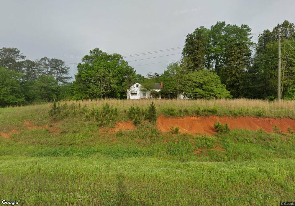
This home is located at 1743 Rome Hwy Unit 1085, Cedartown, GA 30125 and is currently estimated at $314,556, approximately $252 per square foot. 1743 Rome Hwy Unit 1085 is a home located in Polk County with nearby schools including Vineyard Harvester Christian Academy.
Ownership History
Date
Name
Owned For
Owner Type
Purchase Details
Closed on
May 1, 2020
Sold by
Astin Mary B
Bought by
Hospital Authority Of Floyd County
Current Estimated Value
Purchase Details
Closed on
Dec 10, 2013
Sold by
Mccurry David C
Bought by
Astin Mary B
Purchase Details
Closed on
Jun 20, 2007
Sold by
Astin Mary B
Bought by
Astin Mary B
Purchase Details
Closed on
Oct 1, 2001
Sold by
Mcurry Arville B
Bought by
Astin Mary B
Purchase Details
Closed on
Sep 19, 2001
Sold by
Mccurry Arville B
Bought by
Mccurry Arville B
Purchase Details
Closed on
Nov 30, 1961
Bought by
Mccurry Carl R
Create a Home Valuation Report for This Property
The Home Valuation Report is an in-depth analysis detailing your home's value as well as a comparison with similar homes in the area
Home Values in the Area
Average Home Value in this Area
Purchase History
| Date | Buyer | Sale Price | Title Company |
|---|---|---|---|
| Hospital Authority Of Floyd County | $255,000 | -- | |
| Astin Mary B | -- | -- | |
| Astin Mary B | -- | -- | |
| Astin Mary B | -- | -- | |
| Mccurry Arville B | -- | -- | |
| Mccurry Carl R | -- | -- |
Source: Public Records
Tax History Compared to Growth
Tax History
| Year | Tax Paid | Tax Assessment Tax Assessment Total Assessment is a certain percentage of the fair market value that is determined by local assessors to be the total taxable value of land and additions on the property. | Land | Improvement |
|---|---|---|---|---|
| 2024 | -- | $68,364 | $63,216 | $5,148 |
| 2023 | $0 | $68,364 | $63,216 | $5,148 |
| 2022 | $2,391 | $68,364 | $63,216 | $5,148 |
| 2021 | $2,391 | $68,364 | $63,216 | $5,148 |
| 2020 | $1,647 | $68,364 | $63,216 | $5,148 |
| 2019 | $1,836 | $68,364 | $63,216 | $5,148 |
| 2018 | $2,594 | $94,121 | $80,000 | $14,121 |
| 2017 | $467 | $17,148 | $3,027 | $14,121 |
| 2016 | $488 | $17,921 | $3,800 | $14,121 |
| 2015 | $542 | $19,870 | $5,722 | $14,148 |
| 2014 | $546 | $19,870 | $5,722 | $14,148 |
Source: Public Records
Map
Nearby Homes
- 0 Rome Hwy Unit 10521649
- 3159 Rome Hwy
- 160 Cherokee Rd
- 232 Stephens Rd
- 262 Stephens Rd
- 246 Stephens Rd
- 68 Cherokee Terrace
- 133 Virginia Cir
- 95 Virginia Cir
- 64 Virginia Cir
- 828 N College Dr
- 255 Meadow Lakes Blvd
- 0 Woodlawn Dr Unit 7638056
- 0 Woodlawn Dr Unit 10590789
- 462 Oakwood Dr
- 416 Lakeview Dr
- 217 Cherokee Cir
- 113 Cherokee Estates Dr
- 47 Meadow Lakes Terrace
- 1743 Rome Hwy
- 9 Cherokee Rd
- 0 Hwy 27 N Unit 6061662
- 0 Rome Hwy Unit 5961298
- 0 Rome Hwy Unit 5959566
- 0 Martha Berry Hwy Unit 8320905
- 0 Highway 27 N Unit 2548669
- 0 Highway 27 N Unit 2612624
- 0 Highway 27 N Unit 3276686
- 0 Hwy 27 N Unit A 7336469
- 0 Us 27 Martha Berry Hwy Unit 7455337
- 0 Hwy 27 N Unit A 7567666
- 0 Hwy 27 N Unit 7011660
- 0 Highway 27 N Unit 7067253
- 0 Rome Hwy Unit 7081993
- 0 Highway 27 N Unit 7281168
- 0 Hwy 27 N Unit 7336462
- 0 Highway 27 N Unit TRACT 4 & 5 7545859
- 0 Hwy 27 N Unit 7545857
- 0 Hwy 27 N Unit 7567649