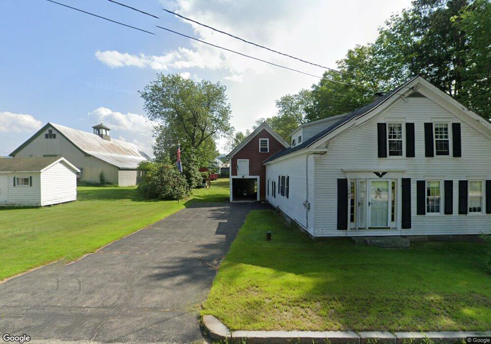
1743 Route 2 Rumford, ME 04276
Estimated Value: $89,000 - $182,895
Studio
1
Bath
1,170
Sq Ft
$135/Sq Ft
Est. Value
About This Home
This home is located at 1743 Route 2, Rumford, ME 04276 and is currently estimated at $157,724, approximately $134 per square foot. 1743 Route 2 is a home with nearby schools including Rumford Elementary School, Meroby Elementary School, and Mountain Valley Middle School.
Create a Home Valuation Report for This Property
The Home Valuation Report is an in-depth analysis detailing your home's value as well as a comparison with similar homes in the area
Home Values in the Area
Average Home Value in this Area
Tax History
| Year | Tax Paid | Tax Assessment Tax Assessment Total Assessment is a certain percentage of the fair market value that is determined by local assessors to be the total taxable value of land and additions on the property. | Land | Improvement |
|---|---|---|---|---|
| 2025 | $2,442 | $130,400 | $21,100 | $109,300 |
| 2024 | $2,167 | $130,400 | $21,100 | $109,300 |
| 2023 | $2,067 | $93,200 | $15,100 | $78,100 |
| 2022 | $2,067 | $93,200 | $15,100 | $78,100 |
| 2021 | $2,092 | $93,200 | $15,100 | $78,100 |
| 2020 | $2,106 | $93,200 | $15,100 | $78,100 |
| 2019 | $1,526 | $50,040 | $7,500 | $42,540 |
| 2018 | $1,489 | $50,040 | $7,500 | $42,540 |
| 2017 | $1,444 | $50,040 | $7,500 | $42,540 |
| 2016 | $1,401 | $50,040 | $7,500 | $42,540 |
| 2015 | $1,374 | $50,040 | $7,500 | $42,540 |
| 2014 | $1,349 | $50,040 | $7,500 | $42,540 |
Source: Public Records
Map
Nearby Homes
- 10 Mill Hill Rd
- 2165 Main St
- 2139 Intervale Rd
- Map 240 Lot 1 Map 239 Lot 4
- 3 Moose Ridge
- 159 Martin Rd
- 3 Gore Line Rd
- 1 Stearns Hill Rd
- TBD Tara's Way
- 49 Balsam Rd
- 86 Lauries Ln
- 1019 U S Highway 2
- TBD Plumbago Mountain
- 46 English Woods Rd
- 1318 U S 2
- 17 Countryside Ln
- 9 Countryside Ln
- 00 Main St
- 509 Blackberry Ln
- 1257 Route 2 Unit 1-5
Your Personal Tour Guide
Ask me questions while you tour the home.