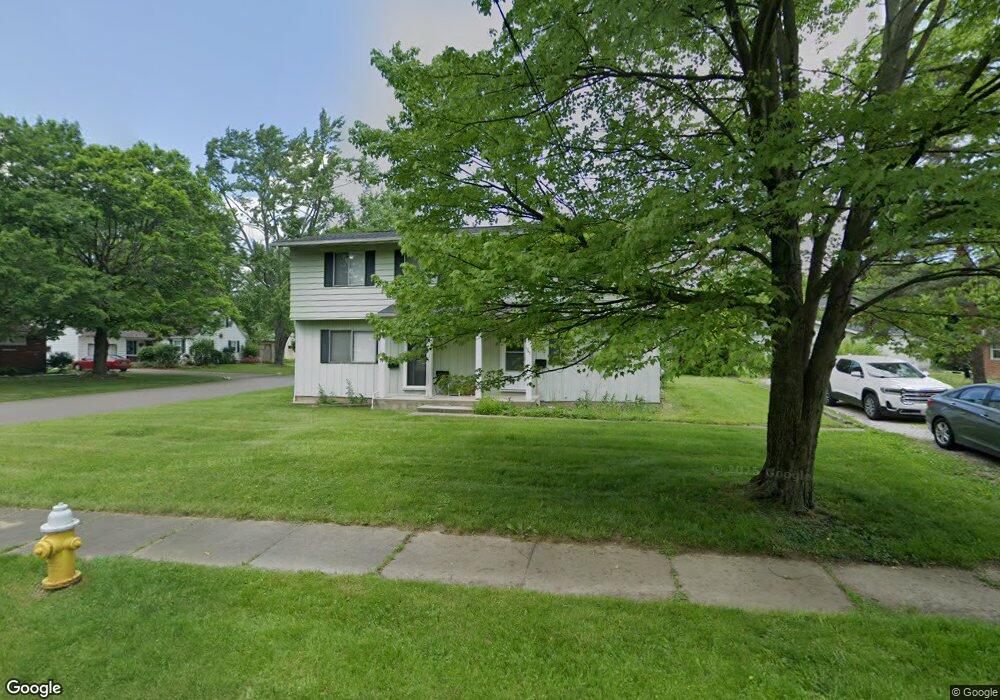
1743 Shatto Ave Unit 1745 Akron, OH 44313
Northwest Akron NeighborhoodEstimated Value: $179,000 - $237,091
6
Beds
4
Baths
2,016
Sq Ft
$100/Sq Ft
Est. Value
About This Home
This home is located at 1743 Shatto Ave Unit 1745, Akron, OH 44313 and is currently estimated at $202,023, approximately $100 per square foot. 1743 Shatto Ave Unit 1745 is a home located in Summit County with nearby schools including Summit Academy School, Our Lady Of The Elms Elementary School, and St. Sebastian Parish School.
Ownership History
Date
Name
Owned For
Owner Type
Purchase Details
Closed on
Oct 20, 2022
Sold by
Barter Kristine M and Watkins Scott T
Bought by
Loureiro Jana L and Watkins Scott T
Current Estimated Value
Purchase Details
Closed on
Nov 12, 2018
Sold by
Elias Eugene
Bought by
Watkins Scott T and Barter Kristine M
Create a Home Valuation Report for This Property
The Home Valuation Report is an in-depth analysis detailing your home's value as well as a comparison with similar homes in the area
Home Values in the Area
Average Home Value in this Area
Purchase History
| Date | Buyer | Sale Price | Title Company |
|---|---|---|---|
| Loureiro Jana L | -- | None Listed On Document | |
| Watkins Scott T | $108,500 | Kingdom Title |
Source: Public Records
Tax History Compared to Growth
Tax History
| Year | Tax Paid | Tax Assessment Tax Assessment Total Assessment is a certain percentage of the fair market value that is determined by local assessors to be the total taxable value of land and additions on the property. | Land | Improvement |
|---|---|---|---|---|
| 2025 | $3,244 | $56,683 | $13,122 | $43,561 |
| 2024 | $3,244 | $56,683 | $13,122 | $43,561 |
| 2023 | $3,244 | $56,683 | $13,122 | $43,561 |
| 2022 | $3,066 | $41,850 | $9,580 | $32,270 |
| 2021 | $3,069 | $41,850 | $9,580 | $32,270 |
| 2020 | $3,026 | $41,850 | $9,580 | $32,270 |
| 2019 | $2,911 | $36,470 | $13,090 | $23,380 |
| 2018 | $2,924 | $36,470 | $13,090 | $23,380 |
| 2017 | $2,885 | $36,470 | $13,090 | $23,380 |
| 2016 | $2,887 | $35,330 | $13,090 | $22,240 |
| 2015 | $2,885 | $35,330 | $13,090 | $22,240 |
| 2014 | $2,863 | $35,330 | $13,090 | $22,240 |
| 2013 | $2,886 | $36,410 | $13,090 | $23,320 |
Source: Public Records
Map
Nearby Homes
- 1725 Liberty Dr Unit 1727
- 1688 Tanglewood Dr Unit 1690
- 1633-1635 Liberty Dr
- 1623 Liberty Dr Unit 1625
- 242 N Hawkins Ave
- 84 S Pershing Ave
- 100 N Hawkins Ave
- 1883 Larchmont Rd
- 2024 Braewick Dr
- 101 N Hawkins Ave
- 2040 Braewick Dr
- 311 Goodhue Dr
- 1785 Fairlawn Knolls Dr
- 2040 Thurmont Rd
- 2113 Stabler Rd
- 297 Harcourt Dr
- 0 White Pond Dr Unit 5156539
- 325 Melbourne Ave
- 590 N Hawkins Ave
- 1804-1808 Cromwell Dr
- 1745 Shatto Ave
- 1735 Shatto Ave Unit 1737
- 1735 1737 Shatto Ave
- V/L #61 Shatto Ave
- V/L Shatto Ave
- 1731 Shatto Ave Unit 1733
- 1784 Liberty Dr Unit 1786
- 1778 Liberty Dr Unit 1780
- 1778 1780 Liberty Dr
- 1774 Liberty Dr Unit 1776
- 1727 Shatto Ave Unit 1729
- 166 Western Ave
- 1768 Liberty Dr Unit 1770
- 1768 1770 Liberty Dr
- 174 Western Ave
- 1776 Liberty Dr
- 1764 Liberty Dr Unit 1766
- 1764 1766 Liberty Dr
- 1723 Shatto Ave Unit 1725
- 1800 Liberty Dr