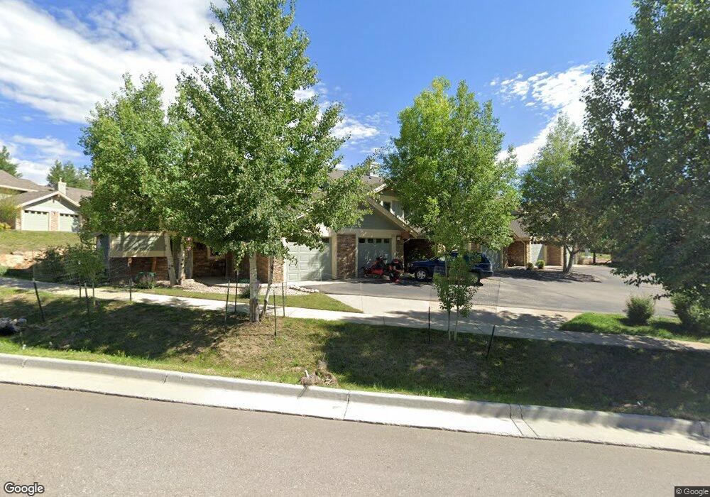
1743 Wildfire Rd Unit 1743 Estes Park, CO 80517
Estimated Value: $322,890 - $513,000
3
Beds
2
Baths
1,388
Sq Ft
$300/Sq Ft
Est. Value
About This Home
This home is located at 1743 Wildfire Rd Unit 1743, Estes Park, CO 80517 and is currently estimated at $416,473, approximately $300 per square foot. 1743 Wildfire Rd Unit 1743 is a home located in Larimer County with nearby schools including Estes Park K-5 School, Estes Park Options School, and Estes Park Middle School.
Ownership History
Date
Name
Owned For
Owner Type
Purchase Details
Closed on
Apr 14, 2009
Sold by
Tapia Jesus S and De Tapia Rosa Bernal
Bought by
Sanchez Jesus Tapia and Detapia Rosa Bernal
Current Estimated Value
Home Financials for this Owner
Home Financials are based on the most recent Mortgage that was taken out on this home.
Original Mortgage
$162,000
Outstanding Balance
$104,049
Interest Rate
5.24%
Mortgage Type
New Conventional
Estimated Equity
$312,424
Purchase Details
Closed on
Mar 31, 2006
Sold by
Estes Investors Llc
Bought by
Detapia Rosa Bernal and Tapia Jesus S
Home Financials for this Owner
Home Financials are based on the most recent Mortgage that was taken out on this home.
Original Mortgage
$7,885
Interest Rate
1%
Mortgage Type
Unknown
Create a Home Valuation Report for This Property
The Home Valuation Report is an in-depth analysis detailing your home's value as well as a comparison with similar homes in the area
Home Values in the Area
Average Home Value in this Area
Purchase History
| Date | Buyer | Sale Price | Title Company |
|---|---|---|---|
| Sanchez Jesus Tapia | -- | Security Title | |
| Detapia Rosa Bernal | $226,500 | None Available |
Source: Public Records
Mortgage History
| Date | Status | Borrower | Loan Amount |
|---|---|---|---|
| Open | Sanchez Jesus Tapia | $162,000 | |
| Closed | Detapia Rosa Bernal | $7,885 | |
| Closed | Detapia Rosa Bernal | $156,000 |
Source: Public Records
Tax History Compared to Growth
Tax History
| Year | Tax Paid | Tax Assessment Tax Assessment Total Assessment is a certain percentage of the fair market value that is determined by local assessors to be the total taxable value of land and additions on the property. | Land | Improvement |
|---|---|---|---|---|
| 2025 | $1,097 | $18,666 | $3,913 | $14,753 |
| 2024 | $1,079 | $18,666 | $3,913 | $14,753 |
| 2022 | $1,923 | $25,180 | $4,059 | $21,121 |
| 2021 | $1,974 | $25,905 | $4,176 | $21,729 |
| 2020 | $1,693 | $21,937 | $4,176 | $17,761 |
| 2019 | $1,684 | $21,937 | $4,176 | $17,761 |
| 2018 | $1,502 | $18,972 | $4,205 | $14,767 |
| 2017 | $1,510 | $18,972 | $4,205 | $14,767 |
| 2016 | $1,384 | $18,436 | $4,649 | $13,787 |
| 2015 | $1,399 | $18,440 | $4,650 | $13,790 |
| 2014 | $1,247 | $16,860 | $4,650 | $12,210 |
Source: Public Records
Map
Nearby Homes
- 1734 Wildfire Rd Unit 102
- 1734 Wildfire Rd Unit 204
- 880 Crabapple Ln
- 1700 Wildfire Rd Unit 301
- 1700 Wildfire Rd Unit 201
- 1700 Wildfire Rd Unit 302
- 1802 Wildfire Rd Unit 302
- 1790 Continental Peaks Cir
- 1780 Continental Peaks Cir
- 1770 Continental Peaks Cir
- 1728 Continental Peaks Cir
- 1760 Continental Peaks Cir
- 1724 Continental Peaks Cir
- 1707 Continental Peaks Cir
- 1722 Continental Peaks Cir
- 1705 Continental Peaks Cir
- 1750 Continental Peaks Cir
- 1720 Continental Peaks Cir
- 1701 Continental Peaks Cir
- 1616 Continental Peaks Cir
- 1745 Wildfire Rd
- 1745 Wildfire Rd Unit 1745
- 1741 Wildfire Rd Unit 1741
- 1747 Wildfire Rd Unit 1747
- 1751 Wildfire Rd Unit 1751
- 1761 Wildfire Rd Unit 1761
- 891 Crabapple Ln Unit 891
- 878 Crabapple Ln Unit 878
- 861 Crabapple Ln Unit 861
- 863 Crabapple Ln Unit 863
- 889 Crabapple Ln Unit 889
- 1763 Wildfire Rd Unit 1763
- 887 Crabapple Ln Unit 887
- 876 Crabapple Ln Unit 876
- 1765 Wildfire Rd Unit 1765
- 867 Crabapple Ln Unit 867
- 874 Crabapple Ln Unit 874
- 869 Crabapple Ln Unit 869
- 872 Crabapple Ln Unit 872
- 871 Crabapple Ln Unit 871