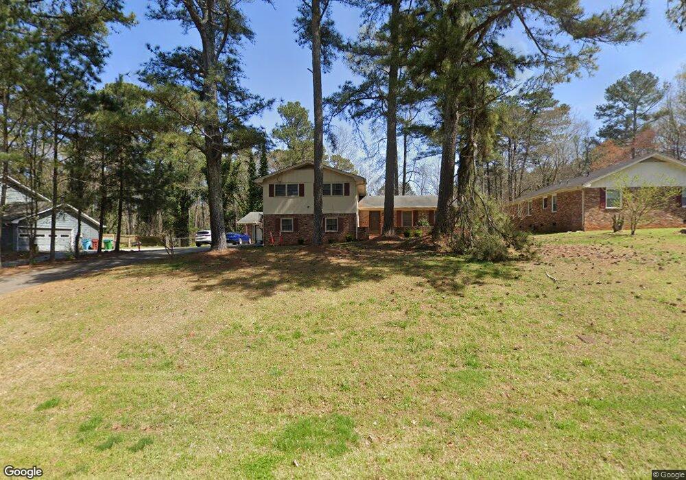
1744 Highpoint Rd Unit 1 Snellville, GA 30078
Estimated Value: $389,000 - $460,000
3
Beds
3
Baths
2,490
Sq Ft
$170/Sq Ft
Est. Value
About This Home
This home is located at 1744 Highpoint Rd Unit 1, Snellville, GA 30078 and is currently estimated at $424,362, approximately $170 per square foot. 1744 Highpoint Rd Unit 1 is a home located in Gwinnett County with nearby schools including Brookwood Elementary School, Five Forks Middle School, and Brookwood High School.
Ownership History
Date
Name
Owned For
Owner Type
Purchase Details
Closed on
Jun 1, 2001
Sold by
Leathers Nancy J
Bought by
Kelley Antoine F and Kelley Larunda D
Current Estimated Value
Home Financials for this Owner
Home Financials are based on the most recent Mortgage that was taken out on this home.
Original Mortgage
$149,814
Outstanding Balance
$55,351
Interest Rate
7.05%
Mortgage Type
FHA
Estimated Equity
$369,011
Create a Home Valuation Report for This Property
The Home Valuation Report is an in-depth analysis detailing your home's value as well as a comparison with similar homes in the area
Home Values in the Area
Average Home Value in this Area
Purchase History
| Date | Buyer | Sale Price | Title Company |
|---|---|---|---|
| Kelley Antoine F | $151,000 | -- |
Source: Public Records
Mortgage History
| Date | Status | Borrower | Loan Amount |
|---|---|---|---|
| Open | Kelley Antoine F | $149,814 |
Source: Public Records
Tax History Compared to Growth
Tax History
| Year | Tax Paid | Tax Assessment Tax Assessment Total Assessment is a certain percentage of the fair market value that is determined by local assessors to be the total taxable value of land and additions on the property. | Land | Improvement |
|---|---|---|---|---|
| 2025 | $4,847 | $200,880 | $22,200 | $178,680 |
| 2024 | $4,648 | $183,960 | $22,200 | $161,760 |
| 2023 | $4,648 | $168,360 | $26,400 | $141,960 |
| 2022 | $3,903 | $149,520 | $23,600 | $125,920 |
| 2021 | $3,128 | $109,200 | $18,400 | $90,800 |
| 2020 | $3,047 | $104,320 | $16,000 | $88,320 |
| 2019 | $2,910 | $100,360 | $13,600 | $86,760 |
| 2018 | $2,771 | $93,800 | $13,600 | $80,200 |
| 2016 | $2,403 | $75,760 | $11,600 | $64,160 |
| 2015 | $2,156 | $63,560 | $9,200 | $54,360 |
| 2014 | $2,165 | $63,560 | $9,200 | $54,360 |
Source: Public Records
Map
Nearby Homes
- 3063 Bruckner Blvd
- 3207 Aspen Cir SW
- 1845 Lisa Springs Dr
- Kenwood Plan at Watson Park
- Stockbridge Plan at Watson Park
- Aiken Plan at Watson Park
- Lawrence Plan at Watson Park
- Easton Plan at Watson Park
- 1904 Britt Dr
- 1953 Watson Park Dr
- 1916 Oakwood Grove Dr Unit 1
- 1721 Bruckner Ct
- 3173 Falconhurst Dr SW
- 1686 Norton Estates Dr
- 3331 Manchester Dr SW
- 1795 Elmwood Cir
- 2034 Britt Dr
- 1220 Edgebrook Ln
- 1750 Manor Brook Way
- 1754 Highpoint Rd
- 1734 Highpoint Rd
- 1723 Vertex Dr
- 1764 Highpoint Rd
- 1724 Highpoint Rd
- 1724 Vertex Dr
- 3159 Vail Ct
- 3160 Vail Ct
- 1774 Highpoint Rd Unit 1
- 1729 Vertex Dr
- 1714 Highpoint Rd
- 1725 Highpoint Rd Unit 3
- 1765 Highpoint Rd
- 1730 Vertex Dr Unit 2
- 3152 Aspen Cir
- 3123 Bruckner Blvd Unit 2
- 1704 Highpoint Rd
- 1704 Highpoint Rd Unit 1
- 1784 Highpoint Rd
- 1775 Highpoint Rd