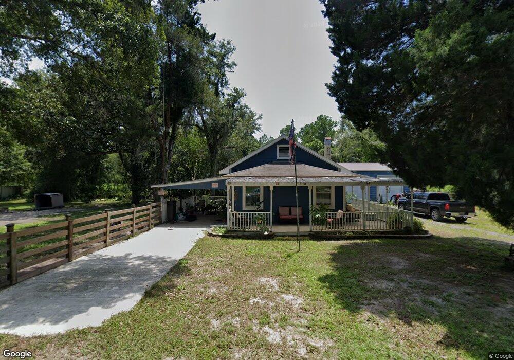
17440 Tavern Rd Brooksville, FL 34604
Estimated Value: $258,000 - $394,237
--
Bed
1
Bath
1,200
Sq Ft
$261/Sq Ft
Est. Value
About This Home
This home is located at 17440 Tavern Rd, Brooksville, FL 34604 and is currently estimated at $313,309, approximately $261 per square foot. 17440 Tavern Rd is a home located in Hernando County with nearby schools including Moton Elementary School, Hernando High School, and D. S. Parrott Middle School.
Ownership History
Date
Name
Owned For
Owner Type
Purchase Details
Closed on
Sep 22, 2021
Sold by
Raffoul Moussa
Bought by
Aponte Carlos
Current Estimated Value
Purchase Details
Closed on
Jun 7, 2019
Sold by
Crum Marshall E and Crum Maixe H
Bought by
Aponte Carlos
Home Financials for this Owner
Home Financials are based on the most recent Mortgage that was taken out on this home.
Original Mortgage
$130,000
Interest Rate
4.1%
Mortgage Type
Purchase Money Mortgage
Purchase Details
Closed on
Mar 13, 2003
Sold by
Woodruff Ken and Crum Eugene
Bought by
State Fl Dept Transportation
Create a Home Valuation Report for This Property
The Home Valuation Report is an in-depth analysis detailing your home's value as well as a comparison with similar homes in the area
Home Values in the Area
Average Home Value in this Area
Purchase History
| Date | Buyer | Sale Price | Title Company |
|---|---|---|---|
| Aponte Carlos | $29,500 | Pineapple Ttl Of Tampa Bay L | |
| Aponte Carlos | -- | Gulf Coast Title Co Inc | |
| Aponte Carlos | $150,000 | Gulf Coast Title Co Inc | |
| State Fl Dept Transportation | -- | -- |
Source: Public Records
Mortgage History
| Date | Status | Borrower | Loan Amount |
|---|---|---|---|
| Previous Owner | Aponte Carlos | $130,000 |
Source: Public Records
Tax History Compared to Growth
Tax History
| Year | Tax Paid | Tax Assessment Tax Assessment Total Assessment is a certain percentage of the fair market value that is determined by local assessors to be the total taxable value of land and additions on the property. | Land | Improvement |
|---|---|---|---|---|
| 2024 | $3,777 | $263,242 | $174,544 | $88,698 |
| 2023 | $3,777 | $260,864 | $174,544 | $86,320 |
| 2022 | $2,383 | $115,488 | $0 | $0 |
| 2021 | $1,723 | $104,989 | $67,620 | $37,369 |
| 2020 | $1,872 | $98,929 | $67,620 | $31,309 |
| 2019 | $1,891 | $96,966 | $67,620 | $29,346 |
| 2018 | $1,365 | $88,788 | $61,985 | $26,803 |
| 2017 | $1,617 | $85,335 | $61,985 | $23,350 |
| 2016 | $1,547 | $82,203 | $0 | $0 |
| 2015 | $1,921 | $104,183 | $0 | $0 |
| 2014 | $1,891 | $103,431 | $0 | $0 |
Source: Public Records
Map
Nearby Homes
- 17455 Sandlewood Ave
- 2757 Kingswood Cir
- 18035 Glen Raven Blvd
- 2459 Ayerswood Dr
- 2435 Ivywood Dr
- 18062 Carrolwood Dr
- 18100 Celia Ave
- 18104 Nicholas Ave
- 2956 Kingswood Cir
- 18112 Nicholas Ave
- 3258 Kentucky St
- 18078 Evening Star Ave
- 2366 Old Oak Trail
- 18216 Rivard Blvd
- 2309 Cross Tee Ct
- 18160 Spangler Ave
- 2255 Long View Cir
- 0 Broad St Unit 2221458
- 0 Broad St Unit 2227361
- 4044 Broad St
- 17440 Tavern Rd
- 17464 Tavern Rd
- 17463 Tavern Rd
- 17470 Sandlewood Ave
- lot 5 Glen Raven
- 17479 Glen Raven Blvd
- 0 Broad St Unit MFRW7876371
- 0 Broad St Unit 2118266
- 0 Broad St Unit 2096835
- 0 Broad St Unit 2097169
- 0 Broad St Unit 2099382
- 0 Broad St Unit 2105048
- 0 Broad St Unit 2107731
- 0 Broad St Unit 2108091
- 0 Broad St Unit 2109922
- 0 Broad St Unit 2112449
- 0 Broad St Unit 2115205
- 0 Broad St Unit 2119209
- 0 Broad St Unit 2119333
- 0 Broad St Unit 2120168