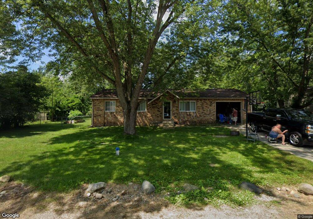
1745 Doris Jean St Hartland, MI 48353
Estimated Value: $251,554 - $276,000
3
Beds
1
Bath
960
Sq Ft
$274/Sq Ft
Est. Value
About This Home
This home is located at 1745 Doris Jean St, Hartland, MI 48353 and is currently estimated at $262,639, approximately $273 per square foot. 1745 Doris Jean St is a home located in Livingston County with nearby schools including Hartland High School, Charyl Stockwell Academy, and Our Savior Evangelical Lutheran School.
Ownership History
Date
Name
Owned For
Owner Type
Purchase Details
Closed on
Oct 29, 2021
Sold by
Green Joseph J and Green Jenifer D
Bought by
Green Jenifer D
Current Estimated Value
Home Financials for this Owner
Home Financials are based on the most recent Mortgage that was taken out on this home.
Original Mortgage
$134,000
Outstanding Balance
$122,599
Interest Rate
2.88%
Mortgage Type
New Conventional
Estimated Equity
$140,040
Purchase Details
Closed on
Jun 20, 2001
Sold by
Fiorillo David L
Bought by
Devoll Diane
Purchase Details
Closed on
Mar 30, 2000
Sold by
Devoll Diane
Bought by
Fiorillo David L and Devoll Diane M
Home Financials for this Owner
Home Financials are based on the most recent Mortgage that was taken out on this home.
Original Mortgage
$57,500
Interest Rate
8.21%
Create a Home Valuation Report for This Property
The Home Valuation Report is an in-depth analysis detailing your home's value as well as a comparison with similar homes in the area
Home Values in the Area
Average Home Value in this Area
Purchase History
| Date | Buyer | Sale Price | Title Company |
|---|---|---|---|
| Green Jenifer D | -- | Closing Usa Llc | |
| Devoll Diane | -- | Metropolitan Title Company | |
| Fiorillo David L | -- | Metropolitan Title Company | |
| Devoll Diane | -- | Metropolitan Title Company |
Source: Public Records
Mortgage History
| Date | Status | Borrower | Loan Amount |
|---|---|---|---|
| Open | Green Jenifer D | $134,000 | |
| Previous Owner | Devoll Diane | $57,500 |
Source: Public Records
Tax History Compared to Growth
Tax History
| Year | Tax Paid | Tax Assessment Tax Assessment Total Assessment is a certain percentage of the fair market value that is determined by local assessors to be the total taxable value of land and additions on the property. | Land | Improvement |
|---|---|---|---|---|
| 2025 | $1,453 | $101,200 | $0 | $0 |
| 2024 | $628 | $94,700 | $0 | $0 |
| 2023 | $600 | $76,500 | $0 | $0 |
| 2022 | $1,317 | $60,900 | $0 | $0 |
| 2021 | $1,263 | $70,800 | $0 | $0 |
| 2020 | $1,259 | $69,800 | $0 | $0 |
| 2019 | $1,711 | $60,900 | $0 | $0 |
| 2018 | $1,154 | $53,100 | $0 | $0 |
| 2017 | $1,134 | $53,100 | $0 | $0 |
| 2016 | $1,132 | $52,500 | $0 | $0 |
| 2014 | $1,512 | $44,100 | $0 | $0 |
| 2012 | $1,512 | $38,200 | $0 | $0 |
Source: Public Records
Map
Nearby Homes
- 1560 Odette
- 11639 Island Ct
- 12002 Renfrew Ct
- 1441 Remsing St Unit 4
- 2.03 Acres Highland Rd
- 12071 Highland Rd
- 1020 Woods Edge Dr
- 2581 Pepper Ct
- V/L Highland Rd
- 2255 Clark Rd
- 1163 Long Lake Dr
- 2933 Bullard Rd
- 1412 North Ct
- 000 Highland Rd
- V/L Parcel D Old Us-23 Hwy
- V/L Parcels C & D Old Us-23 Hwy
- V/L Parcel C Old Us-23 Hwy
- 10456 Viewtop Ct
- Chase Plan at Hunters Ridge - Landings 5
- Beretta Loft Plan at Hunters Ridge - Landings 5
- 1757 Doris Jean St
- 11803 Maxfield Blvd
- 1760 Doris Jean St
- 11795 Maxfield Blvd
- 11859 Maxfield Blvd
- 1769 Doris Jean St
- 1740 Maxfield Rd Unit Bldg-Unit
- 1740 Maxfield Rd
- 11832 Clair St
- 1760 Maxfield Rd
- 11879 Maxfield Blvd
- 1728 Maxfield Rd
- 1781 Doris Jean St
- 11846 Clair St
- 11893 Maxfield Blvd
- 11835 Clair St
- 1770 Maxfield Rd
- 1712 Maxfield Rd
- 11770 Maxfield Blvd
- 11824 Maxfield Blvd