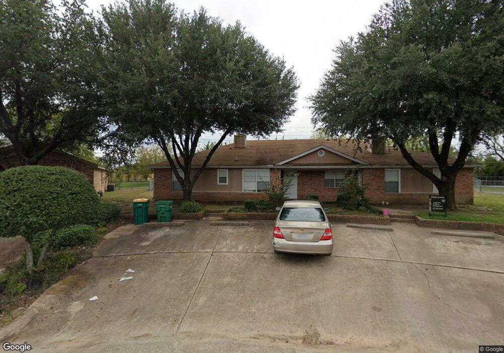
1745 Dynasty Cir Unit DIR Glenn Heights, TX 75154
Estimated Value: $223,000 - $394,238
3
Beds
2
Baths
1,320
Sq Ft
$263/Sq Ft
Est. Value
About This Home
This home is located at 1745 Dynasty Cir Unit DIR, Glenn Heights, TX 75154 and is currently estimated at $347,560, approximately $263 per square foot. 1745 Dynasty Cir Unit DIR is a home located in Dallas County with nearby schools including Woodridge Elementary School, Curtistene S Mccowan Middle School, and Life School Lancaster.
Ownership History
Date
Name
Owned For
Owner Type
Purchase Details
Closed on
Apr 30, 2010
Sold by
Hsbc Bank Usa Na
Bought by
Miller Bernadette
Current Estimated Value
Home Financials for this Owner
Home Financials are based on the most recent Mortgage that was taken out on this home.
Original Mortgage
$95,733
Outstanding Balance
$64,009
Interest Rate
5%
Mortgage Type
FHA
Estimated Equity
$283,551
Purchase Details
Closed on
Jan 6, 2009
Sold by
Carter Aaron
Bought by
Hsbc Bank Usa Na
Purchase Details
Closed on
May 16, 2007
Sold by
Mcbryde Family Partnership Ltd
Bought by
Carter Aaron
Home Financials for this Owner
Home Financials are based on the most recent Mortgage that was taken out on this home.
Original Mortgage
$160,650
Interest Rate
11.24%
Mortgage Type
Purchase Money Mortgage
Create a Home Valuation Report for This Property
The Home Valuation Report is an in-depth analysis detailing your home's value as well as a comparison with similar homes in the area
Home Values in the Area
Average Home Value in this Area
Purchase History
| Date | Buyer | Sale Price | Title Company |
|---|---|---|---|
| Miller Bernadette | -- | Lsi Title Agency Inc | |
| Hsbc Bank Usa Na | $114,390 | None Available | |
| Carter Aaron | -- | None Available |
Source: Public Records
Mortgage History
| Date | Status | Borrower | Loan Amount |
|---|---|---|---|
| Open | Miller Bernadette | $95,733 | |
| Previous Owner | Carter Aaron | $160,650 |
Source: Public Records
Tax History Compared to Growth
Tax History
| Year | Tax Paid | Tax Assessment Tax Assessment Total Assessment is a certain percentage of the fair market value that is determined by local assessors to be the total taxable value of land and additions on the property. | Land | Improvement |
|---|---|---|---|---|
| 2025 | $6,221 | $429,180 | $84,000 | $345,180 |
| 2024 | $6,221 | $390,040 | $84,000 | $306,040 |
| 2023 | $6,221 | $392,990 | $84,000 | $308,990 |
| 2022 | $7,174 | $291,610 | $72,000 | $219,610 |
| 2021 | $7,533 | $271,550 | $72,000 | $199,550 |
| 2020 | $7,095 | $238,630 | $48,000 | $190,630 |
| 2019 | $4,953 | $163,690 | $28,800 | $134,890 |
| 2018 | $4,963 | $163,690 | $28,800 | $134,890 |
| 2017 | $4,993 | $163,690 | $28,800 | $134,890 |
| 2016 | $3,871 | $126,900 | $24,000 | $102,900 |
| 2015 | $3,062 | $126,900 | $24,000 | $102,900 |
| 2014 | $3,062 | $104,550 | $14,000 | $90,550 |
Source: Public Records
Map
Nearby Homes
- 1713 Carrington Dr
- 1707 Creekview Dr
- 1808 High Meadow St
- 818 E Bear Creek Rd
- 331 E Bear Creek Rd
- 1915 Lillian Ave
- 902 Blue Quail Run
- 1906 Drake St
- 923 Blue Quail Run
- 910 Grouse Rd
- 1609 Panda Trail
- 1501 Teddy Trail
- 1528 Polar Trail Unit 164
- 1517 Kodiak Trail
- 515 Bear Trail
- 1511 Honey Trail
- 1519 Grizzly Trail Unit 129
- 1506 Pintail Ct
- 1531 Kodiak Trail
- 1512 Kodiak Trail
- 1745 Dynasty Cir
- 1751 Dynasty Cir
- 1739 Dynasty Cir
- 1759 Dynasty Cir
- 1721 Dynasty Cir
- 1725 Dynasty Cir
- 1731 Dynasty Cir
- 1737 Dynasty Cir
- 1757 Dynasty Cir
- 1735 Dynasty Cir
- 1735 Dynasty Cir Unit 1737
- 1729 Dynasty Cir
- 1738 Dynasty Dr
- 1723 Dynasty Cir
- 1758 Dynasty Dr
- 1750 Dynasty Dr
- 1760 Dynasty Dr
- 1746 Dynasty Dr
- 1736 Dynasty Dr
- 1719 Dynasty Dr