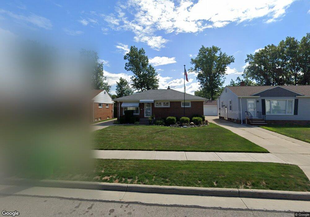
1745 Empire Rd Wickliffe, OH 44092
Estimated Value: $159,000 - $189,666
3
Beds
1
Bath
1,026
Sq Ft
$175/Sq Ft
Est. Value
About This Home
This home is located at 1745 Empire Rd, Wickliffe, OH 44092 and is currently estimated at $179,167, approximately $174 per square foot. 1745 Empire Rd is a home located in Lake County with nearby schools including Wickliffe Elementary School, Wickliffe Middle School, and Wickliffe High School.
Ownership History
Date
Name
Owned For
Owner Type
Purchase Details
Closed on
Jul 26, 2001
Sold by
Eugene Clark and Eugene Beverly A
Bought by
Clark Charles E
Current Estimated Value
Purchase Details
Closed on
Nov 24, 1999
Sold by
Strieble Ruth H
Bought by
Clark Eugene and Clark Beverly A
Purchase Details
Closed on
Jan 11, 1968
Bought by
Strieble William H
Create a Home Valuation Report for This Property
The Home Valuation Report is an in-depth analysis detailing your home's value as well as a comparison with similar homes in the area
Home Values in the Area
Average Home Value in this Area
Purchase History
| Date | Buyer | Sale Price | Title Company |
|---|---|---|---|
| Clark Charles E | -- | -- | |
| Clark Eugene | $82,000 | Midland Title Security Inc | |
| Strieble William H | -- | -- |
Source: Public Records
Tax History
| Year | Tax Paid | Tax Assessment Tax Assessment Total Assessment is a certain percentage of the fair market value that is determined by local assessors to be the total taxable value of land and additions on the property. | Land | Improvement |
|---|---|---|---|---|
| 2025 | -- | $62,960 | $18,100 | $44,860 |
| 2024 | -- | $62,960 | $18,100 | $44,860 |
| 2023 | $5,453 | $44,340 | $15,640 | $28,700 |
| 2022 | $3,181 | $44,340 | $15,640 | $28,700 |
| 2021 | $3,193 | $44,340 | $15,640 | $28,700 |
| 2020 | $3,007 | $35,470 | $12,510 | $22,960 |
| 2019 | $3,006 | $35,470 | $12,510 | $22,960 |
| 2018 | $2,636 | $37,920 | $13,860 | $24,060 |
| 2017 | $2,673 | $37,920 | $13,860 | $24,060 |
| 2016 | $2,660 | $37,920 | $13,860 | $24,060 |
| 2015 | $2,613 | $37,920 | $13,860 | $24,060 |
| 2014 | $2,302 | $37,920 | $13,860 | $24,060 |
| 2013 | $2,301 | $37,920 | $13,860 | $24,060 |
Source: Public Records
Map
Nearby Homes
- 30530 Grant St
- 1677 Mapledale Rd
- 1648 Douglas Rd
- 1842 Eldon Dr
- 30350 Twin Lakes Dr
- 5642 Grand Place
- 5481 Millwood Ln Unit C
- 1597 Lee Terrace Dr Unit F11
- 1522 Mapledale Rd
- 30302 Overlook Dr
- 30335 Euclid Ave Unit 40 and 20
- 30529 Ridge Rd
- 1719 E 300th St
- 5512 Sutton Ln Unit D
- 34345 Giovanni Ave
- 5520 Bretton Ct Unit A
- 5551 Ivy Ct
- 261 Chelsea Dr
- 5095 Shepherds Glen
- 5093 Shepherds Glen
- 1741 Empire Rd
- 1751 Empire Rd
- 1737 Empire Rd
- 1757 Empire Rd
- 1448 Birdie Ln
- 1454 Birdie Ln Unit 10
- 1454 Birdie Ln Unit 1454
- 1442 Birdie Ln
- 1731 Empire Rd
- 1460 Birdie Ln Unit 11
- 1761 Empire Rd
- 1436 Birdie Ln Unit 7
- 1725 Empire Rd
- 1430 Birdie Ln
- 1765 Empire Rd
- 1746 Empire Rd
- 1742 Empire Rd
- 1752 Empire Rd
- 1738 Empire Rd
- 1758 Empire Rd
Your Personal Tour Guide
Ask me questions while you tour the home.