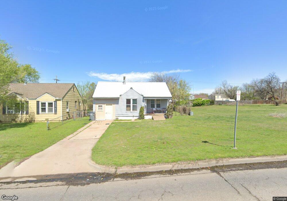
1745 NW Ferris Ave Lawton, OK 73507
Liberty Heights NeighborhoodEstimated Value: $64,000 - $110,000
2
Beds
1
Bath
1,100
Sq Ft
$73/Sq Ft
Est. Value
About This Home
This home is located at 1745 NW Ferris Ave, Lawton, OK 73507 and is currently estimated at $80,667, approximately $73 per square foot. 1745 NW Ferris Ave is a home located in Comanche County with nearby schools including Whittier Elementary School, Tomlinson Middle School, and Lawton High School.
Ownership History
Date
Name
Owned For
Owner Type
Purchase Details
Closed on
Apr 9, 2021
Sold by
Zuspann Joseph A and Znspaan Cynthia L
Bought by
Ftg Brown Llc
Current Estimated Value
Home Financials for this Owner
Home Financials are based on the most recent Mortgage that was taken out on this home.
Original Mortgage
$319,303
Outstanding Balance
$262,660
Interest Rate
2.9%
Mortgage Type
Future Advance Clause Open End Mortgage
Estimated Equity
-$181,993
Purchase Details
Closed on
Apr 1, 2009
Sold by
Nickell Mickey and Nickell Diann S
Bought by
Zuspann Joseph A and Zuspann Cynthia L
Home Financials for this Owner
Home Financials are based on the most recent Mortgage that was taken out on this home.
Original Mortgage
$45,000
Interest Rate
5.16%
Mortgage Type
Future Advance Clause Open End Mortgage
Purchase Details
Closed on
May 17, 1993
Sold by
Nickell Mickey and Nickell Kathy R
Create a Home Valuation Report for This Property
The Home Valuation Report is an in-depth analysis detailing your home's value as well as a comparison with similar homes in the area
Home Values in the Area
Average Home Value in this Area
Purchase History
| Date | Buyer | Sale Price | Title Company |
|---|---|---|---|
| Ftg Brown Llc | $120,000 | Southwest Abstract & Ttl Co | |
| Zuspann Joseph A | $32,500 | -- | |
| -- | -- | -- |
Source: Public Records
Mortgage History
| Date | Status | Borrower | Loan Amount |
|---|---|---|---|
| Open | Ftg Brown Llc | $319,303 | |
| Previous Owner | Zuspann Joseph A | $45,000 |
Source: Public Records
Tax History Compared to Growth
Tax History
| Year | Tax Paid | Tax Assessment Tax Assessment Total Assessment is a certain percentage of the fair market value that is determined by local assessors to be the total taxable value of land and additions on the property. | Land | Improvement |
|---|---|---|---|---|
| 2025 | $434 | $4,212 | $1,958 | $2,254 |
| 2024 | $434 | $4,212 | $2,051 | $2,161 |
| 2023 | $434 | $3,821 | $1,688 | $2,133 |
| 2022 | $407 | $3,821 | $1,688 | $2,133 |
| 2021 | $392 | $3,837 | $1,688 | $2,149 |
| 2020 | $372 | $3,654 | $1,688 | $1,966 |
| 2019 | $369 | $3,654 | $1,688 | $1,966 |
| 2018 | $353 | $3,544 | $1,688 | $1,856 |
| 2017 | $289 | $3,376 | $1,688 | $1,688 |
| 2016 | $86 | $980 | $980 | $0 |
| 2015 | $83 | $934 | $934 | $0 |
| 2014 | $529 | $5,975 | $934 | $5,041 |
Source: Public Records
Map
Nearby Homes
- 1742 NW Ash Ave
- 1713 NW Ferris Ave
- 2205 NW Crosby Ave
- 1712 NW Euclid Ave
- 1703 NW Euclid Ave
- 1908 NW Columbia Ave
- 1702 NW Euclid Ave
- 721 NW 17th St
- 1804 NW Columbia Ave
- 1711 NW Liberty Ave
- 1712 NW Columbia Ave
- 1339 NW Ferris Ave
- 1335 NW Ash Ave
- 1813 NW Lake Ave
- 1712 NW Bell Ave
- 1710 NW Kinyon Ave
- 1602 NW Columbia Ave
- 1006 NW 15th St
- 4102 NE Mossy Oak Dr
- 1514 NW Columbia Ave
- 1747 NW Ferris Ave
- 1749 NW Ferris Ave
- 1740 NW Ash Ave
- 1738 NW Ash Ave
- 1739 NW Ferris Ave
- 1736 NW Ash Ave
- 1734 NW Ash Ave
- 1737 NW Ferris Ave
- 1901 NW Ferris Ave
- 1902 NW Ash Ave
- 1732 NW Ash Ave
- 1735 NW Ferris Ave
- 801 NW Pershing Dr
- 1904 NW Ash Ave
- 1903 NW Ferris Ave
- 1730 NW Ash Ave
- 520 NW Morford Dr
- 802 NW Pershing Dr
- 1901 NW Ash Ave
- 1906 NW Ash Ave