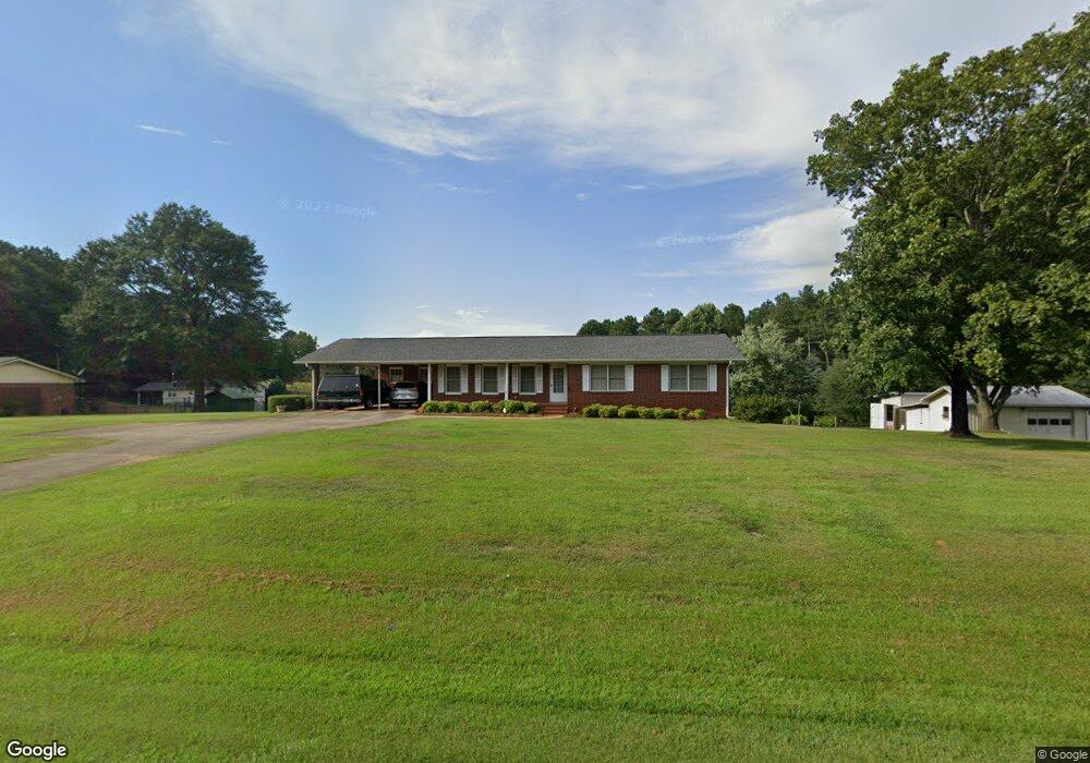
1746 E Main St Royston, GA 30662
Estimated Value: $327,000 - $484,207
3
Beds
2
Baths
1,853
Sq Ft
$219/Sq Ft
Est. Value
About This Home
This home is located at 1746 E Main St, Royston, GA 30662 and is currently estimated at $406,069, approximately $219 per square foot. 1746 E Main St is a home with nearby schools including Franklin County High School, Grace Ranch Academy, and Cornerstone Christian Academy.
Ownership History
Date
Name
Owned For
Owner Type
Purchase Details
Closed on
Sep 30, 2022
Sold by
Phillips Emily S
Bought by
Phillips David and Phillips Cyndee
Current Estimated Value
Purchase Details
Closed on
Feb 19, 2021
Sold by
Phillips David Calvin
Bought by
Callicutt Joshua and Callicutt Courtney
Purchase Details
Closed on
May 31, 2019
Sold by
Phillips Emily S
Bought by
Phillips Emily S and Phillips Calvin C
Purchase Details
Closed on
Aug 25, 2000
Sold by
Phillips Calvin
Bought by
Phillips Emily S
Create a Home Valuation Report for This Property
The Home Valuation Report is an in-depth analysis detailing your home's value as well as a comparison with similar homes in the area
Purchase History
| Date | Buyer | Sale Price | Title Company |
|---|---|---|---|
| Phillips David | -- | -- | |
| Grimes Daphne | -- | -- | |
| Callicutt Joshua | -- | -- | |
| Phillips David Calvin | -- | -- | |
| Phillips Emily S | -- | -- | |
| Phillips Emily S | -- | -- |
Source: Public Records
Tax History
| Year | Tax Paid | Tax Assessment Tax Assessment Total Assessment is a certain percentage of the fair market value that is determined by local assessors to be the total taxable value of land and additions on the property. | Land | Improvement |
|---|---|---|---|---|
| 2025 | $2,271 | $176,032 | $93,038 | $82,994 |
| 2024 | $2,184 | $149,173 | $72,634 | $76,539 |
| 2023 | $2,213 | $135,905 | $66,034 | $69,871 |
| 2022 | $2,450 | $129,116 | $53,386 | $75,730 |
| 2021 | $1,752 | $97,285 | $40,889 | $56,396 |
| 2020 | $1,714 | $80,908 | $34,074 | $46,834 |
| 2019 | $1,662 | $80,908 | $34,074 | $46,834 |
| 2018 | $1,417 | $71,324 | $31,246 | $40,078 |
| 2017 | $1,450 | $71,324 | $31,246 | $40,078 |
| 2016 | $1,278 | $65,670 | $31,246 | $34,424 |
| 2015 | -- | $65,670 | $31,246 | $34,424 |
| 2014 | -- | $60,634 | $31,246 | $29,388 |
| 2013 | -- | $61,137 | $31,246 | $29,891 |
Source: Public Records
Map
Nearby Homes
- 141 Carey St
- 155 Carey St
- 61 College Hgts Place
- 206 College Heights
- 41 College Heights
- 232 Brad St
- 603 Springdale Dr
- 0 Brad St Unit 10677623
- 95 Ext Brad St
- 2394 W Main St
- 00 S Tanglewood
- 60 Tanglewood N
- 0 Tanglewood S Unit 10538272
- 357 Woodridge Way
- 152 Trinity Ct
- 134 Hope St
- 1321 Campbell Ridge Rd
- 121 Cook St
- 44 Bond St
- 285 Wolf Den Rd
- 0 Rice Creek Rd Unit 2680944
- 1778 E Main St
- 91 Rolling Hills Dr
- 155 Rolling Hills Dr
- 1701 E Main St Unit 1
- 1701 E Main St
- 1745 E Main St
- 0 Rolling Hills Dr Unit 10242485
- 1701 Main St E
- 62 Rose Ln
- 1687 E Main St
- 61 Rose Ln
- 1829 E Main St
- 98 Rose Ln
- 1851 E Main St
- 183 Rolling Hills Dr
- 0 Ada St Unit 8387398
- 0 Ada St Unit LOTS 47, 48 7311394
- 0 Ada St Unit 8140382
- 0 Ada St Unit CM965680