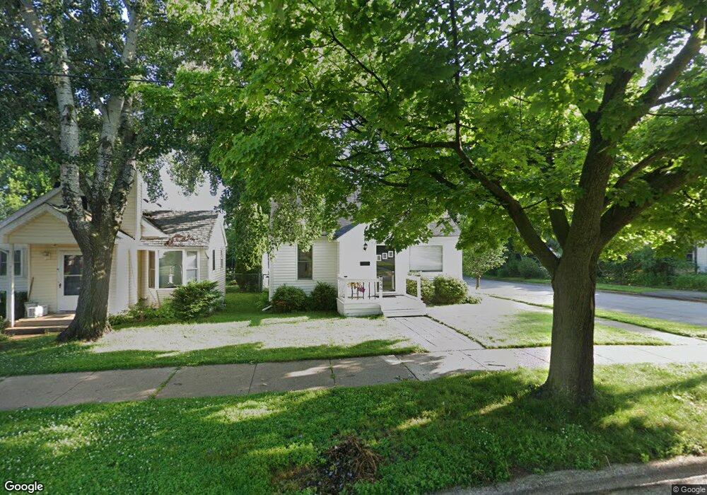
1746 Sheridan St Madison, WI 53704
Sherman NeighborhoodEstimated Value: $324,000 - $356,000
3
Beds
1
Bath
1,331
Sq Ft
$255/Sq Ft
Est. Value
About This Home
This home is located at 1746 Sheridan St, Madison, WI 53704 and is currently estimated at $339,360, approximately $254 per square foot. 1746 Sheridan St is a home located in Dane County with nearby schools including Mendota Elementary School, Sherman Middle School, and East High School.
Ownership History
Date
Name
Owned For
Owner Type
Purchase Details
Closed on
Dec 4, 2020
Sold by
Wpdlb Trust
Bought by
King Tricia Ellen
Current Estimated Value
Home Financials for this Owner
Home Financials are based on the most recent Mortgage that was taken out on this home.
Original Mortgage
$158,500
Outstanding Balance
$140,720
Interest Rate
2.8%
Mortgage Type
New Conventional
Estimated Equity
$198,640
Purchase Details
Closed on
Aug 19, 2019
Sold by
Blair William and Blair Debra
Bought by
Wpdlb Trust
Create a Home Valuation Report for This Property
The Home Valuation Report is an in-depth analysis detailing your home's value as well as a comparison with similar homes in the area
Home Values in the Area
Average Home Value in this Area
Purchase History
| Date | Buyer | Sale Price | Title Company |
|---|---|---|---|
| King Tricia Ellen | $220,000 | None Available | |
| Wpdlb Trust | -- | None Available |
Source: Public Records
Mortgage History
| Date | Status | Borrower | Loan Amount |
|---|---|---|---|
| Open | King Tricia Ellen | $158,500 |
Source: Public Records
Tax History Compared to Growth
Tax History
| Year | Tax Paid | Tax Assessment Tax Assessment Total Assessment is a certain percentage of the fair market value that is determined by local assessors to be the total taxable value of land and additions on the property. | Land | Improvement |
|---|---|---|---|---|
| 2024 | $10,097 | $305,100 | $59,600 | $245,500 |
| 2023 | $4,654 | $277,400 | $54,200 | $223,200 |
| 2021 | $4,367 | $221,200 | $43,200 | $178,000 |
| 2020 | $4,461 | $210,700 | $41,100 | $169,600 |
| 2019 | $4,318 | $204,600 | $39,900 | $164,700 |
| 2018 | $4,040 | $191,200 | $39,900 | $151,300 |
| 2017 | $3,837 | $173,800 | $36,300 | $137,500 |
| 2016 | $3,701 | $164,000 | $36,300 | $127,700 |
| 2015 | $3,541 | $150,200 | $35,200 | $115,000 |
| 2014 | $3,430 | $150,200 | $35,200 | $115,000 |
| 2013 | $3,823 | $147,300 | $34,500 | $112,800 |
Source: Public Records
Map
Nearby Homes
- 1838 Spohn Ave
- 1842 Spohn Ave
- 1942 Northwestern Ave
- 1802 Loftsgordon Ave
- 1937 Northwestern Ave
- 1941 Northwestern Ave
- 1437 Fremont Ave
- 2902 Dryden Dr
- 805 Kings Way
- 401 East Bluff
- 238 Kensington Dr
- 514 East Bluff
- 525 Waxwing Ln Unit 525
- 547 Waxwing Ln Unit 547
- 495 Blackbird Ln Unit 495
- 623 Summit Rd
- 242 Bunting Ln Unit 242
- 237 Bunting Ln Unit 237
- 260 Bunting Ln Unit 260
- 215 Cardinal Ln Unit 215
- 1742 Sheridan St
- 1738 Sheridan St
- 1802 Sheridan St
- 1745 Winchester St
- 1734 Sheridan St
- 1737 Winchester St
- 1806 Sheridan St
- 1801 Winchester St
- 1730 Sheridan St
- 1733 Winchester St
- 1810 Sheridan St
- 1745 Sheridan St
- 1805 Winchester St
- 1801 Sheridan St
- 1737 Sheridan St
- 1726 Sheridan St
- 1731 Winchester St
- 1814 Sheridan St
- 1809 Winchester St
- 1725 Winchester St