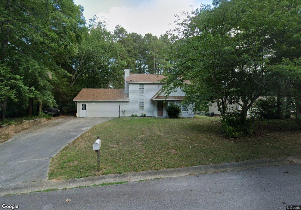
1747 Tall Tree Ct SW Conyers, GA 30094
Estimated Value: $230,000 - $284,000
3
Beds
2
Baths
1,404
Sq Ft
$178/Sq Ft
Est. Value
About This Home
This home is located at 1747 Tall Tree Ct SW, Conyers, GA 30094 and is currently estimated at $249,679, approximately $177 per square foot. 1747 Tall Tree Ct SW is a home located in Rockdale County with nearby schools including Shoal Creek Elementary School, Edwards Middle School, and Heritage High School.
Ownership History
Date
Name
Owned For
Owner Type
Purchase Details
Closed on
Sep 30, 2008
Sold by
Bank Of Ny Mellon Trust Co
Bought by
Hanks Donald B and Hanks Susan M
Current Estimated Value
Purchase Details
Closed on
Jun 5, 2007
Sold by
Herrell Kim R
Bought by
Bank Of New York Trust Co Na
Purchase Details
Closed on
Apr 27, 2005
Sold by
Waller Letread
Bought by
Herrell Kim R
Home Financials for this Owner
Home Financials are based on the most recent Mortgage that was taken out on this home.
Original Mortgage
$117,425
Interest Rate
7.75%
Mortgage Type
New Conventional
Purchase Details
Closed on
Jul 30, 1999
Sold by
Joe E Carlisle Estate
Bought by
Waller Letred
Home Financials for this Owner
Home Financials are based on the most recent Mortgage that was taken out on this home.
Original Mortgage
$86,700
Interest Rate
7.58%
Mortgage Type
VA
Create a Home Valuation Report for This Property
The Home Valuation Report is an in-depth analysis detailing your home's value as well as a comparison with similar homes in the area
Home Values in the Area
Average Home Value in this Area
Purchase History
| Date | Buyer | Sale Price | Title Company |
|---|---|---|---|
| Hanks Donald B | $58,275 | -- | |
| Bank Of New York Trust Co Na | $117,215 | -- | |
| Herrell Kim R | $117,500 | -- | |
| Waller Letred | $85,000 | -- |
Source: Public Records
Mortgage History
| Date | Status | Borrower | Loan Amount |
|---|---|---|---|
| Previous Owner | Herrell Kim R | $117,425 | |
| Previous Owner | Waller Letred | $86,700 |
Source: Public Records
Tax History Compared to Growth
Tax History
| Year | Tax Paid | Tax Assessment Tax Assessment Total Assessment is a certain percentage of the fair market value that is determined by local assessors to be the total taxable value of land and additions on the property. | Land | Improvement |
|---|---|---|---|---|
| 2024 | $3,265 | $81,000 | $20,040 | $60,960 |
| 2023 | $3,192 | $77,120 | $22,400 | $54,720 |
| 2022 | $2,536 | $60,600 | $15,360 | $45,240 |
| 2021 | $2,044 | $48,840 | $11,120 | $37,720 |
| 2020 | $1,916 | $44,560 | $11,120 | $33,440 |
| 2019 | $1,833 | $40,440 | $7,000 | $33,440 |
| 2018 | $1,778 | $39,040 | $7,000 | $32,040 |
| 2017 | $1,548 | $33,640 | $7,000 | $26,640 |
| 2016 | $1,548 | $33,640 | $7,000 | $26,640 |
| 2015 | $1,313 | $28,440 | $5,520 | $22,920 |
| 2014 | $1,122 | $24,000 | $4,520 | $19,480 |
| 2013 | -- | $34,400 | $9,200 | $25,200 |
Source: Public Records
Map
Nearby Homes
- 2289 Amberbrook Dr SW
- 1993 Old Smyrna Rd SW
- 2318 Hedgeview Rd
- 2956 Loch Lomond Dr
- 1700 Carissa Dr
- 2477 Laurel Ridge Place SW
- 1509 Shoal Creek Dr SW
- 2505 Laurel Ridge Place SW
- 2055 Smyrna Rd SW
- 0 Granade Rd SW Unit 10430605
- 0 Granade Rd SW Unit 10430608
- 0 Granade Rd SW Unit 23687414
- 0 Granade Rd SW Unit 10430607
- 0 Granade Rd SW Unit 10430610
- 0 Granade Rd SW Unit 10430604
- 1779 Granade Rd SW
- 2095 Flat Shoals Rd SW
- 2150 Smyrna Ridge Ct SW
- 3009 Inverness Ct
- 1841 Flat Shoals Rd SW
- 1751 Tall Tree Ct SW
- 2186 Lost Forest Ln SW
- 2192 Lost Forest Ln SW
- 2180 Lost Forest Ln SW
- 1755 Tall Tree Ct SW
- 1748 Tall Tree Ct SW
- 2233 Rolling Acres Dr SW
- 2196 Lost Forest Ln SW Unit 5B
- 2241 Rolling Acres Dr SW
- 1750 Tall Tree Ct SW
- 1756 Tall Tree Ct SW
- 2176 Lost Forest Ln SW
- 1754 Tall Tree Ct SW
- 2251 Rolling Acres Dr SW
- 2191 Lost Forest Ln SW
- 2211 Rolling Acres Dr SW
- 2175 Lost Forest Ln SW
- 2195 Lost Forest Ln SW
- 2200 Lost Forest Ln SW
- 0 Rolling Acres Dr SW Unit 7270543