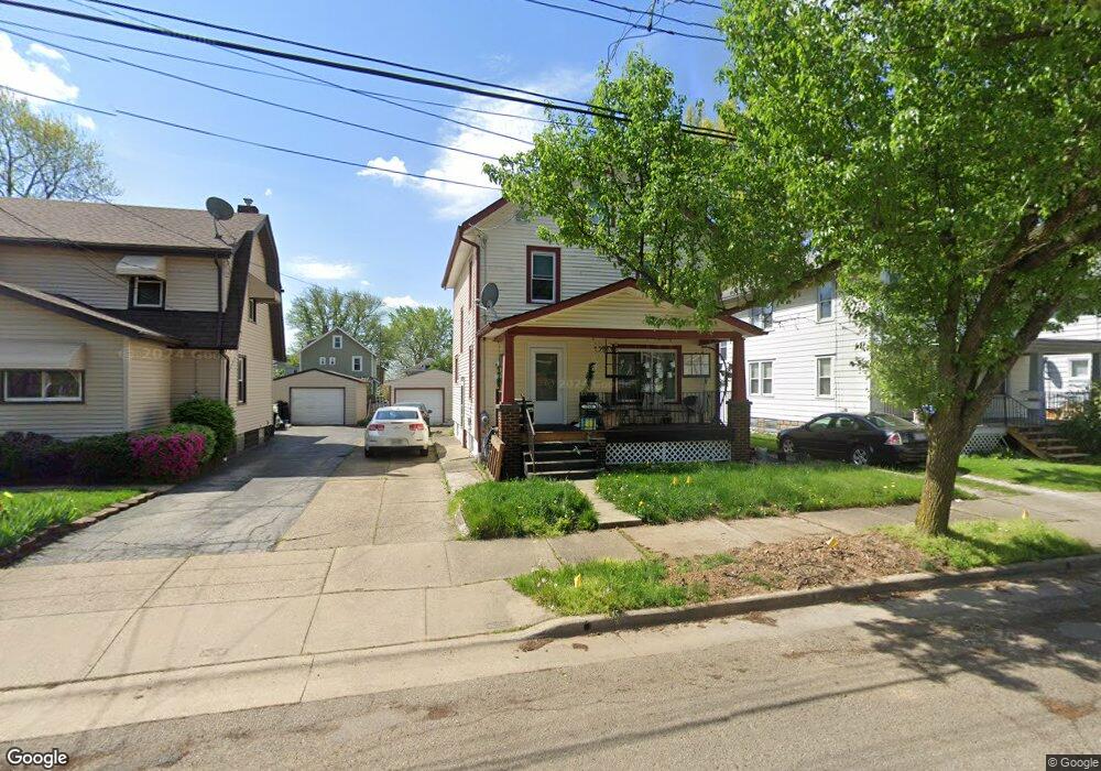
1748 Flint Ave Akron, OH 44305
Goodyear Heights NeighborhoodEstimated Value: $119,000 - $135,000
3
Beds
1
Bath
1,373
Sq Ft
$90/Sq Ft
Est. Value
About This Home
This home is located at 1748 Flint Ave, Akron, OH 44305 and is currently estimated at $124,103, approximately $90 per square foot. 1748 Flint Ave is a home located in Summit County with nearby schools including Seiberling Community Learning Center, Akron Preparatory school, and Middlebury Academy.
Ownership History
Date
Name
Owned For
Owner Type
Purchase Details
Closed on
Oct 30, 2003
Sold by
Turner Thomas and Turner Rita
Bought by
Berry Christopher and Berry Jessica
Current Estimated Value
Home Financials for this Owner
Home Financials are based on the most recent Mortgage that was taken out on this home.
Original Mortgage
$32,800
Interest Rate
6.04%
Mortgage Type
Purchase Money Mortgage
Purchase Details
Closed on
Aug 6, 1999
Sold by
Turner Thomas A and Turner Rita E
Bought by
Turner Thomas A and Turner Rita E
Purchase Details
Closed on
Dec 28, 1995
Sold by
Wagner Lorin J
Bought by
Turner Thomas A and Turner Rita E
Home Financials for this Owner
Home Financials are based on the most recent Mortgage that was taken out on this home.
Original Mortgage
$30,065
Interest Rate
7.42%
Mortgage Type
New Conventional
Create a Home Valuation Report for This Property
The Home Valuation Report is an in-depth analysis detailing your home's value as well as a comparison with similar homes in the area
Home Values in the Area
Average Home Value in this Area
Purchase History
| Date | Buyer | Sale Price | Title Company |
|---|---|---|---|
| Berry Christopher | $41,000 | Guardian Title | |
| Turner Thomas A | -- | -- | |
| Turner Thomas A | $27,000 | -- |
Source: Public Records
Mortgage History
| Date | Status | Borrower | Loan Amount |
|---|---|---|---|
| Closed | Berry Christopher | $32,800 | |
| Previous Owner | Turner Thomas A | $30,065 |
Source: Public Records
Tax History
| Year | Tax Paid | Tax Assessment Tax Assessment Total Assessment is a certain percentage of the fair market value that is determined by local assessors to be the total taxable value of land and additions on the property. | Land | Improvement |
|---|---|---|---|---|
| 2025 | $2,107 | $32,715 | $6,759 | $25,956 |
| 2024 | $1,749 | $32,715 | $6,759 | $25,956 |
| 2023 | $1,837 | $32,715 | $6,759 | $25,956 |
| 2022 | $1,536 | $22,446 | $4,568 | $17,878 |
| 2021 | $1,538 | $22,446 | $4,568 | $17,878 |
| 2020 | $1,515 | $22,450 | $4,570 | $17,880 |
| 2019 | $1,489 | $20,030 | $4,760 | $15,270 |
| 2018 | $1,469 | $20,030 | $4,760 | $15,270 |
| 2017 | $1,493 | $20,030 | $4,760 | $15,270 |
| 2016 | $1,494 | $20,030 | $4,760 | $15,270 |
| 2015 | $1,493 | $20,030 | $4,760 | $15,270 |
| 2014 | $1,481 | $20,030 | $4,760 | $15,270 |
| 2013 | $1,460 | $20,170 | $4,760 | $15,410 |
Source: Public Records
Map
Nearby Homes
- 1837 Marks Ave
- 1874 Adelaide Blvd
- 1551 Preston Ave
- 153 Cutler Pkwy
- 167 Pioneer St
- 1820 Malasia Rd
- 1581 Hillside Terrace
- 1578 Pilgrim St
- 1591 Pilgrim St
- 82 Detroit St
- 248 Malacca St
- 310 Vaniman St
- 1442 Hillside Terrace
- 20 Verdun Dr
- 111 Akers Ave
- 1438 Newton St
- 291 Malacca St
- 320 Para Ave
- 1268 Pondview Ave
- 1239 Pondview Ave
- 1750 Flint Ave
- 1742 Flint Ave
- 1754 Flint Ave
- 1738 Flint Ave
- 1734 Flint Ave
- 1741 Ford Ave
- 1749 Ford Ave
- 1737 Ford Ave
- 1753 Ford Ave
- 1757 Flint Ave
- 1745 Flint Ave
- 1730 Flint Ave
- 1762 Flint Ave
- 1749 Flint Ave
- 1741 Flint Ave
- 1733 Ford Ave
- 1757 Ford Ave
- 1753 Flint Ave
- 1737 Flint Ave
- 1727 Ford Ave Unit 1729
Your Personal Tour Guide
Ask me questions while you tour the home.