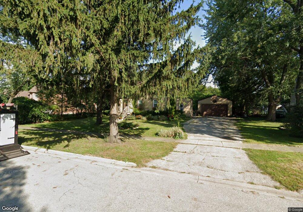
1748 Lunt Ave Des Plaines, IL 60018
Estimated Value: $351,103 - $422,000
3
Beds
2
Baths
1,411
Sq Ft
$277/Sq Ft
Est. Value
About This Home
This home is located at 1748 Lunt Ave, Des Plaines, IL 60018 and is currently estimated at $390,776, approximately $276 per square foot. 1748 Lunt Ave is a home located in Cook County with nearby schools including Orchard Place Elementary School, Algonquin Middle School, and Maine West High School.
Ownership History
Date
Name
Owned For
Owner Type
Purchase Details
Closed on
Nov 22, 2005
Sold by
Brozyna Marek and Brozyna Anastazja
Bought by
Brozyna Marek and Brozyna Anastanzja
Current Estimated Value
Purchase Details
Closed on
May 3, 2005
Sold by
Buck Eugene F
Bought by
Brozyna Marek and Brozyna Anastazja
Home Financials for this Owner
Home Financials are based on the most recent Mortgage that was taken out on this home.
Original Mortgage
$320,000
Outstanding Balance
$159,969
Interest Rate
5.5%
Mortgage Type
Unknown
Estimated Equity
$230,807
Create a Home Valuation Report for This Property
The Home Valuation Report is an in-depth analysis detailing your home's value as well as a comparison with similar homes in the area
Home Values in the Area
Average Home Value in this Area
Purchase History
| Date | Buyer | Sale Price | Title Company |
|---|---|---|---|
| Brozyna Marek | -- | None Available | |
| Brozyna Marek | $400,000 | Ticor Title Insurance Compan |
Source: Public Records
Mortgage History
| Date | Status | Borrower | Loan Amount |
|---|---|---|---|
| Open | Brozyna Marek | $320,000 |
Source: Public Records
Tax History
| Year | Tax Paid | Tax Assessment Tax Assessment Total Assessment is a certain percentage of the fair market value that is determined by local assessors to be the total taxable value of land and additions on the property. | Land | Improvement |
|---|---|---|---|---|
| 2025 | $4,662 | $21,550 | $8,100 | $13,450 |
| 2024 | $4,662 | $17,682 | $6,750 | $10,932 |
| 2023 | $4,550 | $17,682 | $6,750 | $10,932 |
| 2022 | $4,550 | $17,682 | $6,750 | $10,932 |
| 2021 | $4,086 | $13,294 | $5,625 | $7,669 |
| 2020 | $4,017 | $13,294 | $5,625 | $7,669 |
| 2019 | $4,020 | $14,938 | $5,625 | $9,313 |
| 2018 | $3,674 | $12,286 | $4,950 | $7,336 |
| 2017 | $3,609 | $12,286 | $4,950 | $7,336 |
| 2016 | $3,414 | $12,286 | $4,950 | $7,336 |
| 2015 | $3,116 | $10,307 | $4,275 | $6,032 |
| 2014 | $3,528 | $11,921 | $4,275 | $7,646 |
| 2013 | $3,440 | $11,921 | $4,275 | $7,646 |
Source: Public Records
Map
Nearby Homes
- 2646 Maple St
- 1757 Farwell Ave
- 2609 Eisenhower Dr
- 1641 E Touhy Ave
- 1629 E Touhy Ave
- 2600 S Scott St
- 1738 Lunt Ave
- 2993 Curtis St Unit 13
- 2945 S Scott St
- 2469 Parkwood Ln
- 1922 Fargo Ave
- 38 E Touhy Ave
- 2035 Fargo Ave
- 2054 Birch St
- 1370 Fargo Ave Unit E
- 10016 Estelle Dr
- 1881 Orchard St
- 1857 Pine St
- 1445 Everett Ave
- 300 Thames Pkwy Unit 3D
- 1748 Lunt Ave
- 1760 Lunt Ave
- 1760 Lunt Ave
- 1776 Lunt Ave
- 1776 Lunt Ave
- 1730 Lunt Ave
- 1747 Greenleaf Ave
- 1759 Greenleaf Ave
- 1782 Lunt Ave
- 1739 Greenleaf Ave
- 1751 Greenleaf Ave
- 1722 Lunt Ave
- 1731 Greenleaf Ave
- 1771 Greenleaf Ave
- 1771 Greenleaf Ave
- 1753 Lunt Ave
- 1786 Lunt Ave
- 1773 Lunt Ave
- 1773 Lunt Ave
Your Personal Tour Guide
Ask me questions while you tour the home.