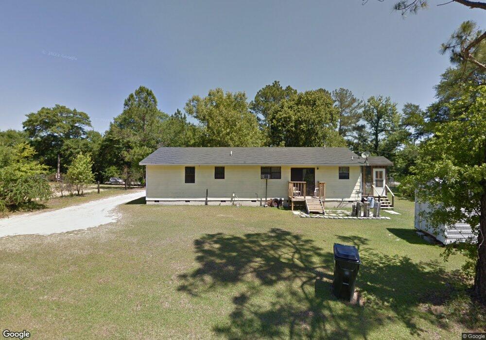
17486 Us Highway 280 Claxton, GA 30417
Estimated Value: $121,000 - $213,000
--
Bed
2
Baths
1,556
Sq Ft
$107/Sq Ft
Est. Value
About This Home
This home is located at 17486 Us Highway 280, Claxton, GA 30417 and is currently estimated at $165,774, approximately $106 per square foot. 17486 Us Highway 280 is a home located in Evans County with nearby schools including Claxton Elementary School, Second Chance, and Claxton Middle School.
Ownership History
Date
Name
Owned For
Owner Type
Purchase Details
Closed on
Oct 21, 2022
Sold by
Lanier Shirley A
Bought by
Robertson Ronald
Current Estimated Value
Home Financials for this Owner
Home Financials are based on the most recent Mortgage that was taken out on this home.
Original Mortgage
$141,391
Outstanding Balance
$136,135
Interest Rate
6.12%
Mortgage Type
FHA
Estimated Equity
$29,639
Purchase Details
Closed on
Feb 6, 2007
Sold by
Not Provided
Bought by
Lanier Shirley A
Home Financials for this Owner
Home Financials are based on the most recent Mortgage that was taken out on this home.
Original Mortgage
$81,000
Interest Rate
9.39%
Purchase Details
Closed on
Jul 17, 1996
Sold by
Jim Walters Homes Inc
Bought by
Charlie Robertson
Create a Home Valuation Report for This Property
The Home Valuation Report is an in-depth analysis detailing your home's value as well as a comparison with similar homes in the area
Home Values in the Area
Average Home Value in this Area
Purchase History
| Date | Buyer | Sale Price | Title Company |
|---|---|---|---|
| Robertson Ronald | $144,000 | -- | |
| Lanier Shirley A | $90,000 | -- | |
| Lanier Shirley A | $90,000 | -- | |
| Charlie Robertson | $39,000 | -- |
Source: Public Records
Mortgage History
| Date | Status | Borrower | Loan Amount |
|---|---|---|---|
| Open | Robertson Ronald | $141,391 | |
| Previous Owner | Lanier Shirley A | $81,000 |
Source: Public Records
Tax History Compared to Growth
Tax History
| Year | Tax Paid | Tax Assessment Tax Assessment Total Assessment is a certain percentage of the fair market value that is determined by local assessors to be the total taxable value of land and additions on the property. | Land | Improvement |
|---|---|---|---|---|
| 2024 | $1,235 | $41,960 | $2,960 | $39,000 |
| 2023 | $849 | $27,520 | $2,440 | $25,080 |
| 2022 | $707 | $27,520 | $2,440 | $25,080 |
| 2021 | $695 | $27,520 | $2,440 | $25,080 |
| 2020 | $861 | $27,520 | $2,440 | $25,080 |
| 2019 | $998 | $27,520 | $2,440 | $25,080 |
| 2018 | $982 | $27,120 | $2,440 | $24,680 |
| 2017 | $955 | $27,520 | $2,440 | $25,080 |
| 2016 | $933 | $25,920 | $1,400 | $24,520 |
| 2015 | -- | $26,200 | $1,320 | $24,880 |
| 2014 | -- | $26,200 | $1,320 | $24,880 |
| 2013 | -- | $26,400 | $1,320 | $25,080 |
Source: Public Records
Map
Nearby Homes
- 680 Railroad St
- 0 Sunbury Rd Unit TRACT 4 10599355
- 0 Sunbury Rd Unit TRACT 6 10599356
- 0 Sunbury Rd Unit Tract 4 SA339073
- 0 Sunbury Rd Unit Tract 6 SA339082
- 10688 Daisy Nevils Hwy
- 304 Mt Pleasant Rd
- 541 Live Oak Lane Rd
- 13320 Sunbury Rd
- 2571 Edgar Hodges Rd
- 0 Mosley Rd Unit 10592562
- 354 Edgewater Dr
- 2637 Mosley Rd
- 4750 Deloach Church Rd
- 3900 Nevils Groveland Rd
- 107 E Liberty St
- 0 Ga Hwy 129 N Unit 10564606
- 201 New Dr
- 1930 Old Groveland Rd
- 206 New Dr
- 17528 Us Highway 280
- 1388 Old Savannah Hwy
- 1453 Old Savannah Hwy
- 1347 Old Savannah Hwy
- 1332 Old Savannah Hwy
- 1208 Old Savannah Hwy
- 1136 Old Savannah Hwy
- 17011 Us Highway 280
- 17992 U S Highway 280
- 1104 Old Savannah Hwy
- 1076 Old Savannah Hwy
- 17201 Us Highway 280
- 18198 Us Highway 280
- 956 Old Savannah Hwy
- 917 Old Savannah Hwy
- 18262 Us Highway 280
- 1042 Railroad Ave
- 940 Old Savannah Hwy
- 1042 Railroad St
- 16633 Us Highway 280