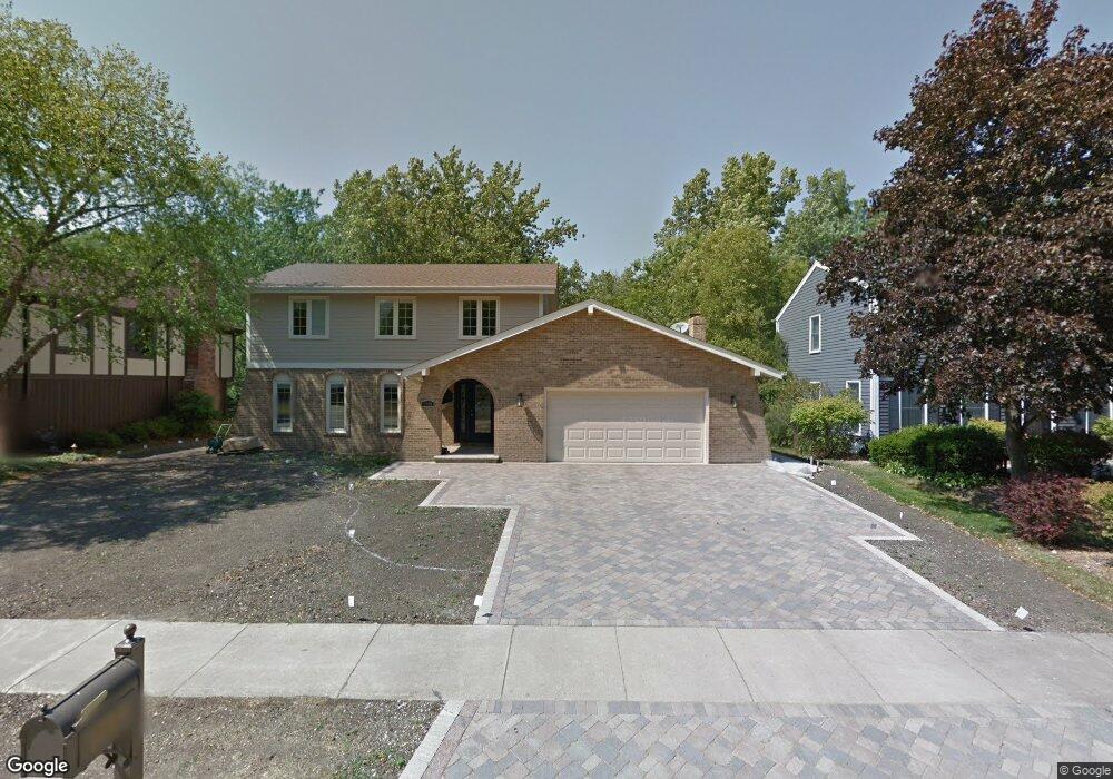
1749 Maple Ln Wheaton, IL 60187
Hawthorne NeighborhoodEstimated Value: $677,000 - $847,000
About This Home
This home is located at 1749 Maple Ln, Wheaton, IL 60187 and is currently estimated at $768,605, approximately $276 per square foot. 1749 Maple Ln is a home located in DuPage County with nearby schools including Churchill Elementary School, Hadley Junior High School, and Glenbard West High School.
Ownership History
We collect this data history from publicly available records. To have your information removed, we recommend requesting removal directly through your county’s website.
Purchase Details
Home Financials for this Owner
Home Financials are based on the most recent Mortgage that was taken out on this home.Home Values in the Area
Average Home Value in this Area
Purchase History
We collect this data history from publicly available records. To have your information removed, we recommend requesting removal directly through your county’s website.
| Date | Buyer | Sale Price | Title Company |
|---|---|---|---|
| $325,000 | First American Title Ins |
Mortgage History
We collect this data history from publicly available records. To have your information removed, we recommend requesting removal directly through your county’s website.
| Date | Status | Borrower | Loan Amount |
|---|---|---|---|
| Previous Owner | $292,500 |
Tax History
We collect this data history from publicly available records. To have your information removed, we recommend requesting removal directly through your county’s website.
| Year | Tax Paid | Tax Assessment Tax Assessment Total Assessment is a certain percentage of the fair market value that is determined by local assessors to be the total taxable value of land and additions on the property. | Land | Improvement |
|---|---|---|---|---|
| 2024 | $14,361 | $209,958 | $36,764 | $173,194 |
| 2023 | $13,790 | $193,260 | $33,840 | $159,420 |
| 2022 | $13,280 | $182,640 | $31,980 | $150,660 |
| 2021 | $12,848 | $178,310 | $31,220 | $147,090 |
| 2020 | $12,658 | $176,650 | $30,930 | $145,720 |
| 2019 | $12,361 | $171,980 | $30,110 | $141,870 |
| 2018 | $11,412 | $157,510 | $28,370 | $129,140 |
| 2017 | $11,248 | $151,700 | $27,320 | $124,380 |
| 2016 | $11,401 | $145,640 | $26,230 | $119,410 |
| 2015 | $9,673 | $138,940 | $25,020 | $113,920 |
| 2014 | $9,910 | $137,880 | $22,310 | $115,570 |
| 2013 | $9,669 | $138,300 | $22,380 | $115,920 |
Map
- 1726 Kay Rd
- 1925 Glencoe St
- 710 N Kenilworth Ave
- 2103 Nachtman Ct
- 273 Geneva Rd
- 835 Avon Ct
- 2142 N Summit St
- 158 Derby Glen Dr
- 1906 Stoddard Ave
- 2009 Mackenzie Place
- 553 N Kenilworth Ave
- 859 Evergreen Ave
- 369 Hawthorne Blvd
- 500 Timber Ridge Dr Unit 202A
- 523 Timber Ridge Dr Unit 204
- 126 Stableford Dr
- 507 N Kenilworth Ave
- 434 Oak St
- 525 Timber Ridge Dr Unit 306
- 466 S President St Unit 304
Ask me questions while you tour the home.