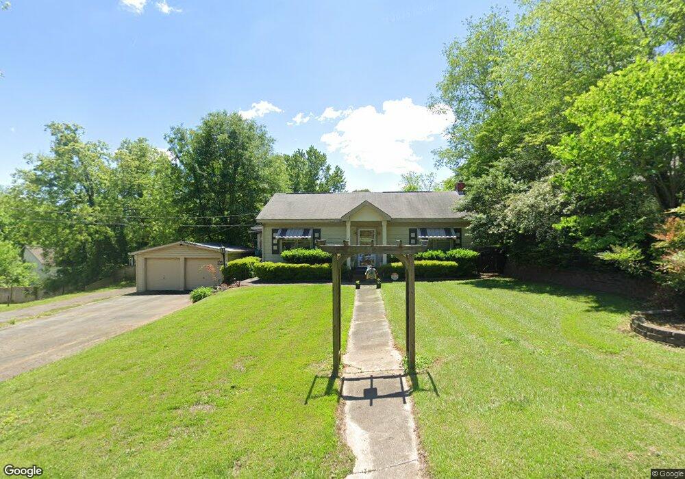
175 A W Roberts Dr Ball Ground, GA 30107
Estimated Value: $346,741 - $480,000
3
Beds
1
Bath
2,123
Sq Ft
$199/Sq Ft
Est. Value
About This Home
This home is located at 175 A W Roberts Dr, Ball Ground, GA 30107 and is currently estimated at $423,185, approximately $199 per square foot. 175 A W Roberts Dr is a home located in Cherokee County with nearby schools including Ball Ground Elementary School, Creekland Middle School, and Creekview High School.
Ownership History
Date
Name
Owned For
Owner Type
Purchase Details
Closed on
Oct 15, 2009
Sold by
Haynes Vicki
Bought by
Haynes Roy D
Current Estimated Value
Create a Home Valuation Report for This Property
The Home Valuation Report is an in-depth analysis detailing your home's value as well as a comparison with similar homes in the area
Home Values in the Area
Average Home Value in this Area
Purchase History
| Date | Buyer | Sale Price | Title Company |
|---|---|---|---|
| Haynes Roy D | -- | -- | |
| Haynes Vicki | $40,000 | -- | |
| Haynes Vicki | -- | -- |
Source: Public Records
Tax History Compared to Growth
Tax History
| Year | Tax Paid | Tax Assessment Tax Assessment Total Assessment is a certain percentage of the fair market value that is determined by local assessors to be the total taxable value of land and additions on the property. | Land | Improvement |
|---|---|---|---|---|
| 2024 | $2,520 | $84,220 | $31,200 | $53,020 |
| 2023 | $2,620 | $87,540 | $31,200 | $56,340 |
| 2022 | $2,392 | $79,140 | $31,200 | $47,940 |
| 2021 | $1,944 | $58,860 | $24,000 | $34,860 |
| 2020 | $1,730 | $51,780 | $17,280 | $34,500 |
| 2019 | $1,590 | $48,000 | $17,280 | $30,720 |
| 2018 | $1,430 | $42,560 | $15,600 | $26,960 |
| 2017 | $1,266 | $94,300 | $14,400 | $23,320 |
| 2016 | $1,054 | $77,400 | $9,600 | $21,360 |
| 2015 | $1,010 | $73,100 | $9,600 | $19,640 |
| 2014 | $986 | $70,800 | $9,600 | $18,720 |
Source: Public Records
Map
Nearby Homes
- 85 Tatum Cir
- 125 Stripling St
- 508 Old Canton Rd
- 256 Cartersville St
- 115 Dixie Ln
- 286 Lowry St
- 170 Summit Cir
- 127 Mills Ln
- 255 Lowry St
- The Dillard Plan at Malone’s Pond
- The Evans Plan at Malone’s Pond
- The Vinings Plan at Malone’s Pond
- The Brooks Plan at Malone’s Pond
- The Bainbridge Plan at Malone’s Pond
- The Ashburn Plan at Malone’s Pond
- The Trenton Plan at Malone’s Pond
- The Desoto Plan at Malone’s Pond
- 326 Reese Way
- 201 Summit Cir
- The Stratford Plan at The Heritage at Farmer's Crossing
- 165 A W Roberts Dr
- 185 A W Roberts Dr
- 382 Old Canton Rd
- 0 Lyons Ave
- 4 Lyons Ave
- 150 Lyons Ave
- 260 Strippling St
- 155 A W Roberts Dr
- 176 Lyons Ave
- 145 Lyon Ave
- 0 Lyons St Unit 5093056
- 0 Lyons St Unit 5185395
- 0 Lyons St Unit 5263335
- 0 Lyons St Unit 5344987
- 210 Gilmer Ferry Rd
- 145 Lyons Ave
- 275 Strippling St
- 0 Strippling St Unit 8756395
- 0 Strippling St Unit 8753629
- 0 Strippling St Unit 7623164