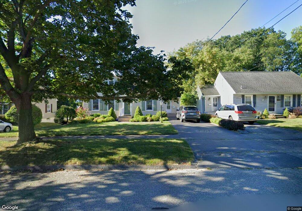
175 Allengate Ave Pittsfield, MA 01201
Estimated Value: $271,000 - $300,000
3
Beds
1
Bath
1,152
Sq Ft
$244/Sq Ft
Est. Value
About This Home
This home is located at 175 Allengate Ave, Pittsfield, MA 01201 and is currently estimated at $281,003, approximately $243 per square foot. 175 Allengate Ave is a home located in Berkshire County with nearby schools including Allendale Elementary School, Theodore Herberg Middle School, and Sinai Academy of the Berkshires.
Ownership History
Date
Name
Owned For
Owner Type
Purchase Details
Closed on
Oct 25, 2017
Sold by
Richardson John and Richardson Susan A
Bought by
Richardson Justin D and Richardson Michael F
Current Estimated Value
Purchase Details
Closed on
Jun 15, 1978
Bought by
Richardson John and Richardson Susan Ann
Create a Home Valuation Report for This Property
The Home Valuation Report is an in-depth analysis detailing your home's value as well as a comparison with similar homes in the area
Home Values in the Area
Average Home Value in this Area
Purchase History
| Date | Buyer | Sale Price | Title Company |
|---|---|---|---|
| Richardson Justin D | -- | -- | |
| Richardson Justin D | -- | -- | |
| Richardson Justin D | -- | -- | |
| Richardson John | $32,900 | -- |
Source: Public Records
Mortgage History
| Date | Status | Borrower | Loan Amount |
|---|---|---|---|
| Previous Owner | Richardson John | $50,000 | |
| Previous Owner | Richardson John | $67,000 | |
| Previous Owner | Richardson John | $70,000 |
Source: Public Records
Tax History Compared to Growth
Tax History
| Year | Tax Paid | Tax Assessment Tax Assessment Total Assessment is a certain percentage of the fair market value that is determined by local assessors to be the total taxable value of land and additions on the property. | Land | Improvement |
|---|---|---|---|---|
| 2025 | $4,306 | $240,000 | $68,600 | $171,400 |
| 2024 | $3,956 | $214,400 | $68,600 | $145,800 |
| 2023 | $3,688 | $201,300 | $68,600 | $132,700 |
| 2022 | $3,324 | $179,100 | $63,700 | $115,400 |
| 2021 | $3,005 | $156,100 | $63,700 | $92,400 |
| 2020 | $2,789 | $141,500 | $51,000 | $90,500 |
| 2019 | $2,552 | $131,400 | $47,000 | $84,400 |
| 2018 | $2,565 | $128,200 | $47,000 | $81,200 |
| 2017 | $2,497 | $127,200 | $49,000 | $78,200 |
| 2016 | $2,369 | $126,300 | $49,000 | $77,300 |
| 2015 | $2,281 | $126,300 | $49,000 | $77,300 |
Source: Public Records
Map
Nearby Homes
- 135 Allengate Ave
- 122 Allengate Ave
- 153 Elberon Ave
- 326 Dalton Ave
- 52 Bossidy Dr
- 87 Maryland Ave
- 81 Dartmouth St Unit 102
- 156 Draper Ave
- 67 Scammell Ave
- 0 Faucett Ln
- I11001904 Scammell Ave
- 919 Tyler St
- 0 Brown St
- LOT 20 Plunkett St
- 127 Oak Hill Rd
- 134 Oak Hill Rd
- 11 Marco Dr
- 24 Glenwood Ave
- 29 Glenwood Ave
- 48 Brown St
- 171 Allengate Ave
- 179 Allengate Ave
- 161 Allengate Ave
- 183 Allengate Ave
- 153 Allengate Ave
- 187 Allengate Ave
- 149 Allengate Ave
- 164 Allengate Ave
- 170 Allengate Ave
- 193 Allengate Ave
- 156 Allengate Ave
- 176 Allengate Ave
- 140 Windsor Ave
- 136 Windsor Ave
- 152 Allengate Ave
- 145 Allengate Ave
- 199 Allengate Ave
- 184 Allengate Ave
- 144 Windsor Ave
- 148 Allengate Ave