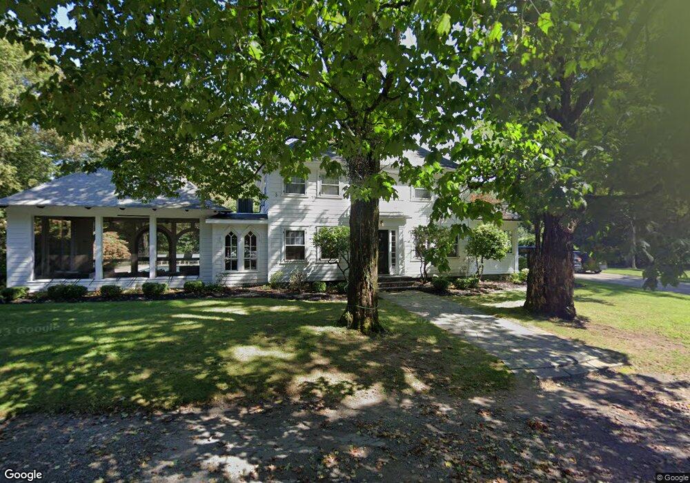
175 Beach St Wrentham, MA 02093
Estimated Value: $1,111,000 - $2,090,000
5
Beds
5
Baths
4,908
Sq Ft
$324/Sq Ft
Est. Value
About This Home
This home is located at 175 Beach St, Wrentham, MA 02093 and is currently estimated at $1,591,066, approximately $324 per square foot. 175 Beach St is a home located in Norfolk County with nearby schools including Delaney Elementary School, Charles E Roderick, and Discovery Daycare Center.
Create a Home Valuation Report for This Property
The Home Valuation Report is an in-depth analysis detailing your home's value as well as a comparison with similar homes in the area
Tax History
| Year | Tax Paid | Tax Assessment Tax Assessment Total Assessment is a certain percentage of the fair market value that is determined by local assessors to be the total taxable value of land and additions on the property. | Land | Improvement |
|---|---|---|---|---|
| 2025 | $11,400 | $983,600 | $324,400 | $659,200 |
| 2024 | $10,878 | $906,500 | $324,400 | $582,100 |
| 2023 | $11,011 | $872,500 | $300,400 | $572,100 |
| 2022 | $10,721 | $784,300 | $293,800 | $490,500 |
| 2021 | $10,330 | $734,200 | $278,600 | $455,600 |
| 2020 | $10,199 | $715,700 | $227,200 | $488,500 |
| 2019 | $10,059 | $712,400 | $243,800 | $468,600 |
| 2018 | $11,747 | $824,900 | $243,700 | $581,200 |
| 2017 | $11,357 | $797,000 | $239,000 | $558,000 |
| 2016 | $11,130 | $779,400 | $232,100 | $547,300 |
| 2015 | $11,000 | $734,300 | $223,200 | $511,100 |
| 2014 | $10,937 | $714,400 | $214,700 | $499,700 |
Source: Public Records
Map
Nearby Homes
- 10 Earle Stewart Ln Unit Lot 5
- 3 Earle Stewart Ln
- 12 Earle Stewart Ln
- 2 Earle Stewart Ln
- 135 Creek St Unit 2
- 10 Nature View Dr
- 15 Nature View Dr
- 1222 South St
- 282 Thurston St
- 500 Franklin St
- 440 South St
- 613 West St
- 0 Berry St
- 483 Thurston St
- 440 Chestnut St
- 18 Huntington Ave
- 160 Washington St Unit 22
- 158 Washington St
- 126 Washington St
- 130 Washington St
Your Personal Tour Guide
Ask me questions while you tour the home.