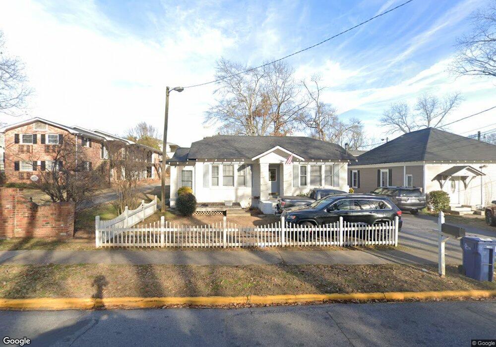
175 Bloomfield St Athens, GA 30605
Midtown-Bloomfield NeighborhoodEstimated Value: $482,000 - $572,283
Studio
3
Baths
1,775
Sq Ft
$294/Sq Ft
Est. Value
About This Home
This home is located at 175 Bloomfield St, Athens, GA 30605 and is currently estimated at $521,821, approximately $293 per square foot. 175 Bloomfield St is a home located in Clarke County with nearby schools including Barrow Elementary School, Clarke Middle School, and Clarke Central High School.
Ownership History
Date
Name
Owned For
Owner Type
Purchase Details
Closed on
Jan 25, 2004
Sold by
Moore Robert Bird
Bought by
Daniel Carolyn Moore
Current Estimated Value
Purchase Details
Closed on
Jan 15, 2004
Sold by
Mm Properties Llc
Bought by
Moore Robert Bird and Carolyn Moor
Purchase Details
Closed on
Jun 23, 1997
Sold by
Singleton Singleton and Singleton Boyer
Bought by
Mm Properties Llc
Create a Home Valuation Report for This Property
The Home Valuation Report is an in-depth analysis detailing your home's value as well as a comparison with similar homes in the area
Home Values in the Area
Average Home Value in this Area
Purchase History
| Date | Buyer | Sale Price | Title Company |
|---|---|---|---|
| Daniel Carolyn Moore | $131,800 | -- | |
| Moore Robert Bird | -- | -- | |
| Cmd Properties Llc | $131,800 | -- | |
| Mm Properties Llc | $80,000 | -- |
Source: Public Records
Tax History
| Year | Tax Paid | Tax Assessment Tax Assessment Total Assessment is a certain percentage of the fair market value that is determined by local assessors to be the total taxable value of land and additions on the property. | Land | Improvement |
|---|---|---|---|---|
| 2025 | $6,036 | $194,397 | $45,000 | $149,397 |
| 2024 | $6,036 | $172,750 | $36,000 | $136,750 |
| 2023 | $5,398 | $158,304 | $36,000 | $122,304 |
| 2022 | $4,497 | $140,976 | $36,000 | $104,976 |
| 2021 | $4,062 | $120,520 | $36,000 | $84,520 |
| 2020 | $3,782 | $112,233 | $36,000 | $76,233 |
| 2019 | $3,416 | $100,632 | $36,000 | $64,632 |
| 2018 | $3,177 | $93,589 | $36,000 | $57,589 |
| 2017 | $2,980 | $87,789 | $36,000 | $51,789 |
| 2016 | $2,854 | $84,060 | $36,000 | $48,060 |
| 2015 | $2,675 | $78,674 | $36,000 | $42,674 |
| 2014 | $2,648 | $77,768 | $34,000 | $43,768 |
Source: Public Records
Map
Nearby Homes
- 495 S Milledge Ave
- 236 Henderson Ave
- 935 Baxter St Unit 3
- 494 Baxter St Unit 32
- 494 Baxter St Unit 55
- 494 Baxter St Unit 22
- 350 S Pope St
- 265 Springdale St
- 338 Springdale St
- 597 Dearing St
- 997 S Milledge Ave Unit 3
- 997 S Milledge Ave Unit 2
- 997 S Milledge Ave Unit 1
- 112 Fortson Dr
- 230 Woodlawn Ave
- 268 Woodlawn Ave
- 1055 Baxter St Unit 201
- 1554 S Lumpkin St Unit 4
- 1554 S Lumpkin St Unit 5
- 1554 S Lumpkin St Unit 1
- 185 Bloomfield St
- 199 Bloomfield St
- 370 Peabody St
- 360 Peabody St
- 180 Bloomfield St
- 180 Bloomfield St
- 180 Bloomfield St Unit 1-16
- 227 Bloomfield St
- 415 Peabody St
- 417 Peabody St
- 425 Peabody St
- 590 S Harris St Unit 7
- 590 S Harris St Unit 3
- 590 S Harris St Unit 1
- 590 S Harris St
- 427 Peabody St
- 435 Peabody St
- 723 Baxter St Unit 3
- 723 Baxter St Unit 2
- 723 Baxter St Unit 5
Your Personal Tour Guide
Ask me questions while you tour the home.