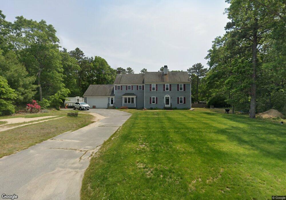
175 Bournehurst Dr Plymouth, MA 02360
Estimated Value: $778,000 - $825,000
4
Beds
4
Baths
3,100
Sq Ft
$259/Sq Ft
Est. Value
About This Home
This home is located at 175 Bournehurst Dr, Plymouth, MA 02360 and is currently estimated at $803,851, approximately $259 per square foot. 175 Bournehurst Dr is a home located in Plymouth County with nearby schools including South Elementary School, Plymouth South Middle School, and Plymouth South High School.
Ownership History
Date
Name
Owned For
Owner Type
Purchase Details
Closed on
Dec 8, 2006
Sold by
Bochman Michael E and Bochman Kathryn R
Bought by
Abruzzi Robert P and Abruzzi Laurie
Current Estimated Value
Home Financials for this Owner
Home Financials are based on the most recent Mortgage that was taken out on this home.
Original Mortgage
$300,000
Interest Rate
6.4%
Mortgage Type
Purchase Money Mortgage
Purchase Details
Closed on
Dec 15, 1989
Sold by
Atlantic West Prop
Bought by
Bochman Michael E
Create a Home Valuation Report for This Property
The Home Valuation Report is an in-depth analysis detailing your home's value as well as a comparison with similar homes in the area
Home Values in the Area
Average Home Value in this Area
Purchase History
| Date | Buyer | Sale Price | Title Company |
|---|---|---|---|
| Abruzzi Robert P | $409,500 | -- | |
| Bochman Michael E | $147,000 | -- |
Source: Public Records
Mortgage History
| Date | Status | Borrower | Loan Amount |
|---|---|---|---|
| Open | Bochman Michael E | $293,318 | |
| Closed | Bochman Michael E | $300,000 |
Source: Public Records
Tax History Compared to Growth
Tax History
| Year | Tax Paid | Tax Assessment Tax Assessment Total Assessment is a certain percentage of the fair market value that is determined by local assessors to be the total taxable value of land and additions on the property. | Land | Improvement |
|---|---|---|---|---|
| 2025 | $7,679 | $605,100 | $216,200 | $388,900 |
| 2024 | $7,471 | $580,500 | $212,200 | $368,300 |
| 2023 | $7,176 | $523,400 | $188,200 | $335,200 |
| 2022 | $6,528 | $423,100 | $171,100 | $252,000 |
| 2021 | $6,461 | $399,800 | $171,100 | $228,700 |
| 2020 | $6,471 | $395,800 | $167,100 | $228,700 |
| 2019 | $6,315 | $381,800 | $151,100 | $230,700 |
| 2018 | $6,118 | $371,700 | $141,100 | $230,600 |
| 2017 | $5,737 | $346,000 | $141,100 | $204,900 |
| 2016 | $5,496 | $337,800 | $131,100 | $206,700 |
| 2015 | $5,279 | $339,700 | $131,100 | $208,600 |
| 2014 | $5,050 | $333,800 | $131,100 | $202,700 |
Source: Public Records
Map
Nearby Homes
- 8 Cabot Cir
- 756 Bourne Rd
- 32 Rickey Ln
- 119 Lake Ave
- 167 Park Ave
- 32 Lake View Blvd
- 47 Mayflower Way
- 118 Puritan Ave
- 4 Park Cir
- 47 Lake Dr
- 810 Head of The Bay Rd
- 110 Packard St
- 7 Central Ave
- 40 Sunset Blvd
- 7 Lakeview Blvd
- 13 Hideaway Village Unit G
- 9 Hideaway Rd Unit F
- 11 Thompson Rd Unit A
- 27 Baker Ln Unit 27
- 19 Milford St
- 185 Bournehurst Dr
- 174 Bournehurst Dr
- 166 Bournehurst Dr
- 184 Bournehurst Dr
- 151 Bournehurst Dr
- 195 Bournehurst Dr
- 107 Bournehurst Dr
- 196 Bournehurst Dr
- 125 Bournehurst Dr
- 115 Bournehurst Dr
- 160 Bournehurst Dr
- 203 Bournehurst Dr
- 145 Bournehurst Dr
- 99 Bournehurst Dr
- 152 Bournehurst Dr
- 204 Bournehurst Dr
- 146 Bournehurst Dr
- 114 Bournehurst Dr
- 211 Bournehurst Dr
- 104 Bournehurst Dr