Estimated Value: $544,547 - $633,000
4
Beds
4
Baths
2,000
Sq Ft
$287/Sq Ft
Est. Value
About This Home
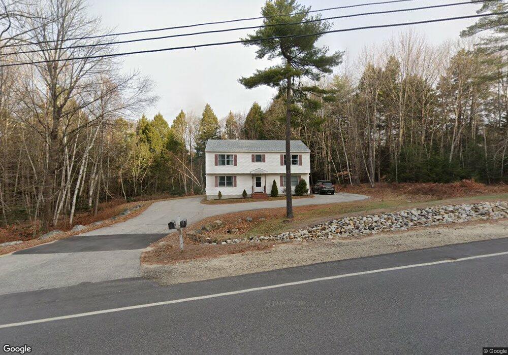
This home is located at 175 Depot Rd, Gray, ME 04039 and is currently estimated at $574,637, approximately $287 per square foot. 175 Depot Rd is a home located in Cumberland County with nearby schools including Gray-New Gloucester High School.
Ownership History
Date
Name
Owned For
Owner Type
Purchase Details
Closed on
Jun 29, 2016
Sold by
Chambers Carl A
Bought by
Williams Valerie L and Ridlon Chad A
Current Estimated Value
Home Financials for this Owner
Home Financials are based on the most recent Mortgage that was taken out on this home.
Original Mortgage
$224,852
Outstanding Balance
$177,064
Interest Rate
3.58%
Mortgage Type
FHA
Estimated Equity
$397,573
Purchase Details
Closed on
Oct 14, 2009
Sold by
Deutsche Bk Natl T Co Tr
Bought by
Chambers Carl A
Home Financials for this Owner
Home Financials are based on the most recent Mortgage that was taken out on this home.
Original Mortgage
$112,500
Interest Rate
5.14%
Mortgage Type
Purchase Money Mortgage
Purchase Details
Closed on
Sep 29, 2009
Sold by
Sobal Gary and Deutsche Bk Natl T Co Tr
Bought by
Wells Fargo Bank Na Tr
Home Financials for this Owner
Home Financials are based on the most recent Mortgage that was taken out on this home.
Original Mortgage
$112,500
Interest Rate
5.14%
Mortgage Type
Purchase Money Mortgage
Purchase Details
Closed on
Jul 31, 2006
Sold by
Buchholz Henry R and Buchholz Patricia A
Bought by
Sabol Gary
Home Financials for this Owner
Home Financials are based on the most recent Mortgage that was taken out on this home.
Original Mortgage
$174,400
Interest Rate
6.67%
Mortgage Type
Purchase Money Mortgage
Create a Home Valuation Report for This Property
The Home Valuation Report is an in-depth analysis detailing your home's value as well as a comparison with similar homes in the area
Home Values in the Area
Average Home Value in this Area
Purchase History
| Date | Buyer | Sale Price | Title Company |
|---|---|---|---|
| Williams Valerie L | -- | -- | |
| Chambers Carl A | -- | -- | |
| Wells Fargo Bank Na Tr | -- | -- | |
| Sabol Gary | -- | -- | |
| Sabol Gary | -- | -- |
Source: Public Records
Mortgage History
| Date | Status | Borrower | Loan Amount |
|---|---|---|---|
| Open | Williams Valerie L | $224,852 | |
| Previous Owner | Sabol Gary | $112,500 | |
| Previous Owner | Sabol Gary | $174,400 | |
| Previous Owner | Sabol Gary | $43,600 |
Source: Public Records
Tax History
| Year | Tax Paid | Tax Assessment Tax Assessment Total Assessment is a certain percentage of the fair market value that is determined by local assessors to be the total taxable value of land and additions on the property. | Land | Improvement |
|---|---|---|---|---|
| 2025 | $4,811 | $497,000 | $128,700 | $368,300 |
| 2024 | $4,821 | $497,000 | $128,700 | $368,300 |
| 2023 | $4,613 | $303,900 | $64,600 | $239,300 |
| 2022 | $4,239 | $303,900 | $64,600 | $239,300 |
| 2021 | $3,991 | $273,200 | $64,600 | $208,600 |
| 2020 | $4,030 | $273,200 | $64,600 | $208,600 |
| 2019 | $4,030 | $273,200 | $64,600 | $208,600 |
| 2018 | $3,825 | $273,200 | $64,600 | $208,600 |
| 2017 | $3,334 | $184,700 | $47,500 | $137,200 |
| 2016 | $3,380 | $184,700 | $47,500 | $137,200 |
| 2015 | $3,362 | $184,700 | $47,500 | $137,200 |
| 2014 | $3,362 | $184,700 | $47,500 | $137,200 |
| 2012 | $2,875 | $181,411 | $47,450 | $133,961 |
Source: Public Records
Map
Nearby Homes
- 179 Depot Rd
- 22 George Perley Rd
- 21 George Perley Rd
- 169 Depot Rd
- 185 Depot Rd
- 19 George Perley Rd
- 165 Depot Rd
- 7 George Perley Rd
- 8 George Perley Rd
- 17 George Perley Rd
- 161 Depot Rd
- 9 George Perley Rd Unit 19
- 1 George Perley Rd
- 193 Depot Rd
- 0 Davis Williams
- 8 Davis Williams Rd
- 139 Depot Rd
- 143 Depot Rd
- 46 Town Farm Rd
- 141 Depot Rd
Your Personal Tour Guide
Ask me questions while you tour the home.