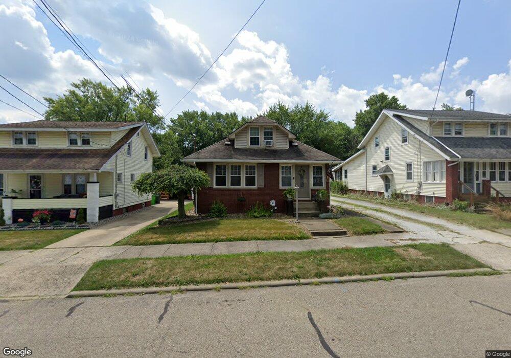
175 E Mill St Alliance, OH 44601
Estimated Value: $154,000 - $184,000
3
Beds
1
Bath
1,650
Sq Ft
$101/Sq Ft
Est. Value
About This Home
This home is located at 175 E Mill St, Alliance, OH 44601 and is currently estimated at $166,703, approximately $101 per square foot. 175 E Mill St is a home located in Stark County with nearby schools including Alliance Elementary School at Rockhill, Alliance Intermediate School at Northside, and Alliance Middle School.
Ownership History
Date
Name
Owned For
Owner Type
Purchase Details
Closed on
Dec 9, 2019
Sold by
Rhome Richard C and Rhome Kathy S
Bought by
Mazzei Philip
Current Estimated Value
Home Financials for this Owner
Home Financials are based on the most recent Mortgage that was taken out on this home.
Original Mortgage
$125,000
Outstanding Balance
$110,206
Interest Rate
3.6%
Mortgage Type
VA
Estimated Equity
$56,498
Purchase Details
Closed on
Dec 7, 2015
Sold by
Ganni Jason
Bought by
Rhome Richard C and Rhome Kathy S
Home Financials for this Owner
Home Financials are based on the most recent Mortgage that was taken out on this home.
Original Mortgage
$95,000
Interest Rate
3.88%
Mortgage Type
New Conventional
Purchase Details
Closed on
Dec 3, 2015
Sold by
Thomas Jeremiah A and Thomas Gwynne A
Bought by
Ganni Jason
Home Financials for this Owner
Home Financials are based on the most recent Mortgage that was taken out on this home.
Original Mortgage
$95,000
Interest Rate
3.88%
Mortgage Type
New Conventional
Purchase Details
Closed on
Aug 4, 2005
Sold by
Thomas Jeremiah A and Thomas Gwynne A
Bought by
Ganni Jason
Home Financials for this Owner
Home Financials are based on the most recent Mortgage that was taken out on this home.
Original Mortgage
$89,610
Interest Rate
5.71%
Mortgage Type
Purchase Money Mortgage
Purchase Details
Closed on
Apr 21, 1999
Sold by
Russell Edward L and Russell Fay A
Bought by
Thomas Jeremiah A and Thomas Gwynne A
Home Financials for this Owner
Home Financials are based on the most recent Mortgage that was taken out on this home.
Original Mortgage
$53,000
Interest Rate
7.17%
Mortgage Type
Purchase Money Mortgage
Purchase Details
Closed on
May 31, 1996
Sold by
Bower Marilyn L
Bought by
Russell Edward L and Russell Fay
Home Financials for this Owner
Home Financials are based on the most recent Mortgage that was taken out on this home.
Original Mortgage
$53,200
Interest Rate
7.99%
Mortgage Type
New Conventional
Create a Home Valuation Report for This Property
The Home Valuation Report is an in-depth analysis detailing your home's value as well as a comparison with similar homes in the area
Home Values in the Area
Average Home Value in this Area
Purchase History
| Date | Buyer | Sale Price | Title Company |
|---|---|---|---|
| Mazzei Philip | $125,000 | Heritage Union Title Co Ltd | |
| Rhome Richard C | $100,000 | Heritage Union Title Co Ltd | |
| Ganni Jason | -- | Attorney | |
| Ganni Jason | $90,000 | -- | |
| Thomas Jeremiah A | $66,500 | -- | |
| Russell Edward L | $56,000 | -- |
Source: Public Records
Mortgage History
| Date | Status | Borrower | Loan Amount |
|---|---|---|---|
| Open | Mazzei Philip | $125,000 | |
| Previous Owner | Rhome Richard C | $95,000 | |
| Previous Owner | Ganni Jason | $95,000 | |
| Previous Owner | Ganni Jason | $89,610 | |
| Previous Owner | Thomas Jeremiah A | $53,000 | |
| Previous Owner | Russell Edward L | $53,200 |
Source: Public Records
Tax History
| Year | Tax Paid | Tax Assessment Tax Assessment Total Assessment is a certain percentage of the fair market value that is determined by local assessors to be the total taxable value of land and additions on the property. | Land | Improvement |
|---|---|---|---|---|
| 2025 | -- | $49,600 | $11,380 | $38,220 |
| 2024 | -- | $49,600 | $11,380 | $38,220 |
| 2023 | $1,033 | $44,030 | $8,890 | $35,140 |
| 2022 | $1,073 | $44,030 | $8,890 | $35,140 |
| 2021 | $1,074 | $44,030 | $8,890 | $35,140 |
| 2020 | $1,373 | $31,680 | $7,740 | $23,940 |
| 2019 | $543 | $31,680 | $7,740 | $23,940 |
Source: Public Records
Map
Nearby Homes
- 2041 Watson Ave
- 2405 Cherry Ave
- 2372 S Union Ave
- 2406 S Union Ave
- 2351 S Freedom Ave
- 2408 S Linden Ave
- 2117 Miller Ave
- 390 E College St
- 233 Shadyside Ct
- 224 Shadyside Ct
- 2364 Shunk Ave
- 555 E Milton St
- 1608 S Liberty Ave
- 853 Fairway Dr
- 834 Devine St
- 2705 Shunk Ave
- 167 11th St
- 720 Vincent Blvd
- 134 11th St
- 226 Milner St