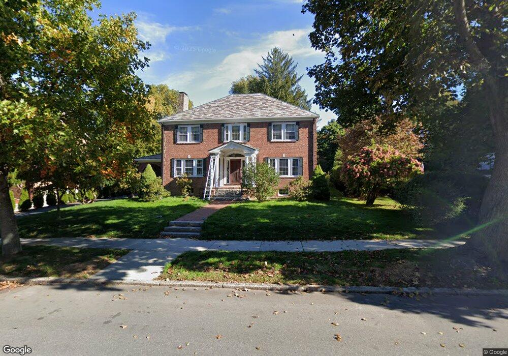
175 Eliot St Chestnut Hill, MA 02467
Chestnut Hill NeighborhoodEstimated Value: $2,157,000 - $2,533,000
3
Beds
3
Baths
2,688
Sq Ft
$861/Sq Ft
Est. Value
About This Home
This home is located at 175 Eliot St, Chestnut Hill, MA 02467 and is currently estimated at $2,314,665, approximately $861 per square foot. 175 Eliot St is a home located in Norfolk County with nearby schools including Heath Elementary School, Brookline High School, and Brimmer & May School.
Ownership History
Date
Name
Owned For
Owner Type
Purchase Details
Closed on
Dec 30, 2005
Sold by
Lewis Eleanor L and Levinson Eliot
Bought by
Komarnitsky Philip B and Komarnitsky Svetlana L
Current Estimated Value
Home Financials for this Owner
Home Financials are based on the most recent Mortgage that was taken out on this home.
Original Mortgage
$880,000
Outstanding Balance
$498,133
Interest Rate
6.39%
Mortgage Type
Purchase Money Mortgage
Estimated Equity
$1,816,532
Create a Home Valuation Report for This Property
The Home Valuation Report is an in-depth analysis detailing your home's value as well as a comparison with similar homes in the area
Home Values in the Area
Average Home Value in this Area
Purchase History
| Date | Buyer | Sale Price | Title Company |
|---|---|---|---|
| Komarnitsky Philip B | $1,100,000 | -- |
Source: Public Records
Mortgage History
| Date | Status | Borrower | Loan Amount |
|---|---|---|---|
| Open | Komarnitsky Philip B | $880,000 |
Source: Public Records
Tax History
| Year | Tax Paid | Tax Assessment Tax Assessment Total Assessment is a certain percentage of the fair market value that is determined by local assessors to be the total taxable value of land and additions on the property. | Land | Improvement |
|---|---|---|---|---|
| 2025 | $21,541 | $2,182,500 | $1,421,900 | $760,600 |
| 2024 | $20,526 | $2,100,900 | $1,367,200 | $733,700 |
| 2023 | $17,455 | $1,750,800 | $976,800 | $774,000 |
| 2022 | $16,991 | $1,667,400 | $930,300 | $737,100 |
| 2021 | $15,712 | $1,603,300 | $894,500 | $708,800 |
| 2020 | $14,294 | $1,512,600 | $813,100 | $699,500 |
| 2019 | $13,498 | $1,440,600 | $774,400 | $666,200 |
| 2018 | $13,581 | $1,435,600 | $779,900 | $655,700 |
| 2017 | $13,380 | $1,354,300 | $735,700 | $618,600 |
| 2016 | $13,189 | $1,265,700 | $687,600 | $578,100 |
| 2015 | $12,633 | $1,182,900 | $642,600 | $540,300 |
| 2014 | $12,537 | $1,100,700 | $584,200 | $516,500 |
Source: Public Records
Map
Nearby Homes
- 142 Crafts Rd
- 2420 Beacon St Unit 401
- 2400 Beacon St Unit 102
- 2400 Beacon St Unit 409
- 282 Buckminster Rd
- 6 Sutherland Rd Unit 41
- 43 Druce St
- 1014 Boylston St
- 41 Orkney Rd
- 130 Cabot St
- 120 Seaver St Unit C-102
- 31 Orkney Rd Unit 54
- 331 Heath St
- 188 Heath St
- 40 Heath Hill
- 55 Leicester St
- 5 Braemore Rd Unit 10
- 60 Sutherland Rd Unit 4
- 26 Chiswick Rd Unit 6
- 47 Englewood Ave
Your Personal Tour Guide
Ask me questions while you tour the home.