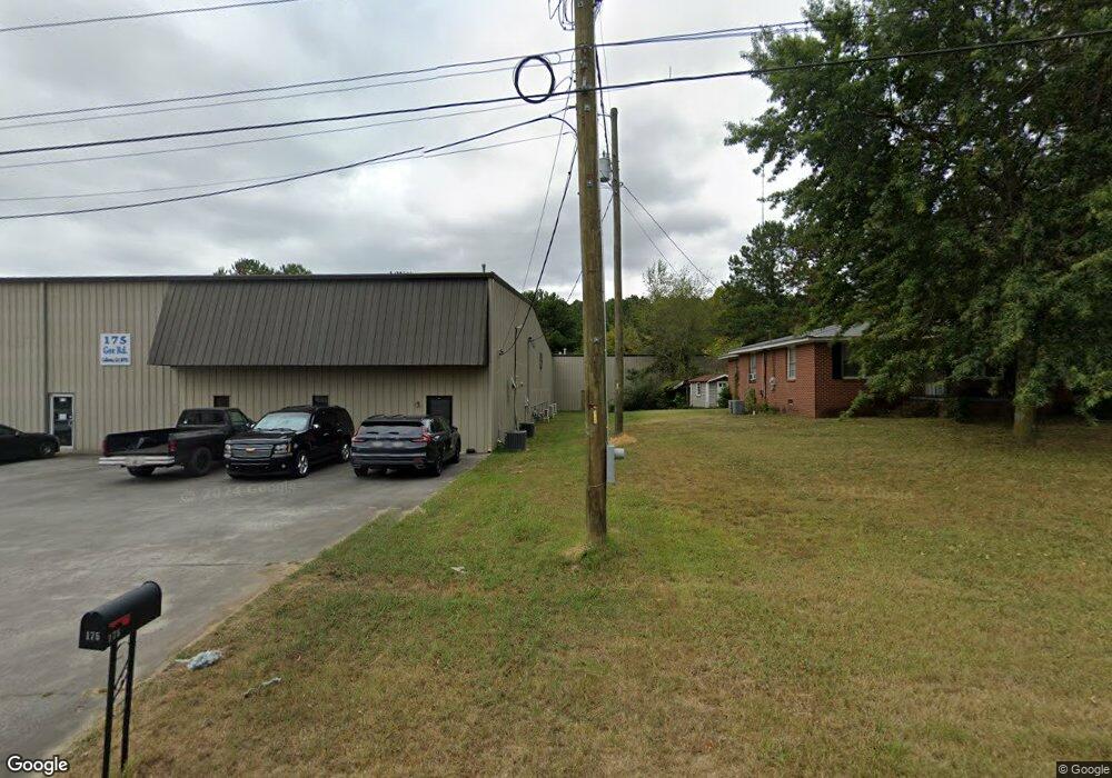
175 Gee Rd NE Calhoun, GA 30701
Estimated Value: $1,411,739
--
Bed
--
Bath
25,000
Sq Ft
$56/Sq Ft
Est. Value
About This Home
This home is located at 175 Gee Rd NE, Calhoun, GA 30701 and is currently estimated at $1,411,739, approximately $56 per square foot. 175 Gee Rd NE is a home located in Gordon County with nearby schools including Calhoun Primary School, Calhoun Elementary School, and Calhoun Middle School.
Ownership History
Date
Name
Owned For
Owner Type
Purchase Details
Closed on
Mar 3, 2017
Sold by
John E
Bought by
Aspire Pci Llc
Current Estimated Value
Purchase Details
Closed on
Mar 11, 2013
Sold by
Church Street Retail Prope
Bought by
Bryant John E
Purchase Details
Closed on
Feb 15, 2013
Sold by
M & H Holdings Llc
Bought by
Church Street Retail Propertie
Purchase Details
Closed on
Aug 20, 2001
Sold by
Weaver Properties Inv Inc
Bought by
M & S Properties Llc
Purchase Details
Closed on
Apr 23, 1998
Bought by
Weaver Properties Inv Inc
Purchase Details
Closed on
Jun 6, 1996
Bought by
Simpson Stanley
Create a Home Valuation Report for This Property
The Home Valuation Report is an in-depth analysis detailing your home's value as well as a comparison with similar homes in the area
Home Values in the Area
Average Home Value in this Area
Purchase History
| Date | Buyer | Sale Price | Title Company |
|---|---|---|---|
| Aspire Pci Llc | -- | -- | |
| Bryant John E | $485,000 | -- | |
| Church Street Retail Propertie | $485,000 | -- | |
| M & S Properties Llc | $400,000 | -- | |
| Weaver Properties Inv Inc | -- | -- | |
| Simpson Stanley | $9,000 | -- |
Source: Public Records
Tax History Compared to Growth
Tax History
| Year | Tax Paid | Tax Assessment Tax Assessment Total Assessment is a certain percentage of the fair market value that is determined by local assessors to be the total taxable value of land and additions on the property. | Land | Improvement |
|---|---|---|---|---|
| 2024 | $4,966 | $176,640 | $21,640 | $155,000 |
| 2023 | $5,192 | $184,680 | $21,640 | $163,040 |
| 2022 | $5,783 | $192,720 | $21,640 | $171,080 |
| 2021 | $6,135 | $206,080 | $21,640 | $184,440 |
| 2020 | $6,345 | $211,440 | $21,640 | $189,800 |
| 2019 | $6,336 | $211,440 | $21,640 | $189,800 |
| 2018 | $1,991 | $206,720 | $21,640 | $185,080 |
| 2017 | $2,032 | $206,720 | $21,640 | $185,080 |
| 2016 | $2,037 | $206,720 | $21,640 | $185,080 |
| 2015 | $2,063 | $206,720 | $21,640 | $185,080 |
| 2014 | $1,910 | $206,820 | $21,672 | $185,148 |
Source: Public Records
Map
Nearby Homes
- 308 Heritage Dr
- 101 Brexley Dr
- 148 Brexley Dr
- 136 Brexley Dr
- 126 Brexley Dr
- 130 Brexley Dr
- 132 Brexley Dr
- 107 Brexley Dr
- 146 Brexley Dr
- 105 Brexley Dr
- 103 Brexley Dr
- 113 Brexley Dr
- 109 Brexley Dr
- 142 Brexley Dr
- 115 Brexley Dr
- 134 Brexley Dr
- 128 Brexley Dr
- 138 Brexley Dr
- 111 Brexley Dr
- 204 Patriots Row SW
- 000 Gee Rd NE
- 00 Gee Rd NE
- 0 Gee Rd NE
- 0 Gee Rd NE Unit 20084110
- 0 Gee Rd NE Unit 10033121
- 0 Gee Rd NE Unit 20029283
- 0 Gee Rd NE Unit 3094081
- 0 Gee Rd NE Unit 5400415
- 115 Gee Rd NE
- 211 Gee Rd NE
- 202 Gee Rd NE
- 163 Damascus Rd NE
- 108 Colonial Dr
- 109 Colonial Dr
- 105 Colonial Dr
- 107 Colonial Dr
- 100 Heritage Dr
- 101 Colonial Dr
- 106 Colonial Dr
- 104 Colonial Dr