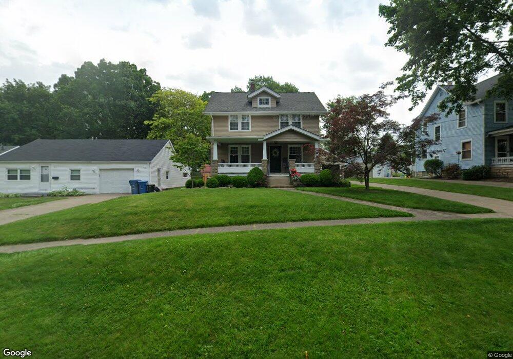
175 Jackson St Amherst, OH 44001
Estimated Value: $219,000 - $263,000
3
Beds
3
Baths
1,732
Sq Ft
$137/Sq Ft
Est. Value
About This Home
This home is located at 175 Jackson St, Amherst, OH 44001 and is currently estimated at $238,077, approximately $137 per square foot. 175 Jackson St is a home located in Lorain County with nearby schools including Powers Elementary School, Walter G. Nord Middle School, and Amherst Junior High School.
Ownership History
Date
Name
Owned For
Owner Type
Purchase Details
Closed on
Jan 30, 1996
Sold by
Wasem Richard R
Bought by
Kordeleski Daniel J and Kordeleski Kelly A
Current Estimated Value
Home Financials for this Owner
Home Financials are based on the most recent Mortgage that was taken out on this home.
Original Mortgage
$104,500
Outstanding Balance
$3,480
Interest Rate
7.19%
Mortgage Type
New Conventional
Estimated Equity
$234,597
Create a Home Valuation Report for This Property
The Home Valuation Report is an in-depth analysis detailing your home's value as well as a comparison with similar homes in the area
Home Values in the Area
Average Home Value in this Area
Purchase History
| Date | Buyer | Sale Price | Title Company |
|---|---|---|---|
| Kordeleski Daniel J | $110,000 | -- |
Source: Public Records
Mortgage History
| Date | Status | Borrower | Loan Amount |
|---|---|---|---|
| Open | Kordeleski Daniel J | $104,500 |
Source: Public Records
Tax History
| Year | Tax Paid | Tax Assessment Tax Assessment Total Assessment is a certain percentage of the fair market value that is determined by local assessors to be the total taxable value of land and additions on the property. | Land | Improvement |
|---|---|---|---|---|
| 2024 | $2,773 | $68,016 | $15,372 | $52,644 |
| 2023 | $2,752 | $56,809 | $13,570 | $43,239 |
| 2022 | $2,639 | $56,809 | $13,570 | $43,239 |
| 2021 | $2,646 | $56,809 | $13,570 | $43,239 |
| 2020 | $2,536 | $48,310 | $11,540 | $36,770 |
| 2019 | $2,459 | $48,310 | $11,540 | $36,770 |
| 2018 | $2,447 | $48,310 | $11,540 | $36,770 |
| 2017 | $2,422 | $44,480 | $7,660 | $36,820 |
| 2016 | $2,441 | $44,480 | $7,660 | $36,820 |
| 2015 | $2,367 | $43,380 | $7,660 | $35,720 |
| 2014 | $2,133 | $38,910 | $6,870 | $32,040 |
| 2013 | $2,140 | $38,910 | $6,870 | $32,040 |
Source: Public Records
Map
Nearby Homes
- 165 Woodhill Dr
- 950 Park Ave
- 145 Pearl St
- 1071 Tenney Ave
- 1150 Woodside Dr
- 180 S Leavitt Rd
- 105 N Woodhill Dr
- 162 S Leavitt Rd
- 495 Church St
- 613 Jackson St
- 645 Terra Ln
- 653 Brennan Dr
- 107 Keswick Ct
- 267 Milan Ave
- 0 Middle Ridge Rd Unit 5180506
- 0 Middle Ridge Rd Unit 5102632
- 707 Lincoln St
- 578 N Main St
- 7475 S Dewey Rd
- 894 S Main St
- 173 Jackson St
- 171 Jackson St
- 183 Jackson St
- 167 Jackson St
- 168 Woodhill Dr
- 172 Woodhill Dr
- 185 Jackson St
- 176 Woodhill Dr
- 166 Woodhill Dr
- 161 Jackson St
- 180 Woodhill Dr
- 162 Woodhill Dr
- 174 Jackson St
- 190 Woodhill Dr
- 184 Jackson St
- 153 Jackson St
- 168 Jackson St
- 160 Woodhill Dr
- 188 Jackson St
- 162 Jackson St
Your Personal Tour Guide
Ask me questions while you tour the home.