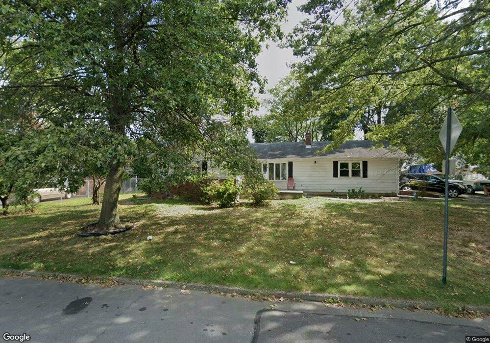
175 King Ave Ewing, NJ 08638
Braeburn Heights NeighborhoodEstimated Value: $345,000 - $455,000
Studio
--
Bath
1,504
Sq Ft
$265/Sq Ft
Est. Value
About This Home
This home is located at 175 King Ave, Ewing, NJ 08638 and is currently estimated at $398,104, approximately $264 per square foot. 175 King Ave is a home located in Mercer County with nearby schools including Ewing High School and Trenton Stem-To-Civics Charter School.
Ownership History
Date
Name
Owned For
Owner Type
Purchase Details
Closed on
Dec 20, 2006
Sold by
Duchard Betty
Bought by
Fields Johnny
Current Estimated Value
Home Financials for this Owner
Home Financials are based on the most recent Mortgage that was taken out on this home.
Original Mortgage
$243,000
Outstanding Balance
$143,911
Interest Rate
6.14%
Estimated Equity
$254,193
Purchase Details
Closed on
Aug 28, 2003
Sold by
Smith William
Bought by
Duchard Betty
Home Financials for this Owner
Home Financials are based on the most recent Mortgage that was taken out on this home.
Original Mortgage
$196,910
Interest Rate
5.98%
Create a Home Valuation Report for This Property
The Home Valuation Report is an in-depth analysis detailing your home's value as well as a comparison with similar homes in the area
Home Values in the Area
Average Home Value in this Area
Purchase History
| Date | Buyer | Sale Price | Title Company |
|---|---|---|---|
| Fields Johnny | $270,000 | -- | |
| Duchard Betty | $200,000 | -- |
Source: Public Records
Mortgage History
| Date | Status | Borrower | Loan Amount |
|---|---|---|---|
| Open | Fields Johnny | $243,000 | |
| Previous Owner | Duchard Betty | $196,910 |
Source: Public Records
Tax History
| Year | Tax Paid | Tax Assessment Tax Assessment Total Assessment is a certain percentage of the fair market value that is determined by local assessors to be the total taxable value of land and additions on the property. | Land | Improvement |
|---|---|---|---|---|
| 2025 | $7,559 | $192,200 | $58,800 | $133,400 |
| 2024 | $7,106 | $192,200 | $58,800 | $133,400 |
| 2023 | $7,106 | $192,200 | $58,800 | $133,400 |
| 2022 | $6,913 | $192,200 | $58,800 | $133,400 |
| 2021 | $6,744 | $192,200 | $58,800 | $133,400 |
| 2020 | $6,648 | $192,200 | $58,800 | $133,400 |
| 2019 | $6,475 | $192,200 | $58,800 | $133,400 |
| 2018 | $7,099 | $134,400 | $42,000 | $92,400 |
| 2017 | $7,264 | $134,400 | $42,000 | $92,400 |
| 2016 | $7,166 | $134,400 | $42,000 | $92,400 |
| 2015 | $7,071 | $134,400 | $42,000 | $92,400 |
| 2014 | $7,052 | $134,400 | $42,000 | $92,400 |
Source: Public Records
Map
Nearby Homes
- 360 Hollowbrook Rd
- 40 Arden Ave
- 140 Crescent Ave
- 104 King Ave
- 42 Running Brook Rd
- 100 Carnine Ave
- 161 Louisiana Ave
- 23 Sundew Dr
- 27 Blossom Dr
- 124 Hawthorne Ave
- 20 Running Brook Rd
- 16 Bittersweet Rd
- 20 Steinway Ave
- 56 Ridgewood Ave
- 256 Ewingville Rd
- 3 Beth Ann Way
- 24 Keswick Ave
- 50 Groveland Ave
- 41 Harding St
- 1005 Terrace Blvd
Your Personal Tour Guide
Ask me questions while you tour the home.