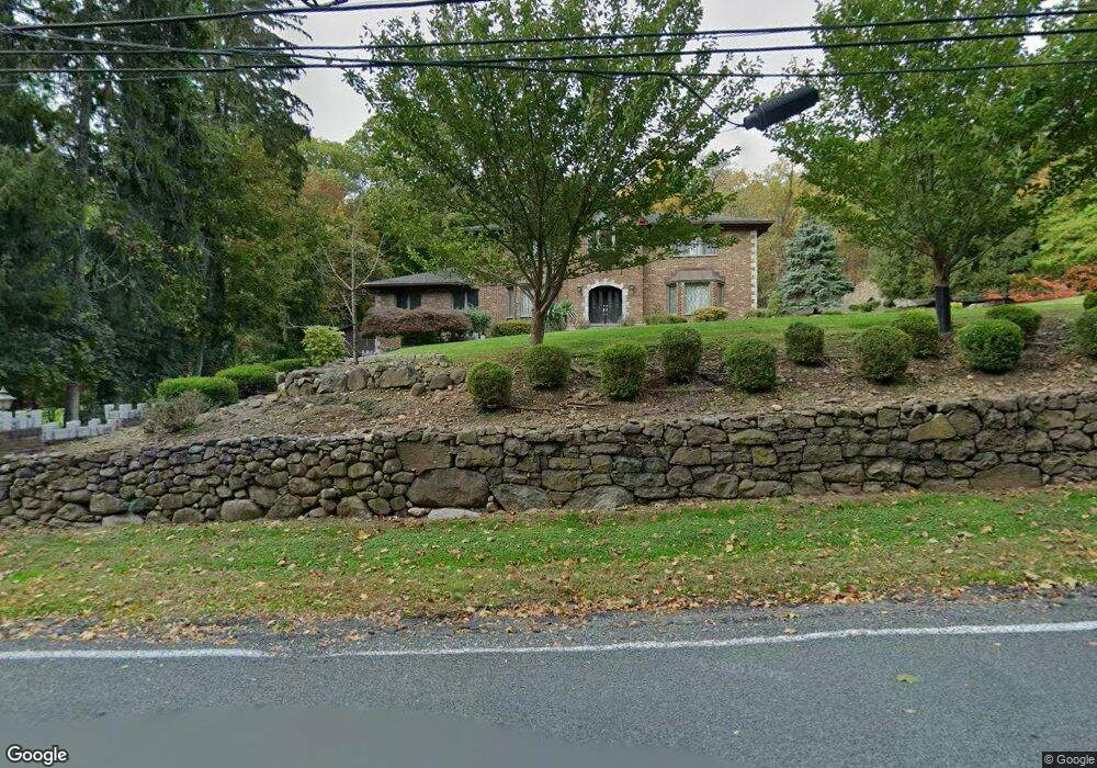
175 Kings Hwy Orangeburg, NY 10962
Estimated Value: $929,000 - $1,033,788
3
Beds
5
Baths
3,232
Sq Ft
$299/Sq Ft
Est. Value
About This Home
This home is located at 175 Kings Hwy, Orangeburg, NY 10962 and is currently estimated at $965,697, approximately $298 per square foot. 175 Kings Hwy is a home located in Rockland County with nearby schools including William O Schaefer Elementary School, Cottage Lane Elementary School, and South Orangetown Middle School.
Ownership History
Date
Name
Owned For
Owner Type
Purchase Details
Closed on
Apr 5, 2002
Sold by
Fogarty James and Fogarty Marcella
Bought by
Fogarty Regina
Current Estimated Value
Home Financials for this Owner
Home Financials are based on the most recent Mortgage that was taken out on this home.
Original Mortgage
$190,000
Interest Rate
6.84%
Create a Home Valuation Report for This Property
The Home Valuation Report is an in-depth analysis detailing your home's value as well as a comparison with similar homes in the area
Home Values in the Area
Average Home Value in this Area
Purchase History
| Date | Buyer | Sale Price | Title Company |
|---|---|---|---|
| Fogarty Regina | $92,750 | Uslife Title Insurance Compa |
Source: Public Records
Mortgage History
| Date | Status | Borrower | Loan Amount |
|---|---|---|---|
| Closed | Fogarty Regina | $190,000 |
Source: Public Records
Tax History Compared to Growth
Tax History
| Year | Tax Paid | Tax Assessment Tax Assessment Total Assessment is a certain percentage of the fair market value that is determined by local assessors to be the total taxable value of land and additions on the property. | Land | Improvement |
|---|---|---|---|---|
| 2024 | $23,530 | $316,000 | $101,200 | $214,800 |
| 2023 | $23,530 | $316,000 | $101,200 | $214,800 |
| 2022 | $8,158 | $316,000 | $101,200 | $214,800 |
| 2021 | $19,577 | $316,000 | $101,200 | $214,800 |
| 2020 | $20,885 | $316,000 | $101,200 | $214,800 |
| 2019 | $7,765 | $316,000 | $101,200 | $214,800 |
| 2018 | $18,681 | $316,000 | $101,200 | $214,800 |
| 2017 | $18,074 | $316,000 | $101,200 | $214,800 |
| 2016 | $17,505 | $316,000 | $101,200 | $214,800 |
| 2015 | -- | $316,000 | $101,200 | $214,800 |
| 2014 | -- | $316,000 | $101,200 | $214,800 |
Source: Public Records
Map
Nearby Homes
- 199 Tweed Blvd
- 201 Tweed Blvd
- 613 Route 9w
- 1 W Lawrence Park Dr Unit 10
- 52 Broadway
- 3 W Lawrence Park Dr Unit 1
- 50 Franklin St
- 699 Route 9w S
- 21 Hartz Terrace
- 8 Haring Ave
- 44-46 Kinney St
- 46 Upper Ritie St
- 75 Tate Ave
- 563 Piermont Ave
- 13 Ash St
- 414 Kings Hwy
- 272 Piermont Ave
- 210 Ferdon Ave
- 307 Harbor Cove
- 48 - 50 Kinney St