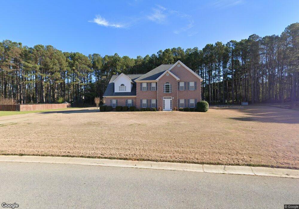
175 Longshore Way Unit B Fayetteville, GA 30215
Whitewater NeighborhoodEstimated Value: $493,544 - $575,000
--
Bed
1
Bath
3,122
Sq Ft
$168/Sq Ft
Est. Value
About This Home
This home is located at 175 Longshore Way Unit B, Fayetteville, GA 30215 and is currently estimated at $525,136, approximately $168 per square foot. 175 Longshore Way Unit B is a home located in Fayette County with nearby schools including Sara Harp Minter Elementary School, Whitewater Middle School, and Whitewater High School.
Ownership History
Date
Name
Owned For
Owner Type
Purchase Details
Closed on
Apr 14, 1999
Sold by
Stinchcomb Dan V
Bought by
Muller Margaret E
Current Estimated Value
Home Financials for this Owner
Home Financials are based on the most recent Mortgage that was taken out on this home.
Original Mortgage
$90,000
Outstanding Balance
$22,828
Interest Rate
7.06%
Mortgage Type
New Conventional
Estimated Equity
$502,309
Create a Home Valuation Report for This Property
The Home Valuation Report is an in-depth analysis detailing your home's value as well as a comparison with similar homes in the area
Home Values in the Area
Average Home Value in this Area
Purchase History
| Date | Buyer | Sale Price | Title Company |
|---|---|---|---|
| Muller Margaret E | $220,000 | -- |
Source: Public Records
Mortgage History
| Date | Status | Borrower | Loan Amount |
|---|---|---|---|
| Open | Muller Margaret E | $90,000 |
Source: Public Records
Tax History Compared to Growth
Tax History
| Year | Tax Paid | Tax Assessment Tax Assessment Total Assessment is a certain percentage of the fair market value that is determined by local assessors to be the total taxable value of land and additions on the property. | Land | Improvement |
|---|---|---|---|---|
| 2024 | $2,400 | $187,168 | $30,000 | $157,168 |
| 2023 | $2,018 | $179,600 | $30,000 | $149,600 |
| 2022 | $3,954 | $160,840 | $30,000 | $130,840 |
| 2021 | $3,740 | $138,760 | $30,000 | $108,760 |
| 2020 | $3,743 | $132,920 | $19,200 | $113,720 |
| 2019 | $3,805 | $133,680 | $19,200 | $114,480 |
| 2018 | $3,601 | $125,160 | $19,200 | $105,960 |
| 2017 | $3,587 | $124,200 | $19,200 | $105,000 |
| 2016 | $3,073 | $104,240 | $19,200 | $85,040 |
| 2015 | $2,873 | $95,800 | $19,200 | $76,600 |
| 2014 | $2,677 | $87,960 | $19,200 | $68,760 |
| 2013 | -- | $85,720 | $0 | $0 |
Source: Public Records
Map
Nearby Homes
- 215 Watershed Way
- 140 Canal Place
- 100 Carrollwood Dr
- 200 Providence Rd
- 300 Wrightsburg Ct
- 150 Melody Ln
- 145 Bryson Ln
- 125 Newberry St
- 0 Mcbride Rd Unit LOT 5
- 0 Mcbride Rd Unit LOT 2 10607045
- 0 Mcbride Rd Unit 10631745
- 0 Mcbride Rd Unit LOT 3 10607237
- 105 Greenfield Cir
- 114 Mcbride Rd
- 120 Broad Meadows Ln
- 155 Paislee Park Dr Unit 13
- 140 Olivia Ct
- 140 Paislee Park (Lot #5 Paislee Park) Dr
- 170 Paislee Park Dr Unit LOT 8
- 130 Wright Trace Unit LOT 20
- 185 Longshore Way
- 170 Longshore Way Unit B
- 155 Longshore Way Unit B
- 180 Longshore Way
- 145 Marina Ct Unit A
- 135 Marina Ct Unit A
- 135 Marina Ct
- 125 Marina Ct
- 160 Longshore Way
- 205 Longshore Way
- 190 Longshore Way
- 115 Marina Ct
- 155 Marina Ct Unit A
- 145 Longshore Way
- 0 Marina Ct Unit 7373484
- 0 Marina Ct Unit 7192437
- 0 Marina Ct Unit 8863102
- 0 Marina Ct Unit 8771889
- 0 Marina Ct Unit 8750905
- 0 Marina Ct Unit 8637900