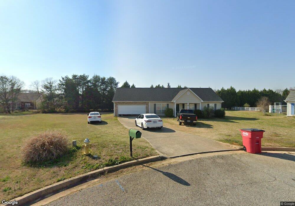
175 Mason Philip Dr Macon, GA 31216
Estimated Value: $193,000 - $252,000
3
Beds
2
Baths
1,530
Sq Ft
$141/Sq Ft
Est. Value
About This Home
This home is located at 175 Mason Philip Dr, Macon, GA 31216 and is currently estimated at $216,403, approximately $141 per square foot. 175 Mason Philip Dr is a home located in Bibb County with nearby schools including Heard Elementary School, Rutland Middle School, and Rutland High School.
Ownership History
Date
Name
Owned For
Owner Type
Purchase Details
Closed on
Jul 15, 2008
Sold by
Popwell David and Popwell Stacie
Bought by
Tidwell Bradlee Kevin
Current Estimated Value
Home Financials for this Owner
Home Financials are based on the most recent Mortgage that was taken out on this home.
Original Mortgage
$120,607
Outstanding Balance
$78,259
Interest Rate
6.27%
Mortgage Type
FHA
Estimated Equity
$138,144
Purchase Details
Closed on
Apr 26, 2005
Sold by
Popwell David
Bought by
Popwell David and Popwell Stacie
Purchase Details
Closed on
Oct 28, 2003
Create a Home Valuation Report for This Property
The Home Valuation Report is an in-depth analysis detailing your home's value as well as a comparison with similar homes in the area
Home Values in the Area
Average Home Value in this Area
Purchase History
| Date | Buyer | Sale Price | Title Company |
|---|---|---|---|
| Tidwell Bradlee Kevin | $122,500 | None Available | |
| Popwell David | -- | None Avilabel | |
| -- | $106,000 | -- |
Source: Public Records
Mortgage History
| Date | Status | Borrower | Loan Amount |
|---|---|---|---|
| Open | Tidwell Bradlee Kevin | $120,607 |
Source: Public Records
Tax History Compared to Growth
Tax History
| Year | Tax Paid | Tax Assessment Tax Assessment Total Assessment is a certain percentage of the fair market value that is determined by local assessors to be the total taxable value of land and additions on the property. | Land | Improvement |
|---|---|---|---|---|
| 2025 | $1,590 | $64,705 | $10,000 | $54,705 |
| 2024 | $1,641 | $64,621 | $10,000 | $54,621 |
| 2023 | $1,703 | $57,496 | $10,000 | $47,496 |
| 2022 | $2,100 | $60,654 | $6,400 | $54,254 |
| 2021 | $1,636 | $43,064 | $5,250 | $37,814 |
| 2020 | $1,672 | $43,064 | $5,250 | $37,814 |
| 2019 | $1,596 | $40,759 | $5,000 | $35,759 |
| 2018 | $2,328 | $35,826 | $5,000 | $30,826 |
| 2017 | $1,342 | $35,826 | $5,000 | $30,826 |
| 2016 | $1,239 | $35,826 | $5,000 | $30,826 |
| 2015 | $1,754 | $35,826 | $5,000 | $30,826 |
| 2014 | $1,757 | $35,826 | $5,000 | $30,826 |
Source: Public Records
Map
Nearby Homes
- 436 Joseph Chandler Dr
- 411 Bob White Rd
- 102 Haylie Ct
- 330 Cody Dr
- 104 Alayna Ct
- 328 Cody Dr
- 428 Bob White Rd
- 813 Ocala National Trail
- Jodeco Plan at Goodall Woods
- Sierra Plan at Goodall Woods
- Poplar Plan at Goodall Woods
- Russell Plan at Goodall Woods
- Clayton Plan at Goodall Woods
- 108 Alayna Ct
- 318 Cody Dr
- 310 Cody Dr
- 465 Bob White Rd
- 320 Cody Dr
- 405 Stonecrest Ct
- 303 Cody Dr
- 136 Jabrok Cir
- 132 Jabrok Cir
- 128 Jabrok Cir
- 140 Jabrok Cir
- 174 Mason Philip Dr
- 124 Jabrok Cir
- 144 Jabrok Cir
- 125 Alex Bailey Ct
- 179 Mason Philip Dr
- 120 Jabrok Cir
- 180 Mason Philip Dr
- 126 Alex Bailey Ct
- 148 Jabrok Cir
- 148 Jabrok Cir Unit 44
- 116 Jabrok Cir
- 118 Shelby Ct
- 118 Shelby Ct Unit 137
- 143 Jabrok Cir
- 119 Alex Bailey Ct
- 224 Jabrok Cir