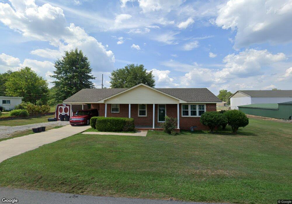
175 Mcclung St Phil Campbell, AL 35581
Estimated Value: $121,478 - $185,000
Studio
--
Bath
1,986
Sq Ft
$71/Sq Ft
Est. Value
About This Home
This home is located at 175 Mcclung St, Phil Campbell, AL 35581 and is currently estimated at $140,870, approximately $70 per square foot. 175 Mcclung St is a home located in Franklin County.
Ownership History
Date
Name
Owned For
Owner Type
Purchase Details
Closed on
Mar 14, 2025
Sold by
Down The Stretch Llc
Bought by
Palmer Macie
Current Estimated Value
Purchase Details
Closed on
Dec 13, 2024
Sold by
Kilgore Shannon
Bought by
Down The Stretch Llc
Purchase Details
Closed on
Jun 24, 2024
Sold by
Kilgoar Victor Barry and Kilgoar Deborah
Bought by
Allen Julie Dawn and Williams Debra Faye
Purchase Details
Closed on
Aug 25, 2015
Sold by
Kilgoar Victor Barry and Brooks Kilgoar
Bought by
Kilgoar Victor Barry and Kilgoar Deborah Gayle
Create a Home Valuation Report for This Property
The Home Valuation Report is an in-depth analysis detailing your home's value as well as a comparison with similar homes in the area
Purchase History
| Date | Buyer | Sale Price | Title Company |
|---|---|---|---|
| Palmer Macie | $100,000 | None Listed On Document | |
| Palmer Macie | $100,000 | None Listed On Document | |
| Down The Stretch Llc | -- | None Listed On Document | |
| Allen Julie Dawn | $112,000 | None Listed On Document | |
| Kilgoar Victor Barry | -- | -- |
Source: Public Records
Tax History
| Year | Tax Paid | Tax Assessment Tax Assessment Total Assessment is a certain percentage of the fair market value that is determined by local assessors to be the total taxable value of land and additions on the property. | Land | Improvement |
|---|---|---|---|---|
| 2025 | $531 | $13,680 | $740 | $12,940 |
| 2024 | $531 | $11,200 | $700 | $10,500 |
| 2023 | $1 | $10,660 | $680 | $9,980 |
| 2022 | $1 | $9,700 | $600 | $9,100 |
| 2021 | $1 | $8,800 | $600 | $8,200 |
| 2020 | $1 | $8,800 | $600 | $8,200 |
| 2019 | $1 | $17,600 | $1,200 | $16,400 |
| 2018 | $1 | $8,500 | $600 | $7,900 |
| 2017 | $1 | $7,500 | $600 | $6,900 |
| 2016 | $642 | $14,900 | $1,200 | $13,700 |
| 2015 | $1 | $7,500 | $600 | $6,900 |
| 2014 | $1 | $7,500 | $600 | $6,900 |
| 2013 | $1 | $7,300 | $600 | $6,700 |
Source: Public Records
Map
Nearby Homes
- 0 Hwy 13 Unit 526340
- 000 Hwy 8
- 3020 Broad St
- 1440 Pike Ave
- 0 County Road 81
- 11 Mc Clung Ave
- 364 Mc Clung Ave
- 87 Jackson St
- 191 Railroad St
- 2463 Alabama 237
- 165 Belva St
- 0 Holder St
- 1 County Road 63
- 531 Pike Ave
- 0 Hyde Rd Unit LotWP001 23713578
- 1 Hyde Rd
- 395 County Road 81
- 000 Nix Rd
- 1537 County Road 81
- 2209 Nix Rd
- 151 Mc Clung Ave
- 160 Mc Clung Ave
- 1518 Pike Ave
- 98 Maple St
- 0 Kelly Rd Unit 151458
- 00000 Kelly Rd Unit 4
- 0 Thompson Ave Unit 520912
- 00 Thompson Ave
- 2332 Hwy 175
- 221 Hwy 79
- 1750 Hwy 79
- 1004 Hwy 85
- 1044 Hwy 281
- 80 Crouch Mountain Rd
- 2044 Hwy 89
- 66 Turkey Farm Rd
- 0 Hwy 13 Unit 511310
- 0 County Hwy 123 Unit 506363
- 2357 Broadway St
- 0 Hwy 93 Unit 75445
Your Personal Tour Guide
Ask me questions while you tour the home.