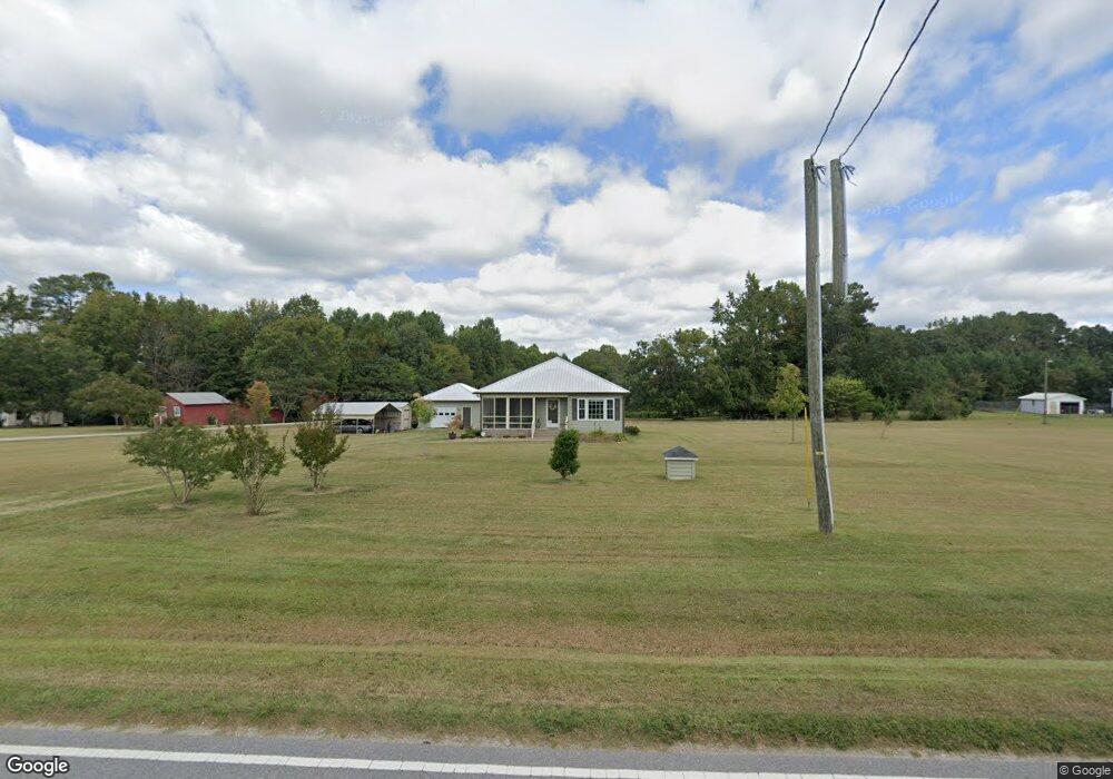
175 Moulton Rd Louisburg, NC 27549
Estimated Value: $218,000 - $356,770
2
Beds
2
Baths
1,291
Sq Ft
$233/Sq Ft
Est. Value
About This Home
This home is located at 175 Moulton Rd, Louisburg, NC 27549 and is currently estimated at $300,443, approximately $232 per square foot. 175 Moulton Rd is a home with nearby schools including Louisburg Elementary School, Terrell Lane Middle School, and Louisburg High School.
Ownership History
Date
Name
Owned For
Owner Type
Purchase Details
Closed on
Mar 16, 2006
Sold by
Walton William L and Walton Sammie F
Bought by
Edwards Carla K
Current Estimated Value
Home Financials for this Owner
Home Financials are based on the most recent Mortgage that was taken out on this home.
Original Mortgage
$20,700
Interest Rate
6.19%
Mortgage Type
New Conventional
Create a Home Valuation Report for This Property
The Home Valuation Report is an in-depth analysis detailing your home's value as well as a comparison with similar homes in the area
Home Values in the Area
Average Home Value in this Area
Purchase History
| Date | Buyer | Sale Price | Title Company |
|---|---|---|---|
| Edwards Carla K | $23,000 | None Available |
Source: Public Records
Mortgage History
| Date | Status | Borrower | Loan Amount |
|---|---|---|---|
| Closed | Edwards Carla K | $20,700 |
Source: Public Records
Tax History Compared to Growth
Tax History
| Year | Tax Paid | Tax Assessment Tax Assessment Total Assessment is a certain percentage of the fair market value that is determined by local assessors to be the total taxable value of land and additions on the property. | Land | Improvement |
|---|---|---|---|---|
| 2025 | $2,063 | $324,140 | $80,920 | $243,220 |
| 2024 | $2,063 | $324,140 | $80,920 | $243,220 |
| 2023 | $1,573 | $165,780 | $30,240 | $135,540 |
| 2022 | $1,563 | $165,780 | $30,240 | $135,540 |
| 2021 | $1,580 | $165,780 | $30,240 | $135,540 |
| 2020 | $876 | $98,670 | $30,240 | $68,430 |
| 2019 | $162 | $18,210 | $18,210 | $0 |
| 2018 | $162 | $18,210 | $18,210 | $0 |
| 2017 | $141 | $14,460 | $14,460 | $0 |
| 2016 | $146 | $14,460 | $14,460 | $0 |
| 2015 | $146 | $14,460 | $14,460 | $0 |
| 2014 | $138 | $14,460 | $14,460 | $0 |
Source: Public Records
Map
Nearby Homes
- 0 Zinnia Ct Unit 10129898
- 376 T K Allen Rd
- 615 Woodland Trail
- 109 Drew St
- 101 Briarwood Ct
- 0 Beasley Rd Unit 10130664
- 7.69 Acres N Carolina 561
- 23.20 Acre N Carolina 561
- 10.26 Acre N Carolina 561
- 0-0 Halifax Rd
- 126 Person St
- 612 N Main St
- 604 N Main St
- 125 Davis St
- 55 Leisure Ln
- 70 Leisure Ln
- 45 Leisure Ln
- 301 W College St
- 313 W Noble St
- 414 W Noble St
- 155 Moulton Rd
- 203 Moulton Rd
- 145 Moulton Rd
- 207 Moulton Rd
- 135 Moulton Rd
- 174 Moulton Rd
- 174 Moulton Rd
- 202 Moulton Rd
- 202 Moulton Rd
- 162 Moulton Rd
- Lot 2 Kneeto Rd
- lot 1 Kneeto Dr
- Lot 2 Kneeto Rd Unit 2
- lot 1 Kneeto Dr Unit 1
- 8.94 Acres Moulton Rd
- 7.82 Acres Moulton Rd
- 141 Ball Airport Rd
- 10 Tunstall Trail
- 0 Kneeto Dr Unit 1919184
- 0 Kneeto Dr Unit 2 1919184