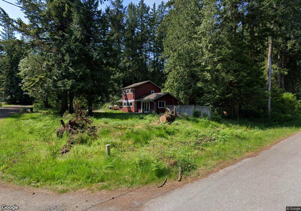
175 Nelson Rd Point Roberts, WA 98281
Estimated Value: $375,691 - $469,000
3
Beds
1
Bath
1,464
Sq Ft
$277/Sq Ft
Est. Value
About This Home
This home is located at 175 Nelson Rd, Point Roberts, WA 98281 and is currently estimated at $405,173, approximately $276 per square foot. 175 Nelson Rd is a home located in Whatcom County with nearby schools including Point Roberts Primary School, Blaine Middle School, and Blaine High School.
Ownership History
Date
Name
Owned For
Owner Type
Purchase Details
Closed on
Feb 3, 2010
Sold by
Perritt Darlene P
Bought by
Perritt Darlene P
Current Estimated Value
Purchase Details
Closed on
Jul 18, 2006
Sold by
Perritt Darlene P
Bought by
Perritt Ronald A
Home Financials for this Owner
Home Financials are based on the most recent Mortgage that was taken out on this home.
Original Mortgage
$170,000
Interest Rate
6.5%
Mortgage Type
Purchase Money Mortgage
Purchase Details
Closed on
May 19, 2005
Sold by
Perritt Ronald A
Bought by
Perritt Ronald A and Perritt Darlene P
Create a Home Valuation Report for This Property
The Home Valuation Report is an in-depth analysis detailing your home's value as well as a comparison with similar homes in the area
Home Values in the Area
Average Home Value in this Area
Purchase History
| Date | Buyer | Sale Price | Title Company |
|---|---|---|---|
| Perritt Darlene P | -- | None Available | |
| Perritt Ronald A | -- | First American Title Insuran | |
| Perritt Ronald A | -- | -- |
Source: Public Records
Mortgage History
| Date | Status | Borrower | Loan Amount |
|---|---|---|---|
| Previous Owner | Perritt Ronald A | $170,000 |
Source: Public Records
Tax History
| Year | Tax Paid | Tax Assessment Tax Assessment Total Assessment is a certain percentage of the fair market value that is determined by local assessors to be the total taxable value of land and additions on the property. | Land | Improvement |
|---|---|---|---|---|
| 2025 | $1,739 | $291,882 | $103,403 | $188,479 |
| 2024 | $2,381 | $288,987 | $102,383 | $186,604 |
| 2023 | $2,381 | $279,679 | $93,075 | $186,604 |
| 2022 | $1,702 | $255,415 | $85,000 | $170,415 |
| 2021 | $1,695 | $161,318 | $32,102 | $129,216 |
| 2020 | $1,691 | $149,367 | $29,724 | $119,643 |
| 2019 | $1,575 | $143,276 | $28,512 | $114,764 |
| 2018 | $1,425 | $128,804 | $25,632 | $103,172 |
| 2017 | $1,236 | $123,015 | $24,480 | $98,535 |
| 2016 | $1,334 | $120,603 | $24,000 | $96,603 |
| 2015 | $1,418 | $126,649 | $32,847 | $93,802 |
| 2014 | -- | $132,402 | $34,340 | $98,062 |
| 2013 | -- | $126,558 | $32,980 | $93,578 |
Source: Public Records
Map
Nearby Homes
- 1857 Washington Dr
- 0 15 Whalen Dr
- 19 Whalen Dr
- 1953 Province Rd
- 16 Burns Way
- 0 3 73 Acres Derby Ave
- 2123 Whalen Dr
- 2 Mill Rd
- 103 Goodman Rd
- 245 Shady Glen Ave
- 2138 Benson Rd
- 251 Elizabeth Dr
- 0 Deer Rd
- 25 Roosevelt Way
- Lot 3 Deer Rd
- 157 Northwood Dr
- 6 Weasel Run Rd
- 0 Tyee Dr
- 6 acres S Beach Rd
- 1911 Apa Rd
- 1959 Drake Ave
- 0 Lot 4 Drake Ave
- 1981 Drake Ave
- 1960 Drake Ave
- 1966 Drake Ave
- 1976 Drake Ave
- 1953 Drake Ave
- 1977 Drake Ave
- 186 Monte Dr
- 180 Nelson Rd
- 1982 Johnson Rd
- 34 Nelson Rd
- 156 Monte Dr
- 1953 Wellington Rd
- 1976 Johnson Rd
- 1995 Drake Ave
- 1994 Drake Ave
- 1979 Wellington Rd
- 150 Monte Dr
- 1994 Wellington Rd
Your Personal Tour Guide
Ask me questions while you tour the home.