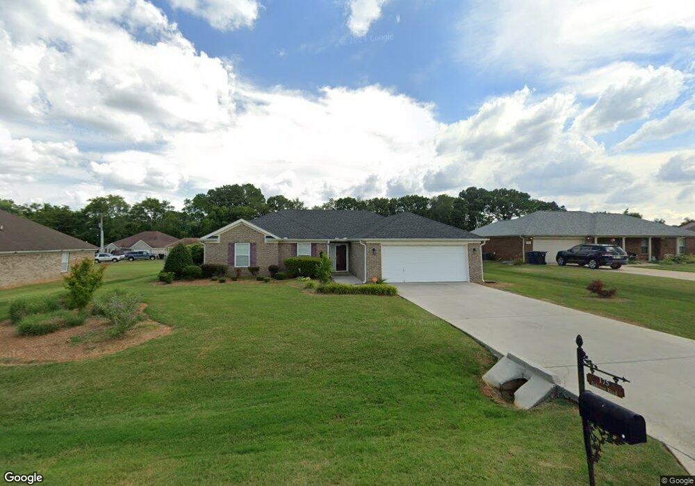
175 Oakcrest Rd Huntsville, AL 35811
Moores Mill NeighborhoodEstimated Value: $264,000 - $288,000
3
Beds
2
Baths
1,511
Sq Ft
$183/Sq Ft
Est. Value
About This Home
This home is located at 175 Oakcrest Rd, Huntsville, AL 35811 and is currently estimated at $275,993, approximately $182 per square foot. 175 Oakcrest Rd is a home located in Madison County with nearby schools including Mt Carmel Elementary School, Riverton Intermediate School, and Buckhorn Middle School.
Ownership History
Date
Name
Owned For
Owner Type
Purchase Details
Closed on
Jun 26, 2009
Sold by
Sps Builders Inc
Bought by
Collins Lea Ann
Current Estimated Value
Home Financials for this Owner
Home Financials are based on the most recent Mortgage that was taken out on this home.
Original Mortgage
$144,796
Outstanding Balance
$91,974
Interest Rate
4.79%
Mortgage Type
Purchase Money Mortgage
Estimated Equity
$184,019
Create a Home Valuation Report for This Property
The Home Valuation Report is an in-depth analysis detailing your home's value as well as a comparison with similar homes in the area
Home Values in the Area
Average Home Value in this Area
Purchase History
| Date | Buyer | Sale Price | Title Company |
|---|---|---|---|
| Collins Lea Ann | -- | -- |
Source: Public Records
Mortgage History
| Date | Status | Borrower | Loan Amount |
|---|---|---|---|
| Open | Collins Lea Ann | $144,796 |
Source: Public Records
Tax History Compared to Growth
Tax History
| Year | Tax Paid | Tax Assessment Tax Assessment Total Assessment is a certain percentage of the fair market value that is determined by local assessors to be the total taxable value of land and additions on the property. | Land | Improvement |
|---|---|---|---|---|
| 2024 | $935 | $27,300 | $4,500 | $22,800 |
| 2023 | $935 | $21,880 | $4,500 | $17,380 |
| 2022 | $658 | $19,660 | $4,000 | $15,660 |
| 2021 | $644 | $19,280 | $4,000 | $15,280 |
| 2020 | $517 | $15,820 | $4,000 | $11,820 |
| 2019 | $498 | $15,280 | $4,000 | $11,280 |
| 2018 | $469 | $14,480 | $0 | $0 |
| 2017 | $458 | $14,180 | $0 | $0 |
| 2016 | $458 | $14,180 | $0 | $0 |
| 2015 | $458 | $14,180 | $0 | $0 |
| 2014 | $469 | $14,500 | $0 | $0 |
Source: Public Records
Map
Nearby Homes
- 146 Henson Dr
- 242 Stone Hill Dr
- 6102 Edwin Jones Dr
- 222 Lyndon Cove Rd
- 216 Lyndon Cove Rd
- 3000 Eolyne Kelly Way
- 210 Lyndon Cove Rd
- 154 Stone Hill Dr
- 100 Cades Cove
- 205 Lyndon Cove Rd
- 111 Henson Dr
- 0.40 acres Laurel Oak Rd
- 102 Tara Dr
- 6002 Doc Sandlin Rd
- 314 Pond Spring Dr
- 103 Cool Cir
- 107 Cool Cir
- 200 Federal Ln
- 247 Pennington Ave
- Independence II Plan at St. Clair Place - Ranchers
- 173 Oakcrest Rd
- 104 Glenfield Ct
- 171 Oakcrest Rd
- 417 Robinson Rd
- 101 Poplar Branch Ln
- 418 Robinson Rd
- 169 Oakcrest Rd
- 106 Glenfield Ct
- 172 Oakcrest Rd
- 180 Oakcrest Rd
- 101 Glenfield Ct
- 103 Glenfield Ct
- 407 Robinson Rd
- 107 Glenfield Ct
- 167 Oakcrest Rd
- 170 Oakcrest Rd
- 182 Oakcrest Rd
- 105 Glenfield Ct
- 395 Robinson Rd
- 168 Oakcrest Rd