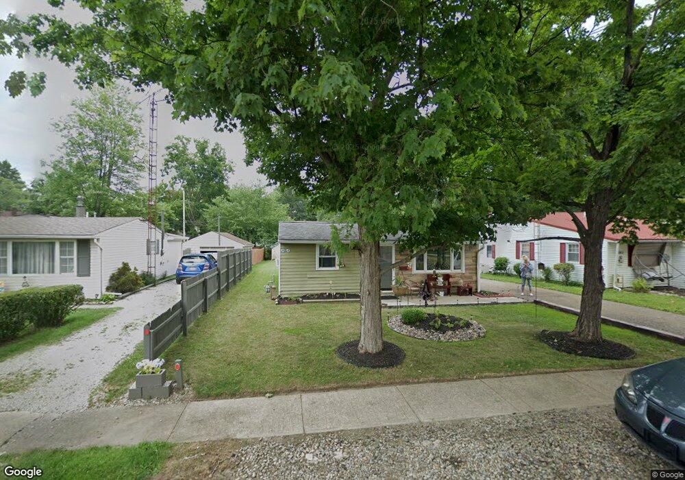
175 Perry Ct Alliance, OH 44601
Estimated Value: $75,000 - $83,000
3
Beds
1
Bath
1,104
Sq Ft
$73/Sq Ft
Est. Value
About This Home
This home is located at 175 Perry Ct, Alliance, OH 44601 and is currently estimated at $80,332, approximately $72 per square foot. 175 Perry Ct is a home located in Stark County with nearby schools including Alliance Early Learning School, Alliance Intermediate School at Northside, and Alliance Middle School.
Create a Home Valuation Report for This Property
The Home Valuation Report is an in-depth analysis detailing your home's value as well as a comparison with similar homes in the area
Home Values in the Area
Average Home Value in this Area
Tax History
| Year | Tax Paid | Tax Assessment Tax Assessment Total Assessment is a certain percentage of the fair market value that is determined by local assessors to be the total taxable value of land and additions on the property. | Land | Improvement |
|---|---|---|---|---|
| 2025 | -- | $17,260 | $5,880 | $11,380 |
| 2024 | -- | $17,260 | $5,880 | $11,380 |
| 2023 | $615 | $15,300 | $5,810 | $9,490 |
| 2022 | $619 | $15,300 | $5,810 | $9,490 |
| 2021 | $620 | $15,300 | $5,810 | $9,490 |
| 2020 | $578 | $13,340 | $5,080 | $8,260 |
| 2019 | $570 | $13,340 | $5,080 | $8,260 |
Source: Public Records
Map
Nearby Homes
- 717 Garfield Ave
- 505 N Union Ave
- 710 N Freedom Ave
- 171 1/2 W Main St
- 000 Meadowbrook Ave
- 0 Meadowbrook Ave
- 163 W Market St
- 11344 Walnut Ave NE
- 264 W Market St
- 62 E Market St
- 118 S Mckinley Ave
- 11335 Meadowbrook Ave NE
- 550 Johnson Ave
- 432 Johnson Ave
- 0 Homestead Ave NE
- 361 E Main St
- 347 Buckeye Ave
- 62 E High St
- 479 W High St
- 427 S Union Ave
Your Personal Tour Guide
Ask me questions while you tour the home.